

30-second overview: At 1:47:15 a.m. on September 21, 1999, the Chelungpu Fault ruptured 8 kilometers beneath Jiji Township for 102 seconds1. The earthquake measured 7.3 on the Richter scale. Across Taiwan, 2,415 people died, 29 went missing, and 51,711 buildings fully collapsed; Nantou County alone accounted for 886 deaths and 23,127 fully collapsed households. More than 90 percent of buildings in Zhongliao Township were damaged; at Jiufen'ershan, a 180-hectare landslide buried 41 people alive, 22 of whom have still not been found2. On October 27, 1930, Mona Rudao, chief of the Seediq community of Mahebo, led people from six communities in an assault during the flag-raising ceremony at Wushe Public School, killing 134 Japanese civilians. In the Second Wushe Incident half a year later, the Toda group raided detention sites at night; 216 community members were killed or died by suicide3. In 1934, the Wujie Dam raised Sun Moon Lake’s water level by 18.18 meters, submerging the Thao sacred site of Lalu Island; in 1957, Zhongxing New Village was completed as the Taiwan Provincial Government’s temporary office site, and the 1998 downsizing of the province hollowed out its functions, leaving only the coconut-palm boulevard4. In 2016, Lushan Hot Spring formally disappeared from Taiwan’s tourism map. Some 470,000 people live in this county, which rises from 100 meters in urban Nantou to Yushan at 3,952 meters, and where Seediq, Bunun, Thao, Tsou, and Han people live together. Taiwan’s deepest wounds are all here.
At 1:47 a.m., the Tables in Jiji Township Jumped
1:47:15.9 a.m., September 21, 1999.
Eight kilometers beneath Jiji Township, the Chelungpu Fault moved upward. The surface rupture extended from Zhuolan in Miaoli all the way to Tongtou in Zhushan, Nantou, with a total length of 100 kilometers, a maximum horizontal displacement of 9 meters, and a vertical displacement of 6 meters1. The entire earthquake lasted about 102 seconds. It measured 7.3 on the Richter scale. The United States Geological Survey measured a moment magnitude of 7.6 to 7.7.
It was nearly two in the morning in the mountains of central Taiwan. People were asleep.
In those 102 seconds alone, 2,415 people in Taiwan were gone2. ⚠️ Different sources give two versions of the death toll: the National Fire Agency of the Ministry of the Interior’s official count is 2,415 people, a figure also used by the Central Weather Administration and Chinese Wikipedia; The Reporter’s in-depth twentieth-anniversary report on the 921 Earthquake uses 2,454, including those who later died from severe injuries5. This article uses the official figure of 2,415. Another 29 people went missing, 11,305 were injured, 51,711 buildings fully collapsed, and 53,768 partially collapsed.
How much of that was in Nantou County itself? Chinese Wikipedia records it verbatim: “In Nantou County, 886 people died, 678 were seriously injured, 23,127 households fully collapsed, and 16,792 households partially collapsed”2. Nantou County together with Taichung County and City accounted for “about 95% of all damaged households in Taiwan” that fully or partially collapsed2.
The epicenter was in Jiji Township. It was 9.2 kilometers west-southwest of Sun Moon Lake.
✦ “A powerful earthquake is more terrifying than war.” (Taiwan Panorama’s 921 special issue, quoting a Zhongliao resident6)
The Reporter later tracked the total damage: “Damage from 921 was roughly more than NT$360 billion; the government budgeted more than NT$260 billion for reconstruction, and private donations added another roughly NT$34 billion.”5 On the third day after the disaster, reporters entered Nantou: “Passing the bare Jiujui Peaks, they saw Puli’s Yuying Elementary School collapsed into rubble and Puli Senior High School piled with relief supplies. The next day was Mid-Autumn Festival. As evening approached, the whole old street of Guoxing had no lights at all, and residents stood blankly beneath roadside eaves that had not collapsed.”5
Mid-Autumn Festival came on the fourth day after 921. The moon shone on a mountain town without electricity.
The Only County Without a Coast, Rising from 100 Meters to 3,952 Meters
Sun Moon Lake at dusk. Photo: Wikimedia Commons contributor, CC BY-SA 3.0.
Nantou is the only county among the 22 counties and cities on Taiwan proper that does not border the sea.
From the Changhua County boundary in the west to the Hualien County boundary in the east, Nantou is 95 kilometers long north to south and 72 kilometers wide east to west. With an area of 4,106 square kilometers, it is Taiwan’s second-largest county, behind only Hualien7. Elevation begins at roughly 100 to 150 meters in urban Nantou and climbs all the way to Yushan’s main peak at 3,952 meters. Hillslopes account for 83 percent of the county, with very few plains. Among its 13 townships, towns, and cities, Xinyi Township and Ren’ai Township are mountain Indigenous townships, while Yuchi Township is a plains Indigenous township.
The Zhuoshui River is Taiwan’s longest river, at 186.4 kilometers. It originates at “Sakuma Saddle” between Hehuan Mountain’s main and east peaks, at an elevation of 3,220 meters, then descends through eight Nantou townships7. Provincial Highway 14A climbs to the saddle between Hehuan Mountain’s main and east peaks at 3,275 meters. It is called Wuling and is the highest point on Taiwan’s road system.
Some 470,000 people live in the county, according to 2025 figures7. The share of residents aged 65 or older is 22.51 percent, making Nantou the third-most-aged county in Taiwan. Young people have long been leaving the mountain areas.
📝 Curator’s note: “Landlocked” sounds like a defect. But when the Nationalist government chose Zhongxing New Village as the Taiwan Provincial Government’s temporary office site in 1957, one reason was precisely that it was inland enough: if a cross-strait war reached Taipei, the provincial government would not be knocked out together with the central government. Inland meant backup; it meant safety. Then, at 1:47 a.m. on September 21, 1999, Taiwan’s deepest postwar internal injury burst out from the center of this “most inland” county. The physical meaning of inland was redefined in 102 seconds: you may think distance from war means distance from disaster, but the Chelungpu Fault does not choose sides.
The county’s history is arranged by altitude. Babao Canal on the plains, Wushe on the mountainside, Lalu Island beneath the lake surface, Yushan at 3,952 meters: at every elevation layer, a story is pressed into place.
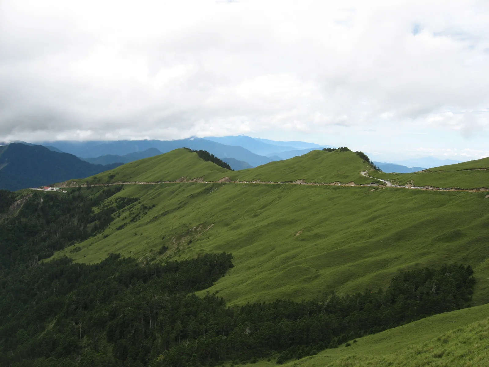
Hehuan Mountain landscape. Photo: Chewy3326, CC BY 2.5. via Wikimedia Commons.
The Water of Babao Canal Has Flowed to Mingjian Township Since the Kangxi Era
In the forty-eighth year of the Kangxi reign of the Qing dynasty, 1709, Shi Shibang began construction8.
The Zhuoshui River carries a great volume of water and sediment. Whoever could divert it downstream would hold the lifeline of the Changhua Plain. Shi Shibang was from Quanzhou; then in his thirties, he staked his family fortune on this canal. After several years of excavation, they still could not get through, with collapses repeatedly occurring at certain points. Legend says an old man calling himself “Mr. Lin” came to find him and gave him a hydraulic diagram, saying the route would open if he followed it. Shi Shibang did so, and the canal opened. The old man refused payment and left without giving his name. Later generations built the “Mr. Lin Temple” at the Ershui canal head to commemorate him8.
⚠️ The Mr. Lin episode is a retelling of folk legend, not a Qing-era primary source. But Shi Shibang did exist (1671-1743), and the completion date of Babao Canal in the fifty-eighth year of Kangxi, 1719, is confirmed by three sources8. The excavation took a full 10 years. It is one of Taiwan’s three major ancient irrigation canals; the other two are the Tongfu Canal in Tainan and Long’en Canal in Hsinchu. Today, Mingjian Township in Nantou is an important irrigation area for Babao Canal, and Shi Shibang’s original intake point was near the Nantou County boundary upstream on the Zhuoshui River.
Every sixth lunar month, Ershui Township in Changhua holds the Water Running Festival to commemorate Shi Shibang, Mr. Lin, and Huang Shiqing, three figures credited with building the canal.
This is the first layer of Qing-era Nantou history: a hydraulic system brought in by Han settlers from the western plains. In 1709, even Yongzheng had not yet taken the throne. In this only landlocked county, the earliest story is of water coming down from the mountains.
In the first year of Yongzheng, 1723, Changhua County was established, and Nantou belonged to it. In the twenty-fourth year of Qianlong, 1759, Changhua County stationed a county assistant magistrate in Nantou, “the beginning of government administration and education in Nantou County”9. In the first year of Guangxu, 1875, Nantou Subprefecture was established. After the Japanese arrived in 1895, they abolished the Qing-era Miaoli County and reorganized Nantou Subprefecture. In 1920, it was transferred under Taichu Prefecture.
The name Nantou County, and this county territory, would not formally appear until after the war in 1945.
At the Moment of the Flag Raising at Wushe Public School, Mona Rudao Led Six Communities In
It was the morning of a sports meet.
On the morning of October 27, 1930, the fifth year of Showa, Wushe Public School in Noko District, today’s Wushe Elementary School in Ren’ai Township, Nantou County, was holding a joint sports meet. Japanese police officers, teachers, and family members were all present. On the school grounds, the Japanese flag was being raised and the national anthem sung10.
More than 300 Indigenous people rushed in.
Their leader was Mona Rudao, chief of the Mahebo community. Chinese Wikipedia records this person verbatim: “Mona Rudao, renowned for bravery from a young age, was one of the few men of both intelligence and courage who obtained chiefly status through ability rather than bloodline”10. The trigger was the “sake-offering incident” of October 7, 1930: at the wedding of Mona Rudao’s son Dado Mona, Japanese police officer Yoshimura knocked away a cup offered in a toast. The Seediq people’s accumulated resentment toward the Japanese police then erupted at once.
Six communities took part in the uprising, listed verbatim by Chinese Wikipedia: “Mahebo (Mhebu), Truwan, Boarung, Suku, Gungu, and Drodux”10.
They killed 134 Japanese civilians and teachers and injured 215 people10. ⚠️ This is the precise figure used by Chinese Wikipedia: 134 Japanese civilians. Another two Han people wearing Japanese clothing were mistakenly killed by the Indigenous attackers; if included, the total deaths on the Japanese side become 136. This article uses the precise formulation of 134 Japanese people plus two Han people counted separately.
The Japanese side mobilized 5,311 personnel for suppression: 1,563 Japanese soldiers, 1,231 police officers, 1,381 military laborers, plus pro-Japanese “allied aborigines”10. ⚠️ Multiple sources state that the Japanese side used poison gas shells in the mountains, but Chinese Wikipedia marks this claim as disputed. The suppression continued until December 1.
Mona Rudao handed command of the fighting to his son, shot his wife dead, then walked alone into the forest above a rock cave and died by suicide with a gun. His body was not found until 1933. It was made into a specimen and transferred to the anthropology department at Taihoku Imperial University, later National Taiwan University.
The incident was not over. Before dawn on April 25, 1931, the Second Wushe Incident broke out. Chinese Wikipedia states verbatim: “more than 200 able-bodied men of the Toda group formed teams and launched nighttime raids on four detention sites at Drodux and Sipo”; “216 people were killed or died by suicide”10. Only 298 survivors remained.
Why would the Toda group kill people of their own ethnic group? “The Japanese authorities admitted that the police stationed there, fearing retaliation by protected aborigines, prompted the Tausa community to carry out the assault”10. Japanese police incited pro-Japanese Indigenous people to kill anti-Japanese Indigenous people, then afterwards granted them the land of the uprising communities. The bloodshed between communities was the result of Japanese manipulation.
📝 Curator’s note: To reduce the Wushe Incident to the phrase “Indigenous resistance against Japan” is to give up on understanding it. The full event contains at least five layers: the Seediq people’s long-accumulated resentment toward Japanese police, the October 7, 1930 sake-offering incident as trigger, the October 27 uprising by six communities at the public school, Mona Rudao’s suicide in the mountain forest, and the April 25, 1931 Second Wushe Incident, in which Japanese police manipulated intra-ethnic killing. 134 Japanese civilians died; 216 community members were killed or died by suicide; 298 survivors were forcibly relocated to “Kawanakajima,” today’s Qingliu community, in the Beigang River basin. To write the Seediq as a neatly unified anti-Japanese whole omits the history of how Japanese police manipulated divisions among communities. The Wushe Incident is a concrete dissection of “how Japanese colonial rule operated in the mountains,” with resistance only one face on the surface.
In 1973, Mona Rudao’s remains were brought back from National Taiwan University’s Department of Anthropology and buried in Wushe. Li Yih-yuan, acting chair of NTU’s Department of Archaeology and Anthropology, wrote to the university president to explain: “The remains of this martyr should not be kept in a research institution; they truly ought to be returned for burial in his hometown.”11 With Han ritual forms, including wreaths, a mourning hall, and music, he was buried behind the Wushe Mountain Compatriots Anti-Japanese Memorial Monument across from Ren’ai Elementary School in Nantou.
In 2011, Wei Te-sheng’s Seediq Bale was released. Its global box office was NT$880 million, with NT$810 million in Taiwan12. Part I, The Sun Flag, premiered on September 9; Part II, The Rainbow Bridge, premiered on September 30. This film made the Wushe Incident from 81 years earlier known again across Taiwan.
But if you go to Wushe today, what you see is a tourist site: Mona Rudao Memorial Park, the Wushe Incident Memorial, Qingliu community. The Seediq wound has been exchanged for a photographed scenic route.
The Wujie Dam Raised the Water by 18.18 Meters, Turning the Thao People’s Lalu Island into a 30-Meter Islet
On June 3, 1934, the Sun Moon Lake No. 1 Power Station, today’s Daguan Power Plant No. 1, was completed. Its generating capacity was 143,500 kilowatts, “at the time the largest hydroelectric facility in Asia and the seventh largest in the world”13.
From the establishment of Taiwan Power Company in 1919, when the Sun Moon Lake hydroelectric project was listed as its priority plan, to the 1923 Great Kanto Earthquake, which sharply increased budgets and halted construction, to the revised plan and resumption of work in 1931, the project involved building a concrete gravity dam upstream on the Zhuoshui River in Ren’ai Township, the Wujie Dam, 57.6 meters high and 90.91 meters long, with six gates, and boring a diversion tunnel to send water into Sun Moon Lake13. The largest hydraulic project of the Japanese colonial period took 15 years.
In September 1934, water began flowing through the Wujie diversion channel, and Sun Moon Lake’s water level rose by 18.18 meters13.
The lake’s surface area expanded from 4.55 square kilometers to 7.73 square kilometers. The history page of the Sun Moon Lake National Scenic Area records the impact on the Thao people verbatim: “The raised water level submerged the Thao people’s traditional settlement and farmland; the Japanese relocated the Thao to Dehua community, allocating only two fen of land per person, and the Thao population gradually declined.”14
The Thao originally lived in the Shiyin settlement on the eastern side of Sun Moon Lake, with farmland distributed around the lake. In the year the water level rose, their home was submerged.
Lalu Island, at the center of Sun Moon Lake, is the highest ancestral-spirit site of the Thao. In the Thao language, Lalu means “sacred island in the heart”15. During the Japanese period it was called “Jade Island”; after the war, in 1949, the Nationalist government renamed it “Guanghua Island,” meaning “to glorify China.” It shrank from what had originally been more than 100 jia of farmland into a reservoir-engineering islet 30 meters in diameter. It took 15 years to turn a sacred island into a small island circled by sightseeing boats for photographs.
Lalu Island, 2013-08-19. Photo: Ckbun, CC BY-SA 3.0. via Wikimedia Commons.
By 2000, the Thao had pushed to rename Guanghua Island back to “Lalu Island”15. The next year, on August 8, 2001, the Thao were renamed from a plains Indigenous group into the tenth recognized Indigenous people. ⚠️ Thao population figures differ by year: the Ministry of the Interior’s Department of Household Registration counted 776 people in 2017, while other statistics put the figure at around 885. This article uses “around 800-plus people,” making the Thao the third smallest by population among Taiwan’s 16 Indigenous peoples16.
✦ “The raised water level submerged the Thao people’s traditional settlement and farmland; the Japanese relocated the Thao to Dehua community, allocating only two fen of land per person.” (Sun Moon Lake National Scenic Area history page14)
The lake surface tourists see at Sun Moon Lake today is a “nature” rewritten by engineering, raised by 18.18 meters. The so-called “Sun Moon Lake boat tour” circles farmland the Thao lost beneath the water 91 years ago.
The Bunun live on another side of Nantou: Xinyi Township. Along the Chenyoulan River basin are five community groups: Takituduh, Takibakha, Takivatan, Takbanuaz, and Isbukun17. The Takituduh group lives in Jiumei Village, the northernmost part of Xinyi Township; the Takibakha group is in Dili and Shuanglong; the Takivatan group is in the upper Chenyoulan River area of Dili Village; the Takbanuaz group is in Fengqiu, Wangxiang, and Xinyi; and the Isbukun group is in Dongpu and Luona. Pasibutbut, often called “eight-part polyphony,” “is passed down only among the Bunun Takbanuaz and Isbukun groups”; the Takivatan, Takibakha, and Takituduh groups do not sing it17. ⚠️ Tourism promotion often treats “eight-part polyphony” as a symbol of all Bunun people, but in fact only two community groups sing it. Mingde community, where Takbanuaz and Isbukun people live together, is today the community that can sing pasibutbut and is closest to the Bunun ancestors’ earliest original homeland.
The eastern part of Xinyi Township also includes the traditional territory of the Tsou, and Yushan National Park sits in this area. Yushan National Park spans four counties and cities: Xinyi Township in Nantou County, Alishan Township in Chiayi County, Taoyuan District in Kaohsiung City, and Zhuoxi Township in Hualien County18. ⚠️ General descriptions often omit the Hualien Zhuoxi Township portion, but the actual park area extends across Hualien’s southeastern corner. Established on April 10, 1985, it covers 105,490 hectares and is Taiwan’s largest national park by area.
In Nantou, Taiwan’s only landlocked county, four Indigenous peoples live together with Han Hoklo and Hakka communities: Seediq, Bunun, Thao, and Tsou. Mountain Indigenous townships account for only two of the county’s 13 townships, towns, and cities, but the area of those two townships far exceeds the other 11 combined.
The Coconut Trees of Zhongxing New Village Are Still There

Zhongxing New Village archway. Photo: Wikimedia Commons contributor, CC BY-SA 2.5. via Wikimedia.
In 1956, the Taiwan Provincial Government relocated from Taipei to Nantou. The place’s original name was Yingpankou19.
The reason for relocation followed backup logic: to avoid the provincial government being knocked out together with the central government if a cross-strait war affected Taipei. The dual governing structure of “a state within the province, a province within the state” needed a physical base far from the capital. Nantou is the only county without a coast: inland, farthest away, safest.
In 1957, the overall urban design of Zhongxing New Village was completed. Modeled on Britain’s London “New Towns,” it was built as a garden-style administrative community covering about 200 hectares19. This was Taiwan’s first formal urban planning project put into practice: separate stormwater and sewage systems, cul-de-sacs to strengthen community consciousness, garden-city zoning, and a 500-meter coconut-palm boulevard as its public face, planted on both sides with tall coconut trees.
At the height of the provincial government, tens of thousands of people lived in Zhongxing New Village. It was a self-sufficient administrative city with civil-servant dormitories, schools, markets, and a cinema.
In 1994, Taiwan Province held the first and only direct election for provincial governor in its history. James Soong was elected with 4.8 million votes19.
In December 1998, the Taiwan Provincial Government was downsized. ⚠️ Two dates are commonly mixed: December 20 was the day James Soong left office, while December 21 was the formal completion date of provincial downsizing, as the Executive Yuan streamlined the province under amendments to the Provincial and County Self-Governance Act. This article uses “the December 1998 downsizing of the province” without specifying a particular day.
At the moment of downsizing, Zhongxing New Village’s functions were hollowed out. Most departments and offices were abolished, the number of civil servants plunged, and the flows of people through dormitories, markets, and schools left with them. In 2011, Nantou County Government registered Zhongxing New Village as a “cultural landscape.” In 2018, the National Development Council established the Zhongxing New Village Revitalization Project Office, dividing the area into three cores: north, a historical and cultural zone; center, a leisure and living zone; and south, a university city, the Nantou campus of National Chung Hsing University19.
But the 500-meter coconut-palm boulevard remains to this day.
📝 Curator’s note: Zhongxing New Village is an inverted story. In ordinary urban decline, the houses decay first, and the people leave later. In Zhongxing New Village, the function was removed first, the people left, and the houses remained. In the nearly 30 years from 1998 to 2026, the coconut trees kept growing; the dormitories remained dormitories, though half-empty; market stalls decreased, but the market kept opening. It did not become a ruin. It became a “specimen of the provincial-government era.” Tourists who come here to photograph the coconut-palm boulevard are photographing the form left behind by an era hollowed out by provincial downsizing. When the Nationalist government built this new town in 1957, it was thinking of “what if there is a cross-strait war”; when the province was downsized in 1998, it was thinking “the provincial government is a redundant layer and should be cut.” Between the first motive and the second lies forty years of Taiwan’s political structure turning over. This coconut-palm boulevard is the physical witness left by that turn.
Zhongxing New Village is the form of Nantou’s provincial-government era. Wushe is the Seediq wound. Sun Moon Lake is the lake left after the Thao homeland was submerged. Babao Canal is the water that entered from the west during the Kangxi era. This only landlocked county presses the wounds and ambitions of Taiwan’s different eras into the same inland ground.
In Zhongliao Township, 92% of Houses Collapsed; in 2016, Lushan Officially Disappeared from the Tourism Map
Back to the night of 921.
Zhongliao Township is in central Nantou County, and the Shuangdong Fault runs directly through it. Taiwan Panorama’s 921 special issue records verbatim: “In Zhongliao Township, more than 90 percent of all buildings were damaged. In villages of only twenty to thirty thousand people, 154 people died, and many families perished together.”6 Fully and partially collapsed buildings accounted for 82.6 percent of the township. All 34 extra-high-voltage transformers at the Zhongliao ultra-high-voltage switching station were destroyed, causing a Taiwan-wide blackout that night.
More than 181 people died in Puli Township, more than 400 buildings collapsed, and even the Puli Township Office itself collapsed2.
In Zhushan Township, 118 people died; 2,711 households fully collapsed and 2,973 partially collapsed2.
Jiufen'ershan is in Nangang Village, Guoxing Township. The head of an entire mountain simply fell away: a 180-hectare landslide with 35 million cubic meters of earth and rock. “At least forty villagers were buried alive”20; the later precise figures are 41 people buried alive and 22 still not found. After the mountain collapsed, its height dropped by about 400 meters.
In Jiji Township, where the epicenter was located, the wooden station building at Jiji Station tilted severely, and the epicentral structure of Wuchang Temple collapsed. The tracks of the Jiji railway branch line were badly twisted. In Caotun Township, the shaking stripped the Jiujui Peaks bare in an instant; in 2000, the area was designated a nature reserve.
✦ “More than two thousand people lost their lives in the rubble, and tens of thousands lost the happy, warm homes they once had amid a thunderous roar.” (Taiwan Panorama’s 921 special issue6)
Revisions to building regulations after 921 occurred in 2003. The government raised seismic-resistance coefficients, roughly from magnitude 3-4 to magnitude 5-6, and strengthened ductility design for walls, columns, and beams. “Only houses that obtained building permits in 2003 or later comply with the new regulations” later became a dividing line in how Taiwan’s real-estate market viewed building age21.

921 Earthquake Museum of Taiwan, 2024-09-21. Photo: Liu Shu-fu / Office of the President, CC BY 2.0. via Wikimedia Commons.
But some things cannot be rebuilt after 2003.
Lushan Hot Spring in Ren’ai Township was already famous in the Japanese period as Fuji Hot Spring and Hatozawa Hot Spring. It sits in the Taluowan River valley at an elevation of more than 400 meters. Its spring is a neutral sodium bicarbonate spring, with water temperatures from 58 to 98 degrees Celsius. It once had a reputation as “the finest spring under heaven,” with source waters reaching 87 degrees22.
On the day of 921, Lushan’s hillside geology first became unstable. Then typhoons came one after another: in 2001, Typhoon Toraji caused the Taluowan River to swell, damaging many lodgings; on September 12, 2008, Typhoon Sinlaku was called “Lushan’s greatest blow,” severely damaging many hotels; in 2010, Typhoon Songda brought further damage22.
In June 2011, the Nantou County Government decided on collective relocation to Fuxing Village in Puli Township, 36 kilometers away.
In 2015, the Water Resources Agency’s Fourth River Management Office completed demolition work on 3.63 hectares within the river-area line at Lushan Hot Spring22.
In 2016, after the five legal Lushan Hot Spring operators received NT$700 million in compensation, they formally ceased operations, and Lushan Hot Spring disappeared from Taiwan’s tourism map. ⚠️ Timing for relocation and closure: relocation demolition began in 2015, and operators fully shut down in 2016. A hot-spring tourism area with more than 80 years of history took 17 years, counted from 921, to complete the process of disappearing.
When Public Television Service’s Our Island reported on Lushan, it used this line: “Water brings wealth, and it also brings disaster. Lushan had unlimited business opportunities because of hot-spring water, and uncertain danger because of flooding on the Taluowan River.”22
Three Ethnonyms Grew Back in 26 Years
Return to the 1:47 a.m. at the beginning.
The Chelungpu Fault beneath Jiji Township ruptured upward for 102 seconds; across Taiwan, 2,415 people were gone; Nantou County alone lost 886 people. That was September 21, 1999.
Twenty-six years later, in 2025.
After those 102 seconds, three things happened, all related to names growing back.
In 2000, the island at the center of Sun Moon Lake was renamed from “Guanghua Island” back to Lalu, the Thao-language “sacred island in the heart”15. Fifty-one years after the Nationalist government had renamed it, the Thao used the opening of attention after the 921 disaster to take back the island’s name.
On August 8, 2001, the Thao were renamed from a plains Indigenous group into the tenth recognized Indigenous people. That year was exactly 67 years after their ancestors’ settlement was submerged by the Wujie Dam in 193416. ⚠️ Why renaming became possible: after 921 in 1999, post-disaster reconstruction in Nantou brought the Thao situation to the attention of all Taiwan: a population of only 800-plus, a sacred site submerged, and traditional land remade into a tourist destination. Disaster became political leverage for the renaming movement.
On April 23, 2008, the Seediq separated from the Atayal and were renamed the fourteenth recognized Indigenous people23. The Seediq include three language groups: Seediq Tgdaya, or the Tgdaya group, the main participants in the Wushe Incident; Sediq Toda, the Toda group; and Sejiq Truku, the Truku group. The Truku group had already been independently recognized as the twelfth people under the name “Truku” on January 14, 2004; this people lives in eastern Hualien. In 2008, the Tgdaya and Toda groups in western Nantou completed their renaming. The people named “Seediq” at the moment of the Wushe Public School flag raising on October 27, 1930, had to spend 78 years returning to their own ethnonym.
Together with the 1998 provincial downsizing and Lushan Hot Spring’s closure in 2016, Taiwan’s only landlocked inland county places more than 80 years of wounds and repair on the same map: the 1934 Wujie Dam, the 1957 Zhongxing New Village, 1999’s 921, the 2001 Thao renaming, the 2008 Seediq renaming, and Lushan’s disappearance in 2016.
If you go to Nantou next time, do not only visit Sun Moon Lake and Qingjing. Try taking Provincial Highway 14 to Wushe and looking at the anti-Japanese memorial behind Mona Rudao Memorial Park. Then drive to Zhongxing New Village and walk the full 500 meters of the coconut-palm boulevard. Then loop back to Jiji and see the tilted gable wall of Wuchang Temple preserved after the earthquake. Finally, stay one night in Puli. The Puli Brewery was established in 1917; in 1949, the Nationalist government brought in Zhejiang brewing techniques, and in 1952 it successfully trial-produced Shaoxing wine using Puli’s natural Ailan spring water. Today, it is Taiwan’s center of Shaoxing wine production24.
Then you will remember one thing: Taiwan’s deepest wounds are all in this only county without a coast. The epicenter is in Jiji; Seediq blood is in Wushe; the form of the provincial government is in Zhongxing New Village. The 18.18 meters raised by the Wujie Dam are still beneath the surface of Sun Moon Lake, turning the Thao people’s Lalu Island from a sacred site into a 30-meter islet; the water of Babao Canal has flowed from the Kangxi era to irrigate the fields of Mingjian Township, and in 1709 even Yongzheng had not yet taken the throne.
Nantou is Taiwan’s deepest postwar internal injury, but it has never left its own position. The Seediq ethnonym grew back in 2008. The Thao grew back in 2001. Lalu Island grew back in 2000. The houses that collapsed across 90 percent of Zhongliao Township were rebuilt, and the 22 people never found in Guoxing Township became names on a stone monument.
After those 102 seconds at 1:47 a.m., Nantou did not become a ruin. It became a tourism county that, as you drive through, you might think is only Sun Moon Lake, Qingjing, Wuling, and Hehuan Mountain. But beneath it are pressed four wounds of Taiwan’s modern history: Han settlers opening irrigation canals in 1709, the Seediq uprising in 1930, the Thao homeland being submerged in 1934, and Taiwan’s deepest earthquake in 1999. Making names grow back is what this county has been doing.
Further Reading
- Sun Moon Lake — the full history of the 1934 Wujie Dam project that raised the lake surface by 18.18 meters, Asia’s largest hydroelectric power station, and the Thao relocation
- Yushan — Taiwan’s highest peak at 3,952 meters; Yushan National Park spans four counties and cities: Xinyi in Nantou, Alishan in Chiayi, Taoyuan in Kaohsiung, and Zhuoxi in Hualien
- History of Taiwan’s Indigenous Peoples and Renaming Movements — the national context of the 2001 recognition of the Thao as the tenth people, the 2004 Truku recognition, and the 2008 Seediq renaming movement
- Pasibutbut — the truth about pasibutbut being passed down only among the Bunun Takbanuaz and Isbukun groups, and Mingde community
- Prehistory and Indigenous Peoples — a timeline of Seediq, Bunun, Thao, and Tsou residence in the Central Mountain Range over millennia
- Keelung City — the pilot in the 22 Counties and Cities series: once the world’s seventh-largest container port in 1984, down to 113th in 2018, and like Nantou a county or city omitted from central narratives
- Miaoli County — a batch 1 sibling in the 22 Counties and Cities series: an inland county of Hakka stubbornness versus county debt that doubled, facing the same dual problem as Nantou of “mountain-area population outflow + political theater”
Image Sources
This article uses five Wikimedia Commons CC-licensed images, hot-linked from the Wikimedia upload server:
- Hero (frontmatter): Sun Moon Lake in Twilight — Photo: Tommy.In, CC BY-SA 3.0. Sun Moon Lake at dusk, the artificial lake formed after the Wujie Dam raised the water level by 18.18 meters in 1934.
- Scene §The Only County Without a Coast (Sun Moon Lake): same as hero — repeated in the body as a geographic visual anchor.
- Scene §The Only County Without a Coast (Hehuan Mountain): Hehuanshan Cuesta — Photo: Chewy3326, CC BY 2.5. The area around Hehuan Mountain’s main peak; Wuling, at 3,275 meters, is the highest point on Taiwan’s road system.
- Scene §Wujie Dam (Lalu Island): Lalu Island, August 19, 2013 — Photo: Ckbun, CC BY-SA 3.0. The Thao sacred island at the center of Sun Moon Lake, renamed back from “Guanghua Island” to Lalu in 2000.
- Scene §Zhongxing New Village: Taiwan JhongSing Village Paifang — the entrance archway of Zhongxing New Village, built in 1957 on the model of Britain’s New Towns, a physical witness to the provincial-government era. CC BY-SA 2.5.
- Scene §Zhongliao Township (921 Earthquake Museum): 921 Earthquake Museum of Taiwan 2024-09-21 — Photo: Liu Shu-fu / Office of the President, CC BY 2.0. The 921 Earthquake Museum of Taiwan, at the former Guangfu Junior High School site in Wufeng, Taichung, preserving the Chelungpu Fault trace.
Licenses: CC BY-SA 3.0 / CC BY-SA 4.0 / CC BY 2.0 / CC BY 2.5.
References
- 921 Earthquake — Central Weather Administration Seismological Center — Official earthquake report by the Central Weather Administration. Complete primary record of the reverse-fault earthquake at 1:47:15.9 a.m. on September 21, 1999: Richter magnitude 7.3, epicenter in Jiji Township, focal depth 8 kilometers, 100 kilometers of Chelungpu Fault rupture, maximum horizontal displacement of 9 meters, vertical displacement of 6 meters, and total duration of 102 seconds.↩
- 921 Earthquake — Wikipedia — Chinese Wikipedia entry, original text: “In Nantou County, 886 people died, 678 were seriously injured, 23,127 households fully collapsed, and 16,792 households partially collapsed” + “the total number of fully and partially collapsed households in Nantou County and Taichung County and City accounted for about 95% of all damaged households in Taiwan.” Includes 92.5% full and partial collapse in Zhongliao Township, 41 people buried alive at Jiufen'ershan, 22 people not found, and detailed township data.↩
- Wushe Incident — Wikipedia — Chinese Wikipedia entry, with the origins of the October 27, 1930 public-school incident (the October 7 sake-offering incident), the list of six participating communities, 134 Japanese civilian deaths, the Second Wushe Incident on April 25, 1931, the Toda group’s night raid and 216 people killed or dead by suicide, and the complete event timeline and quotations on the forced relocation to Qingliu community, or Kawanakajima.↩
- History of Zhongxing New Village — National Development Council Zhongxing New Village Revitalization Project — Official introduction by the National Development Council’s Zhongxing New Village Revitalization Project Office, with a full record of construction and functional change: 1956 relocation, 1957 completion, 1998 provincial downsizing, 2011 registration as a cultural landscape, and the establishment of the revitalization project office in 2018.↩
- 20 Years After the 921 Earthquake: Reconstruction and Unfinished Work — The Reporter — The Reporter’s in-depth twentieth-anniversary report on 921. Original text: “Damage from 921 was roughly more than NT$360 billion; the government budgeted more than NT$260 billion for reconstruction, and private donations added another roughly NT$34 billion” + “On the third day after the disaster ... passing the bare Jiujui Peaks, they saw Puli’s Yuying Elementary School collapsed into rubble.” Another death-toll version, 2,454 people, includes those who later died from severe injuries.↩
- 921 Earthquake Special Issue: A Powerful Earthquake Is More Terrifying Than War — Taiwan Panorama — Taiwan Panorama’s in-depth reporting from the disaster area. Original text: “In Zhongliao Township, more than 90 percent of all buildings were damaged. In villages of only twenty to thirty thousand people, 154 people died, and many families perished together” + “A powerful earthquake is more terrifying than war” + “More than two thousand people lost their lives in the rubble” + “At Jiufen'ershan in Nangang Village, Guoxing Township, Nantou, the deepest subsidence reached 100 meters.”↩
- Nantou County Overview — Nantou County Government — Official Nantou County Government data: area of 4,106.436 square kilometers, Taiwan’s second-largest county, 95 kilometers north-south and 72 kilometers east-west, 13 townships, towns, and cities, hillslopes accounting for 83 percent, population of 470,000 in 2025, share of population aged 65 or older at 22.51 percent, only county without a coast, and Yushan’s main peak at 3,952 meters.↩
- Babao Canal — Wikipedia — Chinese Wikipedia entry. Full history of hydraulic construction: Shi Shibang began excavation in the forty-eighth year of Kangxi, 1709; the canal was completed in the fifty-eighth year of Kangxi, 1719; the legend of Mr. Lin; Ershui Water Running Festival; and its status as one of Taiwan’s three major ancient irrigation canals, alongside the Tongfu Canal in Tainan and Long’en Canal in Hsinchu. The Mr. Lin story is marked as a retelling of folk legend.↩
- Historical Development of Nantou County — Nantou County Government — Nantou County Government official historical record. Full administrative history: in 1683 under Zhuluo County, Taiwan Prefecture, Fujian Province; in 1723 Yongzheng established Changhua County; in 1759, the twenty-fourth year of Qianlong, Changhua County stationed a county assistant magistrate in Nantou, “the beginning of government administration and education in Nantou County”; in 1875 Nantou Subprefecture was established; in 1895, Japanese-rule Nantou Subprefecture; in 1920, transferred to Taichu Prefecture; in 1945, after the war, Nantou County established; in 1957, Zhongxing New Village completed; and provincial downsizing in December 1998.↩
- Wushe Incident — Wikipedia — Same as [^3], including Mona Rudao’s biography, “Mona Rudao, renowned for bravery from a young age, was one of the few men of both intelligence and courage who obtained chiefly status through ability rather than bloodline”; the list of six communities, Mahebo / Truwan / Boarung / Suku / Gungu / Drodux; Japanese mobilization of 5,311 personnel; controversy over the use of poison gas shells; Mona Rudao’s suicide and the specimenization of his remains; the Toda group’s night raid in the Second Wushe Incident; and the full record of forced relocation to Kawanakajima.↩
- The Return and Burial of Mona Rudao’s Remains: Li Yih-yuan’s 1973 NTU Letter — Storm Media — Storm Media historical report, with the original text of a 1973 letter from Li Yih-yuan, acting chair of NTU’s Department of Archaeology and Anthropology, to the university president: “The remains of this martyr should not be kept in a research institution; they truly ought to be returned for burial in his hometown” + the full historical record of burial with Han ritual forms, including wreaths, a mourning hall, and music, behind the Wushe Mountain Compatriots Anti-Japanese Memorial Monument across from Ren’ai Elementary School in Nantou.↩
- Seediq Bale — Wikipedia — Wei Te-sheng’s 2011 film. Full production and release record: Part I, The Sun Flag, premiered on September 9, 2011; Part II, The Rainbow Bridge, premiered on September 30, 2011; global box office of NT$880 million, with NT$810 million in Taiwan; and selection for the official competition at the Venice Film Festival.↩
- Sun Moon Lake Hydroelectric Project — StoryStudio — StoryStudio in-depth historical article. Full engineering history: Taiwan Power Company established in 1919, the 1923 Great Kanto Earthquake halting construction, work resuming in 1931, the June 3, 1934 completion of Sun Moon Lake No. 1 Power Station with generating capacity of 143,500 kilowatts, “at the time the largest hydroelectric facility in Asia and the seventh largest in the world,” Wujie Dam specifications, including 57.6 meters high, 90.91 meters long, and six gates, and Sun Moon Lake’s water level rising by 18.18 meters.↩
- Sun Moon Lake History and Thao Relocation — Sun Moon Lake National Scenic Area — Official Sun Moon Lake tourism site history page, original text: “The raised water level submerged the Thao people’s traditional settlement and farmland; the Japanese relocated the Thao to Dehua community, allocating only two fen of land per person, and the Thao population gradually declined.” Includes the full record of Sun Moon Lake’s water level rising by 18.18 meters in 1934, lake area expanding from 4.55 to 7.73 square kilometers, the flooding of the Thao Shiyin settlement, and forced relocation to Buji community, today’s Ita Thao.↩
- Lalu Island — Sun Moon Lake National Scenic Area — Official Sun Moon Lake tourism site page for Lalu Island, original text: “LALU (Lalu Island) means ‘sacred island in the heart’ in the Thao language.” Includes the full place-name history: “Pearl Islet” in the Qing period, “Jade Island” in the Japanese period, the Nationalist government’s 1949 renaming to “Guanghua Island,” and the Thao campaign in 2000 to rename it Lalu Island.↩
- Thao Renaming — Institute of Ethnology, Academia Sinica — Academia Sinica Institute of Ethnology Thao history page. Full ethnic history: on August 8, 2001, the Thao were renamed from a plains Indigenous group into the tenth recognized Indigenous people; current population of around 800-plus people, with the Ministry of the Interior’s Department of Household Registration counting 776 in 2017 and other statistics 885; and their status as the third smallest by population among Taiwan’s 16 Indigenous peoples.↩
- Five Bunun Community Groups in Xinyi Township — National Repository of Cultural Heritage / Xinyi Township Office — Xinyi Township Office data on ethnic distribution. Distribution of the five major community groups: Takituduh in Jiumei Village, Takibakha in Nantan / Dili / Shuanglong, Takivatan in the upper Chenyoulan River area of Dili Village, Takbanuaz in Fengqiu / Wangxiang / Xinyi / Renlun, and Isbukun in Dongpu / Luona / Mingde. Pasibutbut, or eight-part polyphony, “is passed down only among the Bunun Takbanuaz and Isbukun groups,” and Mingde community is today the community able to sing it that is closest to the ancestors’ earliest original homeland.↩
- Yushan National Park — Yushan National Park Headquarters — Official Yushan National Park website. Primary information: established on April 10, 1985, Taiwan’s second national park, area of 105,490 hectares, Taiwan’s largest national park by area, spanning four counties and cities: Xinyi Township in Nantou + Alishan Township in Chiayi + Taoyuan District in Kaohsiung + Zhuoxi Township in Hualien, and Yushan’s main peak at 3,952 meters located in Xinyi Township, Nantou.↩
- Construction of Zhongxing New Village and Provincial Downsizing — Wikipedia + National Development Council — Chinese Wikipedia entry on Zhongxing New Village + National Development Council Zhongxing New Village Revitalization Project. Full construction and functional-change history: 1956 relocation origins, 1957 completion of overall urban design, modeled on Britain’s New Towns, garden-style administrative community, separated stormwater and sewage systems, cul-de-sacs, 500-meter coconut-palm boulevard, James Soong elected provincial governor in 1994 with 4.8 million votes, provincial downsizing in December 1998, registration as a cultural landscape in 2011, and the National Development Council’s 2018 takeover and division into north, central, and south cores.↩
- Jiufen'ershan Landslide — Taiwan Panorama — Taiwan Panorama’s 921 special issue. Original text: “At Jiufen'ershan in Nangang Village, Guoxing Township, Nantou, the deepest subsidence reached 100 meters; at least forty villagers were buried alive.” Later precise figures: 180-hectare collapse, 35 million cubic meters of earth and rock, 41 people buried alive, 22 still not found, and the mountain’s height reduced by about 400 meters.↩
- Post-921 Building Regulation Revisions — Construction and Planning Agency, Ministry of the Interior — Official record of regulation revisions by the Construction and Planning Agency, Ministry of the Interior. Full regulatory history: after 921, building technical regulations were revised in 2003, seismic-resistance coefficients were raised, roughly from magnitude 3-4 to 5-6, ductility design of walls, columns, and beams was strengthened, and “houses that obtained building permits in 2003 or later comply with the new regulations” became a dividing line for building age in Taiwan’s real-estate market.↩
- Lushan Hot Spring Relocation — PTS Our Island — Public Television Service’s Our Island special report on Lushan Hot Spring. Japanese-period Fuji Hot Spring / Hatozawa Hot Spring, Taluowan River valley, elevation above 400 meters, neutral sodium bicarbonate spring, water temperature 58-98 degrees, and the original sentence: “Water brings wealth, and it also brings disaster. Lushan had unlimited business opportunities because of hot-spring water, and uncertain danger because of flooding on the Taluowan River.” Includes the full chronology: 1999’s 921 + 2001 Toraji + 2008 Sinlaku + 2010 Songda + the 2011 collective relocation decision + the 2015 demolition of 3.63 hectares within the river-area line + the 2016 closure after operators received NT$700 million in compensation.↩
- Seediq Renaming — PTS News — PTS News 2008 renaming report, original text: “On April 23, 2008, the Seediq became an Indigenous group recognized by the Republic of China government, becoming the fourteenth Indigenous people.” Includes the complete context of the three language groups, Seediq Tgdaya / Sediq Toda / Sejiq Truku, the Truku having first been recognized as the twelfth people on January 14, 2004, and the western Seediq completing recognition in 2008.↩
- Puli Brewery Shaoxing Wine — Taiwan Tobacco and Liquor Corporation — Official history of Puli Brewery by Taiwan Tobacco and Liquor Corporation. Full brewery history: privately established in 1917, taken into the Taiwan Governor-General’s monopoly system in 1922 during Japanese rule, Zhejiang brewing techniques brought in by the Nationalist government in 1949, successful trial production of Shaoxing wine using Puli’s natural Ailan spring water in 1952, and present-day status as Taiwan’s center of Shaoxing wine production.↩