30-second overview: In October 1887, Liu Ming-chuan petitioned to establish Taiwan as a province, with the provincial capital chosen at Qiaozitou in Changhua County (today’s downtown Taichung), where an eight-trigram-shaped walled city was planned. Construction began in 18891. Liu resigned in 1891, and in 1894 Shao Youlian formally moved the provincial capital north to Taipei, leaving Taichung’s provincial city unfinished. On October 1, 1920, the Taiwan Governor-General’s Office under Japanese rule implemented the five-prefecture, two-department system, established Taichung Prefecture, and merged Taichung Street with nine surrounding villages to form Taichung City2. In 1955, Tunghai University broke ground on Dadu Mountain, and Luce Memorial Chapel was completed in 1963, “the first work through which the vocabulary of modernist architecture entered Taiwan”3. In the early hours of September 21, 1999, the Chelungpu Fault tore from Jiji in Nantou all the way to Dongshi in Taichung; 358 people died in Dongshi Township4. On December 25, 2010, the county and city merged and were upgraded into a special municipality with 29 districts. In 2016, the National Taichung Theater, designed by Toyo Ito, officially opened in Xitun District at a construction cost of NT$4.36 billion5. Today, 2.86 million people live in this city that waited 123 years to go from provincial-capital candidate to Taiwan’s second-largest special municipality.
The Seven Months When Dajiaxi Village Burned the Subprefect’s Yamen
One hundred and fifty-six years before Liu Ming-chuan petitioned to establish a province, an anti-Qing uprising larger in scale than the Lin Shuangwen rebellion broke out in the Taichung Basin.
At the end of the ninth year of the Yongzheng reign (1731), Lin Wuli (Linbao Maluku), headman of the Taokas Dajiaxi village, rose in revolt because “Qing officials assigned excessive corvée labor,” and burned down the yamen of the Taiwan Prefecture Tamsui Subprefect for Indigenous Affairs6. The revolt lasted seven months. The Qing court mobilized more than 6,000 soldiers from the mainland and suppressed it only by “using barbarians to control barbarians.” The largest armed anti-official incident in the history of Taiwan’s Plains Indigenous peoples took place around today’s Dajia and Qingshui in Taichung.
Dajiaxi belonged to the Taokas. Their traditional settlements were distributed along the Dajia River, and “the coastal plain belt from Taichung City through Miaoli County to Hsinchu County” was this group’s territory7. Farther south, the Dadu River basin was Papora territory; seventeenth-century Dutch records describe their “Middag Kingdom.” Farther south again were the Babuza. These three Plains Indigenous groups later largely migrated collectively to the Puli Basin. Their villages are no longer visible in downtown Taichung today. What remains are place names such as “Datun,” “Lanxingbao,” and “Qiaozitou,” layers left behind after Han settlers entered and cultivated the land.
📝 Curator’s note: The Dajiaxi anti-Qing incident is often compressed into a single sentence: “the Taokas rebelled in the ninth year of Yongzheng.” It happened 55 years before the Lin Shuangwen rebellion of 1786, and its scale at the time came closer to island-wide mobilization, yet it has no place in today’s history textbooks. The reason is not complicated: Lin Shuangwen was a Han immigrant and could be incorporated into the narrative of “immigrant pioneering history”; Lin Wuli was Taokas and was incorporated into the narrative of “pacifying barbarian unrest,” a category that has essentially no seat in the framework of twenty-first-century Taiwan history. To write the history of the Taichung Basin, one must begin with “who lived here before Han cultivation, and who first launched a seven-month war.” The first historical name of the Taichung Basin was in the Taokas language.
The Deity Statue in Lin Yongxing’s Home That Later Became a 340-Kilometer Pilgrimage Procession

Front of Dajia Jenn Lann Temple, 2018-08-04. Photo: Dquai, CC BY-SA 4.0 via Wikimedia Commons.
Two years after the anti-Qing incident ended, a temple began to grow on this land, one that would later draw more than 100,000 people to walk 340 kilometers.
In the eighth year of Qing Yongzheng (1730 CE), Lin Yongxing, a native of Meizhou Island, migrated to Taiwan with his family and “respectfully invited a statue of the Heavenly Holy Mother from the Meizhou Mazu ancestral temple to be worshiped at home”8. In the tenth year of Yongzheng (1732), seeing that incense offerings were flourishing, local gentry built a small shrine with Lin Yongxing’s consent. In the thirty-fifth year of Qianlong (1770), the small shrine was rebuilt and called “Tianhou Temple.” In the fifty-second year of Qianlong (1787), “Dajia suboffice official Zong Jinting, jinshi degree-holder Chen Fenghao, gentry member Lian Kunshan, Plains Indigenous headman Qiao Hualong, and other noted donors initiated a land donation and reconstruction”; after expansion, it was renamed “Jenn Lann Temple”8.
This temple began as one household’s domestic deity altar, became Dajia’s largest temple 57 years later, and another 240 years after that became the starting point of Taiwan’s largest folk activity.
The Dajia Mazu pilgrimage procession sets off every year in the third lunar month: nine days and eight nights, a 340-kilometer round trip on foot, crossing the four counties and cities of Taichung, Changhua, Yunlin, and Chiayi9. The route starts from Dajia in Taichung, passes through Qingshui, Shalu, and Dadu into Changhua, then through Changhua City, Yuanlin, Beidou, and Xizhou, before entering Xiluo, Huwei, Tuku, and Yuanchang in Yunlin, finally arriving at Fengtian Temple in Xingang, Chiayi. It passes more than 100 temples and 21 townships, towns, cities, and districts. Annual participation is “roughly over a hundred thousand people,” and cumulative attendance during peak periods easily reaches the millions. In 2010, the Council for Cultural Affairs designated it an “important folk custom” in the folk category of the Republic of China’s intangible cultural assets. The Discovery Channel ranked it alongside the Vatican Christmas Mass and the Hajj to Mecca as one of the “world’s three great religious events.”
But this route has not looked like this for 290 years.
Before 1988 (Republic of China year 77), Jenn Lann Temple actually made its pilgrimage to Beigang Chaotian Temple. From that year onward, “Jenn Lann Temple canceled its pilgrimage to Beigang Chaotian Temple and instead went to Xingang Fengtian Temple for its pilgrimage procession; from then on, the Beigang pilgrimage was interrupted”10. The reason for the rerouting was inter-temple politics: Jenn Lann Temple was unwilling to accept Chaotian Temple’s characterization of the procession as “returning to the mother’s home to venerate the ancestor” (implying that Dajia Mazu was a branch spirit of Beigang Mazu), and demanded that Chaotian Temple publicly clarify the matter. Chaotian Temple refused, and Jenn Lann Temple left. A pilgrimage route followed for a century was unilaterally rewritten in one move because two temples disagreed over “who was whose mother temple.” From that year on, Beigang in Yunlin lost an annual third-lunar-month grand event, and Xingang in Chiayi gained one.
✦ “The Dajia Mazu pilgrimage procession draws roughly over a hundred thousand participants every year and is one of the world’s three great religious events.” (Discovery Channel selection, cited across multiple sources9)
The current chair of Dajia Jenn Lann Temple, Yen Ching-piao, is from Qingshui on the coast. He was formerly speaker of the Taichung County Council and served four consecutive terms as a legislator. His family, this temple in Dajia, and the coastal political factions share the same root. This root will appear again later.
The Eight-Trigram City That Was Never Finished
During the Qing period, central Taiwan’s administrative center was in Changhua County seat (today’s downtown Changhua), not in Taichung. It was not until October 1887, when Liu Ming-chuan and Min-Zhe Governor-General Yang Changjun jointly petitioned to reorganize Taiwan’s administrative divisions, that Taichung was placed on the capital candidate list for the first time.
“After Taiwan was established as a province, the provincial capital was chosen at the former Qiaozitou in Changhua County (today’s Taichung City)”1. Liu Ming-chuan’s site selection had two dimensions: Qiaozitou was located in the middle of Taiwan Island and could attend to both northern and southern defense; the area around Lanxingbao already had settlements such as Dadun Street and Litoudian, giving it a solid basis for development. “In establishing institutions, terrain must come first; in the method of governance, balanced distribution is essential” was the language in his memorial. Dividing Taiwan into three prefectures and one independent department, and locating the Taiwan prefectural seat at Qiaozitou, was intended to move Taiwan’s administrative center of gravity from Tainan to the middle of the island.
In 1889 (Guangxu 15), construction of the provincial city began. “An eight-trigram-shaped walled city and numerous government office buildings were first constructed”; “the existing north gate tower and prefectural Confucian examination shed are the largest in scale among all walled cities built in Taiwan during Qing rule”2. The eight-trigram city plan was an anomaly in the history of Qing walled cities. Most Qing county seats followed square or circular layouts. Liu Ming-chuan’s eight-trigram city borrowed from both feng shui and military defense logic, radiating eight major roads outward from the center.
But this city was never finished.
In 1891, Liu Ming-chuan resigned and returned home. His successor, Fujian-Taiwan Provincial Governor Shao Youlian, followed a different governing logic. The Chinese Wikipedia article records this turn word for word: “After assessing gains and losses, Shao Youlian pragmatically canceled most of the new-policy measures”; “construction of the provincial city began in 1889, but after Shao Youlian took over as governor, he ordered work on the provincial city stopped and formally moved the provincial capital to Taipei Prefecture”11. In 1894, on the eve of the First Sino-Japanese War, the decision to move the provincial capital north to Taipei was formally settled. The following year, 1895, the Treaty of Shimonoseki ceded Taiwan to Japan, and the eight-trigram city designed by Liu Ming-chuan never had another chance to be completed.
The common narrative often says that “malaria” was the reason the provincial capital moved north, but direct evidence for this claim is thin in search results. The explanation closer to the truth is this: Shao Youlian judged that the Qing court’s strategic investment in Taiwan was receding. Rather than spend public funds building a new city in central Taiwan, it was better to move the administrative center to Taipei, which already had a commercial base. The city-building project in central Taiwan was shelved, and Taipei Prefecture began to grow a new political center out of the commercial clusters of Bangka and Dadaocheng.
📝 Curator’s note: The common narrative is “Taichung nearly became the capital, but failed because of malaria.” This gets causality backward. Malaria in nineteenth-century central Taiwan was not a disease unique to Taichung; at the time, all of southern Taiwan was in a malarial zone. The real reason Shao Youlian stopped work on the provincial city was that the Qing court was downgrading its assessment of Taiwan’s strategic value. Liu Ming-chuan’s active program for building a new province did not match Beijing’s fiscal capacity at that moment. An island the Qing court was no longer willing to invest in heavily did not have the budget to maintain two administrative centers at once. Capital site selection is always a political question: whether the state is still willing to invest in that location.
The “City” the Japanese Brought and the Party Chiang Wei-shui Brought
Twenty-five years after the Qing court stopped construction, Taichung received a formal “city”-level administrative system for the first time.
In 1896 (Meiji 29), the Taiwan Governor-General’s Office under Japanese rule established Taichung County, and the name “Taichung” officially appeared from then on2. In 1901, it was changed to Taichung Department. On October 1, 1920, the Taiwan Governor-General’s Office implemented the “five prefectures and two departments” system, merging Taichung Department and Nantou Department into Taichung Prefecture while also establishing Taichung City: “Taichung Street and nine surrounding villages were merged to form Taichung City”2. From that day onward, Taichung, together with Taipei, Tainan, Kaohsiung, and Hsinchu, became one of the five administrative centers on Taiwan Island upgraded to “city” status.
The urban planning of Taichung during Japanese rule borrowed from Kyoto and the Keihan style: a main axis in front of the railway station, grid-like street blocks, and the two artificial rivers, Green River and Liu River, running through the city. In 1908, the full north-south trunk railway opened, and Taichung Station became central Taiwan’s transport hub; in 1917, Taichung Park was completed, including the twin-pavilion Lakeside Pavilion still visible today.
But what truly secured Taichung’s place in Taiwan history in the 1920s was people.
“Taichung Prefecture streets and Taichung City became strongholds of the non-armed anti-Japanese movement from the 1920s onward; the Taiwanese People’s Party founded by Chiang Wei-shui and others was also established in Taichung City”2. Lin Hsien-tang led the Taiwanese Cultural Association from Wufeng; Chiang Wei-shui founded the Taiwanese People’s Party; Lian Wenqing led the left wing of the Taiwanese Cultural Association. The center of Taiwan’s social movements in the 1920s was in central Taiwan. In 1926, Zhuang Chuisheng convened the founding meeting of Central Bookstore at Zuiyuelou by Taichung’s Green River. It officially opened on January 3, 1927, and its shareholder list included “Lin Hsien-tang, Lin Youchun, Chen Xugu, Zhang Shenqie, Lai He, and others”12, almost a roster of the Taiwanese Cultural Association’s core members.
Central Bookstore was originally planned as “Central Club, a meeting place for the Taiwanese Cultural Association in central Taiwan.” After the Taiwanese Cultural Association split into left and right factions in 1927, it operated instead as a bookstore. It was “the first bookstore in central Taiwan dedicated to importing Chinese- and Japanese-language books and magazines, and also the largest Chinese-language bookstore on the island”12. It closed in 1998 because of financial difficulties, and the building was sold. In 2016, the Sunward Humanities Foundation bought back ownership of the building, and in January 2020 it officially reopened, exactly 93 years after its 1927 opening.
The existence, disappearance, and rebirth of Central Bookstore are physical evidence of Taichung’s identity as a “central Taiwan cultural stronghold.” The non-armed anti-Japanese movement of the Japanese period left few physical remains. Even the venue where Chiang Wei-shui founded the Taiwanese People’s Party was demolished long ago, and the Wufeng Lin Family Garden burned and was rebuilt. But this bookstore is still here. The old building on Jiguang Street is still here. The books in the window are still arranged in Chinese and Japanese. It is still a bookstore selling books.
The Chapel on Dadu Mountain Without a Single Beam or Column

Luce Memorial Chapel, 2021-05-16. Photo: ChiaWeiHo, CC BY-SA 4.0 via Wikimedia Commons.
In postwar Taichung, the first thing that gave the city a name on the global map was a chapel.
On November 11, 1953, U.S. Vice President Richard Nixon came to the Dadu Mountain campus site in Taichung for the groundbreaking ceremony. On November 2, 1955, Tunghai University held its founding dedication ceremony; this date was set as the university anniversary, and Zeng Yuenong became its first president13. The founding context was “one of the American Christian overseas missionary enterprises, closely tied to U.S. aid to Asia and the Cold War policy of containing communism”13. Tunghai was part of the Cold War U.S. aid system, alongside National Tsing Hua University in Hsinchu, reestablished in 1956, and National Chiao Tung University in Hsinchu, reestablished in 1958, forming a contemporaneous “U.S.-aid higher education network.”
The campus was placed on Dadu Mountain because it was “away from dust without being away from the city”: the hilltop overlooks downtown Taichung but is separated from Taichung Station in the city center by the Dadu Plateau. From 1956 onward, the architectural team designed a series of low, terrain-integrated courtyard-style buildings on this hillside, with Tang-style roofs, exposed red brick walls, and quadrangle layouts. This was the origin of what later came to be called the “Tunghai School of Architecture.”
But what the world remembers most about Tunghai is the chapel rising on Dadu Mountain like two clasped hyperbolic thin shells.
✦ “The first work through which the vocabulary of modernist architecture entered Taiwan.” (Luce Memorial Chapel, Ministry of Culture national monument registration rationale3)
In 1956, I. M. Pei invited the then 35-year-old Chen Chi-kwan to discuss the design. In 1957, the drawings were published in an American architecture journal. Construction officially began at the end of 1962. It was completed on November 2, 1963, exactly the day of Tunghai’s eighth anniversary, and Luce Memorial Chapel officially opened3. Its name comes from Henry Luce, founder of Time magazine, who “donated funds to spread the Gospel and commemorate his father, missionary Henry Winters Luce”3.
The chapel’s design was contested. In 1999, I. M. Pei publicly claimed that “Luce Memorial Chapel was entirely my design,” while Chen Chi-kwan maintained that the two had designed it jointly. The more reliable details are these: Chen Chi-kwan opposed Pei’s earliest brick Gothic proposal on the grounds that “Taiwan has many earthquakes,” and pushed for a “hyperbolic thin-shell structure.” The chapel we see today, “formed by hyperbolic surfaces joined together to create an upward, heavenward image, uses a thin-shell lattice-beam structure, and its interior does not have a traditional beam-column structure”3. The roof ridge is split to install a glass skylight, implying “a line of sky.” Not a single beam or column runs through the entire chapel; it depends entirely on four curved concrete surfaces supporting one another.
In April 2019, it was upgraded to a national monument, registered in the category of “university campus architecture.” In the 62 years from 1963 to today, this chapel has gone from a corner of the Dadu Mountain campus to a Taichung tourist landmark, a totem of postwar modernist architecture in Taiwan, and a shape that Tunghai alumni recognize no matter how long ago they graduated. It gave Taichung its first building that “the whole world recognizes,” 53 years before the National Taichung Theater would do the same.
The Chelungpu Fault Tore into Dongshi: 358 Names

921 Earthquake Museum of Taiwan, 2024-09-21. Photo: Liu Shu-fu / Office of the President, CC BY 2.0 via Wikimedia Commons.
At 1:47:15.9 a.m. on September 21, 1999, eight kilometers beneath Jiji Township, the Chelungpu Fault shifted northward.
The seismic waves reached Taichung in only a few seconds.
Across Taiwan, 2,415 people died. Taichung County (which had not yet merged with Taichung City) accounted for more than 1,154 people, the figure used by Chinese Wikipedia; a CDC investigation report from early November recorded 1,190 deaths4, the difference reflecting subsequent statistics on people who died from serious injuries more than 50 days later. This article uses the conservative formulation “more than 1,100 people.” In Taichung County, 16,861 buildings fully collapsed and 12,341 partially collapsed. “Fully and partially collapsed homes in Taichung County and Nantou County accounted for about 95% of all damaged households in Taiwan”4.
The deepest wound was in Dongshi.
“Dongshi Township had 358 deaths, the highest casualty count of any township in this disaster”4. Both buildings of the Dongshi Wangchao complex collapsed completely, killing 28 people in those two buildings alone. Dongshi Township was the largest Hakka settlement in Taichung County, with Hakka people comprising about 80% of the population, and the local common language was the Dabu accent of Taiwanese Hakka14. Taichung’s densest Dabu-accent Hakka settlement was the township in Taichung County with the highest death toll from 921. One earthquake cut away a large piece of Dongshi’s population, housing, and Hakka cultural center all at once.
Fengyuan City recorded 160 deaths. Dali City recorded 162. Shigang Township recorded 174; its population was only one-third that of Dongshi, but its death toll was similar.
Shigang’s wound was not only the number of dead. Shigang Dam was built directly on top of the Chelungpu Fault. “Because it was located exactly on the Chelungpu Fault zone, spillway gates 15 through 18 were fractured and damaged, subsiding by about five meters; the dam body broke, the operating system was destroyed, and it could no longer block the stream water”4. A key dam in the Dajia River basin became ruins in those 102 seconds.
Farther south in Wufeng, the Chelungpu Fault cut through the athletic field of Guangfu Junior High School, “causing about 2.5 meters of displacement and uplift.” The athletic field was later preserved in its original state. In 2001 it was named the “921 Earthquake Museum of Taiwan,” and on September 21, 2004, it fully opened. Today it is Taiwan’s most complete earthquake museum. The 340 meters of surface rupture along the fault zone remain there exactly as they were, allowing you to see with your own eyes how the fault tore a school athletic field in half.
The section of the Central Cross-Island Highway from Guguan to Deji Reservoir, after 921, had “slope collapse mileage exceeding 80%, with as many as 26 places where the roadbed was completely lost”15. Bus service was not reopened until November 16, 2018, and then only on the Tongxiao section. In 2024, the Executive Yuan approved a reconstruction plan that “adopts the Qingshan lower-line approach, with a total budget exceeding NT$20.6 billion and expected completion no earlier than 2037”15. From 1999 to 2037, this road will have been under repair in the Central Mountain Range for 38 years and still not finished. Taichung’s mountains are still dealing today with the wound left by those 102 seconds.
Nantou’s wounds were in Zhongliao, Jiufen’ershan, and the Wufeng Lin Family Garden; Taichung’s wounds were in Dongshi, Shigang Dam, and Guguan. The same fault cut two central Taiwan county governments into brothers of shared trauma16.
📝 Curator’s note: The common 921 narrative makes Nantou the protagonist: the epicenter was in Jiji, 886 people died, and a major Seediq cultural area was smashed. Taichung County’s wound is often passed over as “collateral damage in a neighboring county.” But look concretely at the numbers: 1,154 people died in Taichung County, 268 more than in Nantou. The reason was geography: the northern section of the Chelungpu Fault passed through the foothill belt of Taichung County, and townships and cities such as Dongshi, Shigang, Dali, and Taiping sat directly on the fault. Rapid urbanization in Taichung County during the 1990s had also concentrated population along the fault zone. The Fengyuan-Dali-Taiping corridor was the hardest-hit urban belt in central Taiwan that year aside from Jiji. To write 921 as “Nantou’s tragedy” misses these 1,154 people in Taichung County.
Houli’s Rice Fields and Wafer Fabs Negotiating on the Same Land
While the trauma of 921 was still being rebuilt, another industrial park began to grow in the Taichung Basin.
The Central Taiwan Science Park timeline is often confused. As early as the 1990s, the National Science Council was studying site selection for a “third science park.” In 1999, the NSC proposed the Study on Overall Environmental Analysis for Establishing a Science Park. In May 2001, the Executive Yuan approved the “Green Silicon Island” policy blueprint. In 2001, the CTSP site selection committee chose Dadu Mountain (Xitun and Daya) and Huwei from eight candidate sites17. The formal Executive Yuan approval of the preparatory plan came on September 23, 200217, eight years later than the commonly remembered “1994 Central Taiwan Science Park.”
“From approval of the preparatory plan to the start of construction took only 10 months and 5 days”17. On July 28, 2003, CTSP opened to resident firms. This speed is rare in Taiwan’s public works history; even the second phase of Taoyuan Airport was not this fast. On October 27, 2004, AU Optronics officially began operations, becoming the first large manufacturer at CTSP to enter mass production.
Houli Park was CTSP’s second phase. “The promotion of the newly added Houli Park also proceeded from Executive Yuan approval of the preparatory plan on June 27, 2005, to the introduction of firms beginning factory construction on March 31, 2006”17. Houli was one of the townships severely damaged in 921, so the park’s establishment carried a political layer of “post-disaster industrial reconstruction.” On November 16, 2009, Erlin Park was also approved; this park belongs to Changhua County and crosses the Taichung administrative boundary.
Major CTSP firms include TSMC (the largest landholder), AU Optronics, Micron Taiwan, and ChenFull Precision. Its industrial position is the central node in the semiconductor axis of “northern Hsinchu Science Park, central Central Taiwan Science Park, southern Southern Taiwan Science Park”: Hsinchu Science Park leads in IC design and advanced wafer foundry processes, CTSP leads in memory and panels, and Southern Taiwan Science Park leads in wafer manufacturing and packaging. From the perspective of Taiwan’s semiconductor map, central Taiwan waited nine years from initial planning in 1994 to firm occupancy in 2003 before this node was placed on the map.
✦ “Since the Executive Yuan approved CTSP’s preparatory plan on September 23, 2002... from approval of the preparatory plan to the start of construction took only 10 months and 5 days, and the park opened to resident firms on July 28, 2003.” (Official history of the Central Taiwan Science Park17)
But CTSP’s expansion did not come without cost. The expansion of Houli Park was fiercely contested locally: wastewater discharged by the park flows toward the upper reaches of the Dajia River, and agricultural irrigation water quality, air pollution, noise, and declining groundwater levels all entered environmental impact assessment hearings. During the 2010s environmental review process for the expansion of Houli Park’s Qixing Base, residents and firms clashed multiple times. This section of the Taichung Basin’s history is the 1990s rice fields and the 2000s wafer fabs negotiating on the same piece of land.
There Is Not a Single Straight Line Inside Toyo Ito’s Curved Walls
Thirteen years after CTSP opened, Taichung for the first time acquired a world-class work of contemporary architecture.

Exterior of the National Taichung Theater, 2018-03-17. Photo: Wikimedia Commons contributor, CC BY-SA 4.0.
In October 2001, the Council for Cultural Affairs approved a subsidy covering half of the construction cost. In a 2005 international design competition, Japanese architect Toyo Ito won first prize. Ground was broken on December 3, 2009. On November 23, 2014, Ma Ying-jeou and Jason Hu cut the ribbon at completion. On September 30, 2016, Vice President Chen Chien-jen attended the official opening and launch5. Construction cost NT$4.36 billion.
Inside the theater are three halls: the Grand Theater with 2,007 seats (including 133 orchestra-pit seats), the Playhouse with 794 seats (including 94 orchestra-pit seats), and the Black Box with 200 seats. What the global architecture world remembers most about this building is its curved-wall structure.
“Using humanity’s most primal ideas of the ‘tree house’ and ‘cave,’ it designs a sound cave, with all interior walls formed as curved surfaces.” (Official National Taichung Theater design description5)
The entire building has no straight walls or standard columns: 58 curved walls are connected, and the interior contains more than 70,000 custom small-format concrete panels, each cast individually according to the angle of the curved surface. The construction difficulty led Discovery Channel to make a special 2017 documentary, Uncovered: The 8-Year Construction Process, recording the building process from 2009 to 2016. Toyo Ito himself called it his “life’s representative work”5. Chronologically, it came later than his winning of the Pritzker Architecture Prize in 2013; the theater was still unfinished the year he won.
The theater is located on Section 3 of Taiwan Boulevard in Xitun District, the core development area of the new Taichung City after the 2010 county-city merger. In architectural scale, it forms a triangle with the National Theater and Concert Hall in Taipei and Weiwuying in Kaohsiung as Taiwan’s “three major performing arts centers” in the north, center, and south. In the cultural map of central Taiwan, it joins the National Taiwan Museum of Fine Arts, opened in 1988, and Tunghai’s Luce Memorial Chapel of 1955, forming Taichung’s three-tier cultural architectural genealogy: postwar modernism (1963 Luce), 1980s public art museum (1988 NTMoFA), and twenty-first-century international starchitect architecture (2016 Theater)18.
The history of NTMoFA is also worth mentioning. In June 1988, the “Taiwan Provincial Museum of Fine Arts” was completed and opened, “with the opening ceremony presided over by Taiwan Provincial Government Chair Chiu Chuang-huan and Taiwan Provincial Government Department of Education Director Chen Zhuomin”18. After the streamlining of the provincial government in 1999, it was transferred to the Executive Yuan Council for Cultural Affairs and renamed the “National Taiwan Museum of Fine Arts,” “becoming the country’s first national-level art museum.” This turn from provincial to national happened exactly in step with the political rhythm of provincial streamlining in December 1998.
The Theater, NTMoFA, and Tunghai Luce are all on the western side of Taichung’s urban area. The axis of Xitun and Beitun districts is the true contemporary heart of post-2010 merged Taichung. The decline of the old city districts (Central and East districts) and the rise of the new axis mark the westward shift of Taichung’s geographic center of gravity in the 2010s.
Taichung’s 29 Districts Stretch from Sea to Mountain
While the Theater was still under construction, Taichung underwent its largest postwar administrative restructuring.
On December 25, 2010, Taichung County (21 townships, towns, and cities) and Taichung City (8 districts) formally merged and were upgraded into the special municipality of Taichung City. Twenty-nine districts. New Taipei City, Tainan City, and Kaohsiung City (through county-city merger) were upgraded on the same day; Taoyuan came later, in 201419. From the postwar establishment of separate Taichung City and Taichung County in 1945 to their merger in 2010, the 65-year dual-track administrative structure of “county versus city” came to an end.
The merger was supposed to improve administrative efficiency, but in practice it created new urban-rural disparities. The original Taichung City (8 districts) concentrated elites, budgets, and public facilities; the original Taichung County (21 townships, towns, and cities) had its mountain areas, coastal line, and Hakka villages reincorporated into the administrative level of a special municipality, but resource allocation still leaned toward the metropolitan core.
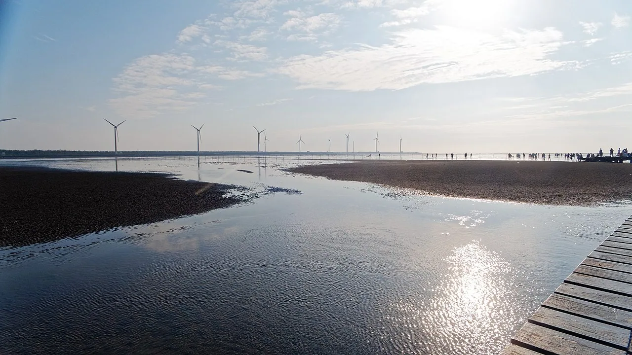
Gaomei Wetlands and wind turbines, 2018-05-11. Photo: Axjun, CC BY-SA 4.0 via Wikimedia Commons.
Heping District is the most distinctive of the 29 districts. It covers about 1,038 square kilometers, the largest in Taichung City, but has a population of only about 10,000. It is Taichung City’s only mountain Indigenous district within a special municipality20. Atayal communities of the Beishi group are distributed in settlements such as Sanchakeng, Shuangqi, Daguan, and Xueshankeng. Farther east, in the upper Dajia River, the Huanshan community (Sqoyaw) is “the largest Atayal community in the Lishan area, with 177 households and 590 people at the end of 2023”20. Wuling Farm sits at an elevation of 1,750-2,200 meters and, together with Qingjing and Fushoushan, is known as one of Taiwan’s three major high-mountain farms. It is also the trailhead for Xueshan Main Peak (3,886 meters).
From Qingshui District at sea level to the Huanshan community in Heping District above 1,800 meters, these 29 districts span a complete landform profile from sea to mountain. Taichung City Government’s official zoning divides it into three layers: nine coastal districts (Da’an, Dajia, Waipu, Qingshui, Wuqi, Shalu, Longjing, Dadu, Wuri), 14 plain-center districts (Central, East, West, South, North, Beitun, Xitun, Nantun, Fengyuan, Tanzi, Daya, Shengang, Dali, Taiping), and five eastern mountain-side districts (Dongshi, Shigang, Xinshe, Wufeng, Heping)21.
Terrain determined the political structure. The coastal line was the traditional base of the “Black Faction,” whose origin lay in Chen Shuitan’s 1951 campaign for Taichung County magistrate, when “campaign materials and business cards all used black as their mark”22. Wufeng, Dali, and Taiping were the base of the “Red Faction,” originating in the Wufeng Lin family of the Japanese period; when Lin Henian ran for the first Taichung County magistracy, his “campaign materials used red.” The Red and Black factions alternated in governing Taichung County for half a century, until the 2001 incident in which Yen Ching-piao, while serving as council speaker, was “searched and investigated for using public funds to drink flower wine,” combined with the rise of Democratic Progressive Party power, after which “the half-century factional politics of Red-Black confrontation and alternation in Taichung County gradually declined”22.
But the factions never truly disappeared. After the 2010 merger, the Yen Ching-piao family on the coast still retained legislative and council seats; Wufeng’s Red Faction tradition reorganized under the new electoral district structure. In the Taichung mayoral election on November 24, 2018, Lu Shiow-yen won 827,996 votes to Lin Chia-lung’s 619,855, a landslide of about 200,000 votes23. She took the coastal line (traditionally blue-leaning), the mountain line (Dongshi and Fengyuan), and parts of the central districts, becoming “the first female special-municipality mayor of Taichung City and the first female special-municipality mayor from the Kuomintang.” Lu was reelected in 2022, “setting an extraordinarily high ceiling in Taichung mayoral elections.”
One of the key flashpoints in the 2018 election was the Taichung World Flora Exposition, which had just opened that November. The exposition was held in three park areas, Houli, Waipu, and Fengyuan, from November 3, 2018 to April 24, 2019, for a total of 173 days, and received A2/B1-level certification from the International Association of Horticultural Producers (AIPH)24. Lin Chia-lung’s administration invested NT$16.7 billion in development budgets for the expo, and later financial controversies became a main axis of the campaign. The Flora Expo was supposed to be a municipal achievement report; in the end, it became an electoral liability.
📝 Curator’s note: The decline of factional politics does not mean disappearance. When writing about half a century of Red-Black alternation in Taichung County, the point is not Yen Ching-piao personally; he is only the representative figure of the Black Faction’s transformation into a modern brand. The point is that Taichung County’s electoral structure was long determined by the “Red Faction versus Black Faction” axis rather than by the national blue-green divide. It was not until Lu Shiow-yen swept the field in 2018 that this axis was fully incorporated into the national blue-green map. But the coastal Black Faction, Wufeng’s Red Faction, Dongshi’s Hakka vote bank, and Heping District’s Atayal vote bank remain recognizable substructures in Taichung elections. Taichung City’s political map reads like a topographic map: elevation, ethnicity, and distance from the metropolitan core each correspond to a political line.
The City That Waited 123 Years
In April 2026, Taichung City had a population of 2,868,452, making it Taiwan’s second-largest city25. It is second only to New Taipei’s 4.01 million and has 390,000 more people than the capital, Taipei, with 2.47 million. Yet the identity of “second-largest city” has a noticeably thinner presence in public narratives than its population ranking suggests.
The difference lies in the fact that Taichung’s history as the second-largest special municipality is only 16 years old. Taipei was upgraded to a special municipality in 1967 and had already served as capital for 43 years by 2010; Kaohsiung was upgraded in 1979 and had 31 years by 2010. Tainan, Taichung, New Taipei, and Taoyuan were all upgraded only successively in the 2010s. When Taipei and Kaohsiung already had complete special-municipality governance experience, budget structures, and bureaucratic systems, Taichung was still dealing with the integration problems of a 29-district merger.
Return to that October in 1887, when the provincial capital Liu Ming-chuan petitioned for was chosen at Qiaozitou. If that eight-trigram city had not been halted by Shao Youlian in 1894, if the provincial city had truly been completed, if Taiwan had not been ceded to Japan in 1895, would this Taichung Basin have directly become Taiwan’s capital? History cannot be counterfactual, but the hypothesis gives the narrative that “Taichung nearly became the capital” an additional layer of depth: Taichung was once chosen, but that city was never finished.
From 1887 to 2010 was exactly 123 years. Taichung waited more than a century before it went from an “unfinished provincial-capital candidate” to “Taiwan’s second-largest special municipality.” During that waiting, the city grew a base for the non-armed anti-Japanese movement (1920s Central Bookstore and Chiang Wei-shui’s People’s Party), the first postwar modernist chapel (1963 Luce), the first national-level art museum (1988 NTMoFA), the deepest Hakka wound after 921 (1999 Dongshi’s 358 dead), the central node of the semiconductor axis (2003 CTSP), and an opera house remembered by the global architecture world (2016 Toyo Ito).
None of these was in Liu Ming-chuan’s 1887 plan.
✦ “Qiaozitou, today’s center of Taichung City, was the provincial capital Liu Ming-chuan intended to select.” (Multiple historical records11)
Return to Dajia Jenn Lann Temple. At dawn on the day the procession departs every third lunar month, hundreds of thousands gather in front of Dajia Jenn Lann Temple from Taichung, Changhua, Yunlin, and Chiayi. Firecrackers, palanquins, devotees, media satellite trucks. From Jenn Lann Temple to Xingang Fengtian Temple in Chiayi and back, nine days and eight nights, 340 kilometers. Counting from 1730, when Lin Yongxing brought the deity statue from Meizhou to Dajia, this route has been walked for 296 years; counting from the 1988 rerouting to Xingang, it has been walked for 38 years; counting from the Ministry of Culture’s 2010 recognition as intangible cultural heritage, it has been walked for 16 years, exactly the same age as Taichung’s special municipality.
Every timeline has its own length. Taichung’s question has never been “why did Taiwan’s second-largest city take so long to be seen?” Taichung’s answer is: over 138 years of modernization, this city has never stopped growing new layers. From the Taokas, to Qing-era Qiaozitou, to Japanese-era Taichung Prefecture, to the postwar provincial city, to the 2010 special municipality, each layer presses the memory of the previous layer beneath it. What 2.86 million people live in is a city accumulated over 138 years.
Next time you pass through Taichung, do not only go to old sun cake shops and Fengjia Night Market. Try this route: at dawn, first go to Dajia Jenn Lann Temple to see Mazu’s incense offerings; at noon, walk the 340-meter fault zone at the 921 Earthquake Museum on the former Guangfu Junior High School site in Wufeng; in the afternoon, go to Dadu Mountain to see the hyperbolic surfaces of Luce Memorial Chapel; at dusk, attend a performance inside the curved walls of the Xitun theater; at night, buy a book at Central Bookstore on Jiguang Street. After walking this route, you will remember one thing: Taichung waited 123 years to become the second-largest special municipality, but it has never been absent from Taiwan’s modern history.
Further Reading
- Keelung City — 22 Counties and Cities Series pilot: from the world’s seventh-largest container port in 1984 to the 113th in 2018, a county or city that, like Taichung, once had its administrative status noticed and then rewritten
- Nantou County — 22 Counties and Cities Series batch 3 sibling: Taiwan’s only landlocked county, with the 921 epicenter at its center, sharing the trauma of the Chelungpu Fault with Taichung
- Changhua County — 22 Counties and Cities Series batch 4 sibling: the Babao Canal irrigated central Taiwan in 1709, the Lin Shuangwen incident erupted in 1786, and Lugang residents drove away DuPont in 1986; together with Taichung, it belongs to the central Taiwan living sphere of the Bagua Plateau
- Yunlin County — 22 Counties and Cities Series batch 4 sibling: the Dajia Mazu pilgrimage procession passes through Xiluo, Huwei, and Tuku, making it the middle section of the same Mazu route as Taichung
- Chiayi City — 22 Counties and Cities Series batch 2 sibling: Xingang, the endpoint of the Dajia Mazu pilgrimage procession, is in Chiayi County; together with Taichung, it forms the two ends of the same 340-kilometer religious route
- Miaoli County — 22 Counties and Cities Series batch 1 sibling: the neighboring county to the north, an inland county known for Hakka “hard-necked” resilience and county treasury debt; with Taichung’s coastal Qingshui and mountainous Dongshi, it forms central Taiwan’s Hakka map
- Taiwan Administrative Divisions — the full institutional evolution: Taiwan Prefecture established in Taichung in 1887, Taichung Prefecture established in 1920, county and city separated in 1945, and county-city merger and upgrade to special municipality in 2010
- City Characteristics and Regional Culture — cross-county and city comparative context for Taichung as the hub of central Taiwan’s living sphere
Image Sources
This article uses five Wikimedia Commons CC-licensed images, hot-linked from the Wikimedia upload server:
- Hero (frontmatter): National Taichung Theater 20180317 — exterior of the National Taichung Theater, 2018-03-17. Photo: Wikimedia Commons contributor, CC BY-SA 4.0.
- Scene §The Deity Statue in Lin Yongxing’s Home (Dajia Jenn Lann Temple): Front of Dajia Jenn Lann Temple — front of Dajia Jenn Lann Temple, 2018-08-04. Photo: Dquai, CC BY-SA 4.0.
- Scene §The Chapel on Dadu Mountain Without a Single Beam or Column (Luce Memorial Chapel): Luce Memorial Chapel — Luce Memorial Chapel, 2021-05-16. Photo: ChiaWeiHo, CC BY-SA 4.0.
- Scene §The Chelungpu Fault Tore into Dongshi (921 Earthquake Museum): 921 Earthquake Museum of Taiwan 2024-09-21 — 921 Earthquake Museum of Taiwan, 2024-09-21. Photo: Liu Shu-fu / Office of the President, CC BY 2.0.
- Scene §Taichung’s 29 Districts Stretch from Sea to Mountain (Gaomei Wetlands): Gaomei Wetlands and wind turbines — Gaomei Wetlands and wind turbines, 2018-05-11. Photo: Axjun, CC BY-SA 4.0.
Licenses: CC BY-SA 4.0 / CC BY 2.0.
References
- Liu Ming-chuan — Wikipedia — Chinese Wikipedia article. Complete record of Liu Ming-chuan and Min-Zhe Governor-General Yang Changjun jointly petitioning in October 1887 to reorganize Taiwan’s administrative divisions, selecting Qiaozitou in Changhua County (today’s Taichung City) as the provincial capital, the principle “In establishing institutions, terrain must come first; in the method of governance, balanced distribution is essential,” and the three-prefecture, one-department administrative system.↩
- History of Taichung City — Wikipedia — Chinese Wikipedia article. Complete administrative history including Liu Ming-chuan’s 1887 planning of an eight-trigram-shaped walled city in Lanxingbao, the establishment of Taichung County in 1896, its change to Taichung Department in 1901, the 1920/10/01 establishment of Taichung Prefecture by merging Nantou Department, “Taichung Street and nine surrounding villages were merged to form Taichung City,” Taichung as a stronghold of the 1920s non-armed anti-Japanese movement, and Chiang Wei-shui’s Taiwanese People’s Party being founded in Taichung.↩
- Luce Memorial Chapel — Wikipedia — Chinese Wikipedia article. Complete record of I. M. Pei and Chen Chi-kwan’s 1956 collaborative design, construction beginning in 1962, completion on 1963/11/02, commemoration of missionary Henry Winters Luce, “the first work through which the vocabulary of modernist architecture entered Taiwan,” the hyperbolic thin-shell structure, upgrade to national monument in 2019/04, and the design-credit dispute between Pei and Chen.↩
- 921 Earthquake — Wikipedia — Chinese Wikipedia article. Complete data on 1999/09/21 01:47:15.9, the Chelungpu Fault, Richter magnitude 7.3, Jiji epicenter, depth of 8 kilometers, 2,415 deaths across Taiwan, 1,154 deaths in Taichung County with 16,861 fully collapsed and 12,341 partially collapsed households, Dongshi Township’s 358 deaths as the highest casualty count, Shigang Dam’s fractured spillway gates 15-18 and 5-meter subsidence, and Nantou plus Taichung counties and cities accounting for 95% of damaged households across Taiwan.↩
- National Taichung Theater — Wikipedia — Chinese Wikipedia article. Complete engineering and design history including Council for Cultural Affairs approval in 2001/10, Toyo Ito winning first prize in the 2005 international competition, groundbreaking on 2009/12/03, Ma Ying-jeou and Jason Hu ribbon-cutting on 2014/11/23, opening by Vice President Chen Chien-jen on 2016/09/30, construction cost of NT$4.36 billion, 2,007-seat Grand Theater, 794-seat Playhouse, 200-seat Black Box, “using humanity’s most primal ideas of the ‘tree house’ and ‘cave’ to create a sound cave,” 58 curved walls, and 79,576 small-format concrete panels.↩
- Dajiaxi Anti-Qing Incident — Wikipedia — Chinese Wikipedia article. Complete historical record of the ninth year of Yongzheng (1731), Dajiaxi headman Lin Wuli’s uprising, the burning of the Taiwan Prefecture Tamsui Subprefect for Indigenous Affairs yamen, the seven-month duration, the Qing court’s mobilization of more than 6,000 mainland soldiers and “using barbarians to control barbarians” to suppress it, and the largest armed anti-official incident in the history of Taiwan’s Plains Indigenous peoples.↩
- Taokas — Wikipedia — Chinese Wikipedia article. Ethnographic information on distribution across “the coastal plain belt from Taichung City through Miaoli County to Hsinchu County,” the Dajiaxi anti-Qing incident, the Papora Middag Kingdom, Babuza distribution south of the Dadu River, and the collective migration of the three groups to the Puli Basin.↩
- Dajia Jenn Lann Temple — Wikipedia — Chinese Wikipedia article. Complete temple-building history: in Yongzheng 8 (1730), Meizhou native Lin Yongxing brought a Mazu statue to Taiwan; in Yongzheng 10 (1732), gentry built a small shrine; in Qianlong 35 (1770), it was rebuilt as Tianhou Temple; in Qianlong 52 (1787), Dajia suboffice official Zong Jinting and others initiated a land donation and reconstruction, renaming it Jenn Lann Temple.↩
- Dajia Mazu Pilgrimage Procession — Wikipedia — Chinese Wikipedia article. Complete pilgrimage data: nine days and eight nights, 340-kilometer round trip on foot, crossing Taichung, Changhua, Yunlin, and Chiayi, passing more than 100 temples and 21 townships, towns, cities, and districts, more than a hundred thousand participants every year, designation by the Council for Cultural Affairs in 2010 as a national important folk custom, and Discovery’s ranking as one of the world’s three great religious events.↩
- Jenn Lann Temple’s 1988 Rerouting to Xingang — Academia Sinica Cultural Resources Geographic Information System — Academia Sinica Cultural Resources Geographic Information System entry on Dajia Jenn Lann Temple. Complete record of the 1987 Meizhou ancestral pilgrimage, the 1988 change of pilgrimage destination to Xingang Fengtian Temple, divergent understandings of religious status over “venerating the ancestor (returning to the mother’s home)” and “exchanging incense,” and the inter-temple political turn that standardized the name “pilgrimage procession” to the present.↩
- Shao Youlian — Wikipedia — Chinese Wikipedia article. Complete decision history of the provincial capital’s northward move: taking office as Taiwan governor in 1891, “after assessing gains and losses, pragmatically canceled most new-policy measures,” “construction of the provincial city began in 1889, but after Shao Youlian took over as governor, he ordered work on the provincial city stopped and formally moved the provincial capital to Taipei Prefecture,” the 1894 First Sino-Japanese War, and transfer to acting governor of Hunan.↩
- Central Bookstore — Wikipedia — Chinese Wikipedia article. Complete bookstore history: founding meeting on 1926/06/30 at Zuiyuelou by Taichung’s Green River, official opening on 1927/01/03, founder Zhuang Chuisheng, shareholders “Lin Hsien-tang, Lin Youchun, Chen Xugu, Zhang Shenqie, Lai He, and others,” original plan as “Central Club, a meeting place for the Taiwanese Cultural Association in central Taiwan,” “the first bookstore in central Taiwan dedicated to importing Chinese- and Japanese-language books and magazines, and also the largest Chinese-language bookstore on the island,” closure in 1998 from financial difficulties, and reopening by the Sunward Humanities Foundation in 2020/01.↩
- Tunghai University — Wikipedia — Chinese Wikipedia article. Complete founding history: U.S. Vice President Nixon’s groundbreaking ceremony on 1953/11/11, the 1955/11/02 founding dedication ceremony as the university anniversary, first president Zeng Yuenong, “one of the American Christian overseas missionary enterprises, closely tied to U.S. aid to Asia and the Cold War policy of containing communism,” and establishment by the United Board for Christian Higher Education in Asia.↩
- Taichung City Hakka Culture — Hakka Affairs Council Taiwan Hakka Survey — Taiwan Hakka survey data from the Executive Yuan Hakka Affairs Council. Complete ethnic distribution record: Hakka people make up about 80% of Dongshi District, the local common language is the Dabu accent of Taiwanese Hakka, Dongshi District is Taichung City’s largest Hakka settlement, Shigang District was settled by Dabu County Hakka-language groups in the late Kangxi period, and Xinshe District is Taichung City’s second-largest Hakka settlement.↩
- Closure of the Guguan Section of the Central Cross-Island Highway After 921 — Directorate General of Highways — Official records of the Directorate General of Highways, Ministry of Transportation and Communications. Complete rescue record: after the 921 earthquake, slope collapse mileage from Guguan to Deji exceeded 80%, 26 sections of roadbed were completely lost, bus service on the Tongxiao section resumed on 2018/11/16, and the Executive Yuan approved the Qingshan lower-line reconstruction plan in 2024 with a total budget of NT$20.6 billion and expected completion in 2037.↩
- Chelungpu Fault — Central Geological Survey — Official Chelungpu Fault data from the Central Geological Survey, Ministry of Economic Affairs. Complete geologic record of the fault zone: the northern section runs from Zhuolan in Miaoli along the Dajia River and Wu River basins, passes through the foothill belt of Taichung County (Dongshi, Shigang, Dali, Taiping, Wufeng), extends south to Tongtou in Zhushan, Nantou, and then turns to Zhongpu, Chiayi. On 1999/09/21 it ruptured from beneath Jiji Township in its central section and extended 100 kilometers northward through Taichung County townships and cities.↩
- Central Taiwan Science Park — Wikipedia — Chinese Wikipedia article. Complete timeline: the NSC’s 1999 Study on Overall Environmental Analysis for Establishing a Science Park, the Executive Yuan’s 2001/05 approval of the “Green Silicon Island” blueprint, 2001 selection of Dadu Mountain and Huwei sites, Executive Yuan approval of the preparatory plan on 2002/09/23, “from approval of the preparatory plan to the start of construction took only 10 months and 5 days,” firm occupancy on 2003/07/28, AU Optronics mass production on 2004/10/27, Houli Park approval on 2005/06/27, and Erlin Park approval on 2009/11/16.↩
- History of the National Taiwan Museum of Fine Arts — National Taiwan Museum of Fine Arts — Official history page of the National Taiwan Museum of Fine Arts. Complete transformation history: the Taiwan Provincial Museum of Fine Arts was completed and opened in 1988/06, “with the opening ceremony presided over by Taiwan Provincial Government Chair Chiu Chuang-huan and Taiwan Provincial Government Department of Education Director Chen Zhuomin,” Taiwan Provincial Government Chair Lin Yang-kang resolved to establish it on 1980/02/08, and after provincial streamlining in 1999 it was transferred to the Council for Cultural Affairs and renamed the “National Taiwan Museum of Fine Arts,” “becoming the country’s first national-level art museum.”↩
- Administrative Divisions of the Republic of China — Wikipedia — Chinese Wikipedia article. Complete county-city restructuring record: on 2010/12/25, Taichung County and City merged, New Taipei City was reorganized, and Tainan County and City plus Kaohsiung County and City merged and were upgraded to special municipalities on the same day; Taoyuan was upgraded to a special municipality on 2014/12/25.↩
- Heping District (Taichung City) — Wikipedia — Chinese Wikipedia article. Complete geographic and human data: Taichung City’s largest district by area (1,038 square kilometers), population of about 10,000, Taichung City’s only mountain Indigenous district within a special municipality, Atayal Beishi group communities in Sanchakeng, Shuangqi, Daguan, and Xueshankeng, the Huanshan community Sqoyaw in the upper Dajia River as “the largest Atayal community in the Lishan area, with 177 households and 590 people at the end of 2023,” Wuling Farm at an elevation of 1,750-2,200 meters as one of Taiwan’s three major high-mountain farms, and the trailhead for Xueshan Main Peak at 3,886 meters.↩
- Taichung City Administrative Divisions — Taichung City Government — Official Taichung City Government zoning data. Complete three-layer landform-administrative division of the 29 districts: nine coastal districts (Da’an, Dajia, Waipu, Qingshui, Wuqi, Shalu, Longjing, Dadu, Wuri), 14 plain-center districts (Central, East, West, South, North, Beitun, Xitun, Nantun, Fengyuan, Tanzi, Daya, Shengang, Dali, Taiping), and five eastern mountain-side districts (Dongshi, Shigang, Xinshe, Wufeng, Heping).↩
- Taichung Local Factions — The News Lens — In-depth report by The News Lens on Taiwan’s local factions. Complete factional history: the Red Faction originated with the Wufeng Lin family, Lin Henian’s campaign for the first Taichung County magistracy “used red in publicity,” the Black Faction’s Chen Shuitan in 1951 used “black as the mark on campaign materials and business cards,” Yen Ching-piao in 1999, while serving as council speaker, was “searched and investigated for using public funds to drink flower wine,” “the half-century factional politics of Red-Black confrontation and alternation in Taichung County gradually declined,” and the rise of DPP power in 2001.↩
- 2018 Republic of China Special Municipality Mayor and County Magistrate Elections — Wikipedia — Chinese Wikipedia article. Complete election data: on 2018/11/24, Lu Shiow-yen won 827,996 votes to Lin Chia-lung’s 619,855, a landslide of 200,000 votes; she became “the first female special-municipality mayor of Taichung City and the first female special-municipality mayor from the Kuomintang”; in 2022 she was reelected, “setting an extraordinarily high ceiling in Taichung mayoral elections.”↩
- 2018 Taichung World Flora Exposition — Wikipedia — Chinese Wikipedia article. Complete exhibition period and three-park data: 2018/11/03-2019/04/24, 173 days total, “certified and authorized by the International Association of Horticultural Producers as an A2/B1-level international horticultural exposition,” Houli Horse Ranch and Forest Park Area 30.04 hectares (Ecology: Nature, natural coexistence), Waipu Park Area 14.32 hectares (Production: Green, green sharing), and Fengyuan Huludun Park 16.52 hectares (Life: People, humanistic co-prosperity and the only free-admission site).↩
- Taichung City Population Statistics — Department of Civil Affairs, Taichung City Government — Official population statistics from the Taichung City Government Department of Civil Affairs. Latest data: in April 2026, Taichung City had a population of 2,868,452, Taiwan’s second-largest city (after New Taipei City’s 4.01 million), with monthly statistics for all 29 districts updated in parallel on the Wikipedia Taichung City article.↩