In 2016, the music video for Mayday’s “Tough” featured a middle-aged man building a rocket in a wasteland. People treated him as a madman lost in a daydream; in the end, he strapped on a homemade rocket and flew into the sky. Most Taiwanese people first came to know Jong-Shinn Wu not through any state institution, but through that music video: the “Rocket Uncle.”1
Five years later, the man who had been treated as a joke took charge of the country’s space program.
Mayday’s “Tough” music video: directed by Muh Chen, the middle-aged man building rockets in a wasteland and dismissed as a daydreamer was modeled on Rocket Uncle Jong-Shinn Wu.
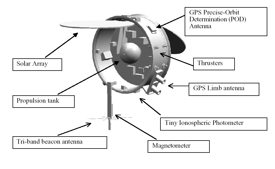
30-second overview: When the Taiwan Space Agency was established in 1991, it did not even have a formal name. It was called the “Preparatory Office of the National Space Program.” Only in 2023 did it obtain legal personhood for the first time, changing its English name from NSPO to TASA and deliberately putting Taiwan into the name.2 Today, it is no longer the temporary unit it once was: its control center in Hsinchu tracks the heartbeats of eight orbiting satellites around the clock; FORMOSAT-7 produces roughly 4,000 radio occultation data points each day for global weather forecasting; after the 0403 Hualien earthquake in 2024, it reset FORMOSAT-5’s mission six minutes after the quake, captured imagery within three hours, and identified more than 1,000 newly formed landslides.34 It is now assembling the FORMOSAT-8 constellation, building the all-weather FORMOSAT-9 radar satellites that can see through clouds, and has already approved a lunar mission that could launch as soon as 2028.5 For thirty years, it told the outside world it was doing weather and science; only when FORMOSAT-8 launched in 2025 did it acknowledge, through a Reporter feature and public remarks by the president, that what it had been doing all along was watching military movements across the Strait.6
A Beginning Called a “Preparatory Office”
On October 3, 1991, the Executive Yuan approved the first phase of the long-term space technology development program and at the same time established the “Preparatory Office of the National Space Program.”7
Pay attention to the three words “Preparatory Office.” It was not an agency, not a bureau, and not even a formal center. It was only a temporary unit, something still waiting to see whether it could survive. It had a budget and an English abbreviation, NSPO, but it had not yet assembled a Chinese name that could hang permanently at its door.
This was an era when Taiwan was still arguing over what to call itself. A country that had only recently lifted martial law, and whose president had not yet been directly elected, decided to send things into the sky. The idea at the time was simple: buy a satellite, hire a U.S. contractor to help build it, and send Taiwanese engineers to learn. That was how the first-phase program was drawn up: three satellites, moving step by step from buying to learning.7
The name “Preparatory Office” was accidentally honest. It described a country that was not yet ready, but had first put its intention out into the world.
Over the next decade-plus, the institution kept changing names, and the changes are revealing. In June 2003, it was folded into the newly established National Applied Research Laboratories and renamed the “National Space Program Office,” with the English name National Space Program Office. Two years later, in April 2005, it was renamed the “National Space Organization.”8 It looked like nothing more than replacing Program with Organization, while the abbreviation NSPO did not change by a single letter. But the same NSPO actually sat behind two different English full names. Even the name was still being tested, and tested in a way that seemed afraid others would notice.
📝 Curator’s Note
Why would an institution change names like this? Because from beginning to end, it was attached beneath someone else. It was a program under the National Science Council, then a center under NARLabs. It had no legal identity of its own, so its name was not its own either. For something without “personhood,” a name is only a label applied by a superior, pasted on and torn off, then pasted on again. This is the same kind of condition Taiwan itself faces: an existence whose name in international settings is often decided by others. The ability to name itself would take a very long time to recover.
And in those years when even the name was still being tested, the institution relied on a handful of satellites in the sky to build its legitimacy bit by bit.
For Thirty Years It Said It Was Watching the Weather
On January 27, 1999, FORMOSAT-1 launched from Cape Canaveral. Its body was built by the U.S. company TRW; Taiwan sent more than twenty engineers to the United States for on-site learning, and made only a small number of components itself.9 It was Taiwan’s “first satellite,” but this satellite was more like an apprentice’s admission ticket. It taught this institution how to talk to something in the sky.
The next two satellites established the way the institution would speak to the outside world for the next thirty years. FORMOSAT-2, launched in 2004, was Taiwan’s first remote sensing satellite. Its body was manufactured by France’s EADS Astrium; it passed over Taiwan once a day, with black-and-white imagery at two-meter resolution.10 What it is remembered for most is disaster relief: the South Asian tsunami, the Sichuan earthquake, Typhoon Morakot. In all, it supported more than 300 disaster imaging operations.10
FORMOSAT-3 in 2006 was even more direct: a constellation of six microsatellites, part of the U.S.-Taiwan COSMIC program, using GPS radio occultation technology to measure the atmosphere.11 It was called “the most accurate thermometer in space” and pushed global weather forecasting accuracy upward by a notch.11
💡 Did You Know?
The FORMOSAT series counts from 1 to 8, but skips 4 and 6. FORMOSAT-4 was halted because of problems in the procurement process, and its work was folded into FORMOSAT-5; FORMOSAT-6 was originally intended in 2009 for a self-conducted launch, later shifted to outsourcing, and then canceled.12 So Taiwan’s FORMOSAT family is a family with two blanks. Those two blanks mark two paths that did not go through.
Disaster relief, weather forecasting, atmospheric measurement: this was the face the institution presented to the outside world for thirty years. It said it was doing science, and that was not false. But it was also a deliberately chosen way of speaking. In a situation where it could not say too loudly whom it was guarding against, “we are watching the weather” was a safe sentence. What it was really watching would not be spoken aloud until much later.
The Fall FORMOSAT-5 Took
On August 25, 2017, FORMOSAT-5 launched aboard SpaceX’s Falcon 9. This one was different: it was Taiwan’s first high-resolution remote sensing satellite billed as “indigenously developed.” It cost NT$5.659 billion, took six years to build, and for the first time entrusted five major key components, including the payload computer, power control, and flight software, to Taiwan itself.13
✦ “Once people have seen a rocket made by Taiwan launch, national confidence will rise. You will immediately become 100 percent Taiwanese.” — Jong-Shinn Wu14
The first wall FORMOSAT-5 hit in becoming self-made was not technical, but political. It originally wanted to use industry-standard CCD image sensors, but high-grade remote sensing components of this kind are subject to export controls, and Taiwan could not buy them.15 The team had to take a detour, using CMOS sensors common in consumer electronics and redesigning them into space-grade remote sensing components. The result was the world’s first high-resolution remote sensing satellite using CMOS image sensors, built through five years of work by more than fifty industry-academia-research teams.15 The word “autonomous” acquired concrete meaning for the first time: when you reach the critical component, others simply will not sell it to you.
Then it fell.
The images transmitted after launch were blurry, with rings of light appearing beside urban buildings. It was a moment when the whole country watched television and held its breath: would this NT$5.6 billion “pride of Taiwan” turn into a piece of expensive space junk?16
The satellite imaging team brought it back. The team leader at the time, Hsiao-ching Liu, later recalled that FORMOSAT-5’s collimator had not been properly calibrated and had not provided truly parallel light: “a one-millimeter deviation can cause very serious defocus.”17 NARLabs proposed three solutions; in the end, software was used to reverse and restore the blurred images layer by layer, reaching commercial quality by the end of November.17 Afterward, the Control Yuan spent one year and four months investigating and traced the problem to a collimator purchased from the United States in 2011 for more than NT$8 million, concluding that its calibration management had failed.18
That fall meant more to this institution than any success. “Autonomy” became something that, in the vacuum 561 kilometers above Earth, could turn six years of work into garbage because one piece of ground equipment had not been calibrated properly. Taiwan fell on its own for the first time, then got back up on its own.
Rocket Uncle in the Wasteland Takes the Controls
The year Hsiao-ching Liu saved FORMOSAT-5, Jong-Shinn Wu was still building his private rocket in a wasteland.
Wu was born in 1964 in a rural village in Tainan to parents without formal education.19 He attended Tainan First Senior High School and studied mechanical engineering at National Taiwan University, earned a PhD in aerospace engineering from the University of Michigan, joined the space center as an associate researcher in 1995, and later taught at National Chiao Tung University.19 In 2012, he founded the Advanced Rocket Research Center, or ARRC, and used crowdfunding to build rockets: a university professor and a group of students test-firing things they had made on Taiwan’s coast. In 2015, he took the TEDxTaipei stage and spoke entirely in Tâi-gí, the Taiwanese language, about his rocket dream. His closing line was: “We absolutely will not give up. We just have to leave Earth!”20
TEDxTaipei 2015: Jong-Shinn Wu spoke entirely in Tâi-gí about his rocket dream. This was the talk that made him “famous after his 2015 TED talk,” and one of the inspirations for Mayday’s “Tough” music video.
⚠️ Contested View
Rocket Uncle’s story is not all romance. In 2016, Wu and former NASA scientist Yen-Sen Chen co-founded the private company TiSPACE.21 On February 13, 2020, TiSPACE ignited its Hapith I rocket in Nantian Village, Daren Township, Taitung, but it failed to lift off.21 It later emerged that the launch site had been applied for under the name of a “shrimp farm,” but was in fact built on Indigenous reserved land, violating the Regional Planning Act. Taitung County imposed three fines totaling NT$860,000, and former chair Lee Jin-yi was ultimately sentenced to 50 days of detention.22 Wu had already left TiSPACE in 2018 over differences in philosophy and stated that ARRC had no connection with TiSPACE.21 But this shadow is part of his arc. Taiwan’s space dream has at times stepped across environmental justice and Indigenous land rights.
On August 1, 2021, the man who had been treated as a joke in the wasteland took over as director general of the National Space Organization.23 He described the change himself as going from the scholar’s criticism, like “a dog barking at a train,” to becoming the person driving the train after he became director.24
📝 Curator’s Note
Jong-Shinn Wu is almost a miniature of this institution. A person who set out from a poor rural village, wanted to leave Earth, and was treated as a daydreamer ultimately took up the rocket dream for the whole country. He is often asked why Taiwan does not build complete satellite systems itself. His counterquestion is: if we clearly have the ability, why go help someone else sharpen their knife? Applied to a person, that sentence is ambition. Applied to an institution, it is the full meaning of the word “autonomy.” The private rocket in the wasteland and the national satellite in the sky are really asking for the same thing.
Putting Taiwan Back in the Name
Around the time Wu took over, this institution finally began to assemble the two things it lacked most: legal identity, and a name of its own.
On May 31, 2021, the Legislative Yuan passed the Space Development Act on its third reading.25 This was Taiwan’s first dedicated space law, with six chapters and twenty-two articles. Article 11 provides that launch vehicles launched within Taiwan must conduct launch operations at a “national launch site.”26 The meaning of that sentence is that Taiwan, for the first time in law, acknowledged that it must have its own launch site.
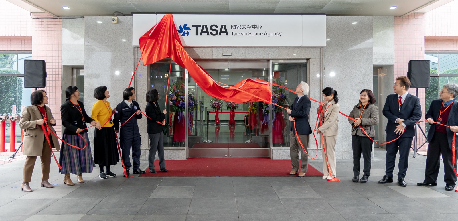
The following year was even more important. On April 19, 2022, the Legislative Yuan passed the Act for the Establishment of the National Space Center on its third reading, and it formally took effect on January 1, 2023.27 Article 2 states directly: “The Center shall be an administrative corporation; its supervisory authority shall be the National Science and Technology Council.”28
The four words “administrative corporation” meant that, for the first time in the thirty-two years since its establishment, the institution had legal “personhood.” Before this, it was a center under NARLabs and did not even have the authority to sign contracts or make procurements in its own name. After the restructuring, it could sign contracts and procure independently, and its salaries were separated from the civil service system. Wu said this made recruitment nearly ten times faster.29
Along with the restructuring, its English name changed from NSPO to TASA: Taiwan Space Agency. The official explanation was that adding Taiwan to the name would “enhance international recognition.”30
✦ A country that cannot even print its name on the sports field first put Taiwan back onto its own space agency.
This is the quietest and most crucial moment in this story. Changing an English abbreviation altered nothing technically. The satellites were still the same satellites; the engineers were still the same engineers. But an institution whose name had been decided by others for thirty years, and which had changed names back and forth without daring to make the matter real, put “Taiwan” into its name for the first time. When the draft bill was announced, Premier Su Tseng-chang said the goal was to “send Taiwan’s national strength into space.”31 That can sound like political language, but at the moment of this name correction, it referred to something very concrete.
What This Institution Does Every Day Now
To understand TASA today, start inside the control center in the building on Zhanye 1st Road in Hsinchu Science Park. On its screens, the heartbeats of eight satellites pulse at the same time.3
Each satellite passes over Taiwan at fixed times. In the few minutes when it flies overhead, the control center has to upload commands and download data. Among the eight, the oldest is FORMOSAT-5, launched in 2017 and now serving beyond its expected life; the middle six are FORMOSAT-7, the COSMIC-2 constellation launched in 2019 in cooperation with the United States, which sends roughly 4,000 radio occultation data points from space every day into global weather prediction models;332 Triton, launched in 2023, sniffs the wind over the ocean surface; the newest one is the first FORMOSAT-8 satellite, launched at the end of November 2025 and still in trial operation, with formal operations expected in July 2026.33 A preparatory office that did not even have a name in 1991 now holds a satellite fleet that cannot go offline for 24 hours.
At the other end of the facility, the next batch of satellites is being assembled. FORMOSAT-8 is an eight-satellite constellation to be launched in batches, with full deployment scheduled through 2031.33 When the first satellite, the Chi Po-lin Satellite, sent back its first images in early 2026 — Hsinchu Science Park, Anping in Tainan, Hsingda Harbor in Kaohsiung, as well as the National Stadium in Tokyo and Barcelona Airport — the team was already testing the second satellite.33 Farther along is FORMOSAT-9, the radar satellite program still in the component procurement stage: two satellites, one to be launched in 2028 and the other in 2030.34
💡 Did You Know?
The FORMOSAT-8 generation carries something even more important for Taiwan’s industry: it took sixteen domestically made key components into space for “in-orbit verification,” and all of them passed.33 Whether a component can be used in space cannot be proven by any amount of ground testing alone. It must really fly, endure vacuum and radiation, and only then is it qualified to be written into a specification sheet and sold to others. FORMOSAT-8 is effectively issuing more than twenty Taiwanese firms a certificate saying: this component has been to space.33
What satellites photograph must ultimately become services that people can use. TASA runs an imagery service platform for government agencies to apply for data: disaster prevention needs to see where slopes have collapsed; agriculture needs to see crop growth; national land planning needs to see how coastlines are changing.3 Historical images accumulated over the years by FORMOSAT-2 and FORMOSAT-5 have also gradually been placed on the government’s open data platform.3
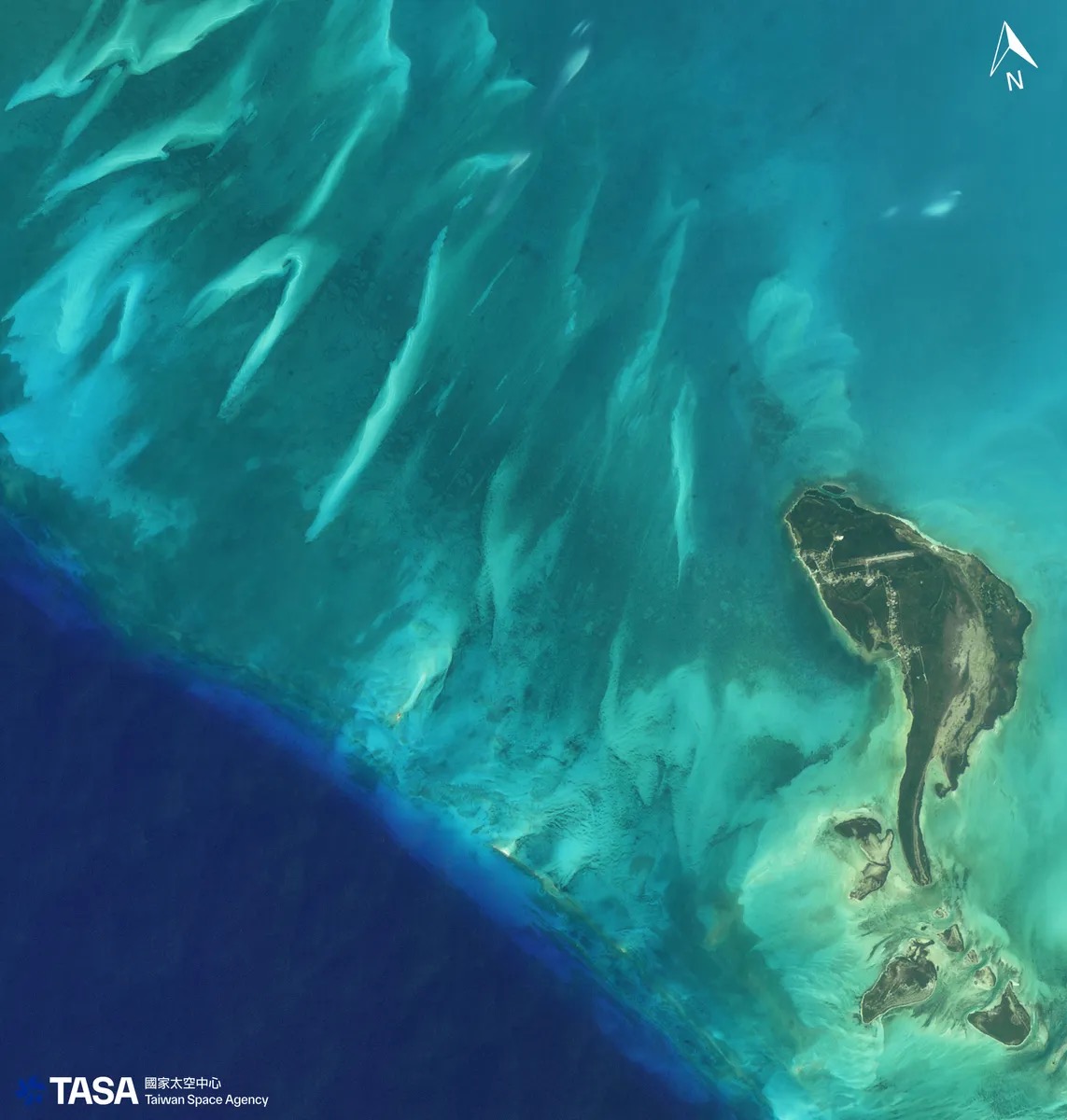
The Bahamas shoals captured by a FORMOSAT satellite. Thirty years ago, that preparatory office did not even have a name. Today, its eyes can see the seabed on the other side of the world this clearly.
And this is only the part in the sky. On the ground, TASA is leveling land at Jiupeng in Pingtung to build its own launch site, while also building a NT$3.388 billion rocket integration and testing base in Shalun, Tainan, expected to open in 2030.35 Wu has summarized what the institution now needs to do in one long sentence: “deploy communication, optical remote sensing, and synthetic aperture radar satellite constellations to build Taiwan’s autonomous three-dimensional communication and Earth observation network.”36 Put plainly, Taiwan wants its own communication network, its own eyes that can see clearly, and its own radar that can see through clouds — with every layer relying on no one else.
What Satellites Have Actually Done for Taiwan
On the morning of April 3, 2024, a magnitude 7.4 earthquake struck off Hualien, Taiwan’s largest in twenty-five years. Six minutes after the earthquake, TASA engineers remotely connected to FORMOSAT-5 and reset its mission parameters; three hours later, FORMOSAT-5 passed over Taiwan and captured emergency imagery of the epicentral area.4
This is the value of a satellite in its most concrete form. FORMOSAT-5’s single imaging swath is only twenty-four kilometers wide. To see all of Hualien’s mountain areas, it had to fly pass after pass, stitching the area together piece by piece.4 The Agency of Rural Development and Soil and Water Conservation used imagery from FORMOSAT-5 and other satellites to interpret the damage, identifying 1,391 newly formed landslides after the quake, totaling 943.76 hectares. Of these, 444 were within debris-flow potential zones, and 62 directly threatened railways or roads.4 A National Central University team calculated roughly 20.6 square kilometers of landslides in the Xiulin area alone.4 These numbers were not academic paper data. They were the basis for emergency evacuation, road closures, and disaster response resource allocation.
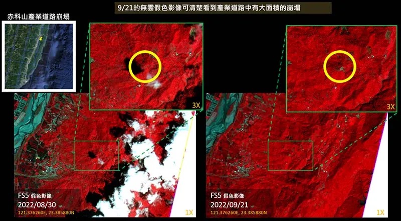
The landslide at Chike Mountain interpreted from FORMOSAT-5 after the 2022 Chishang earthquake in Taitung. The same interpretation workflow counted more than 1,000 newly formed landslides after the 0403 Hualien earthquake.
✦ “Imagery of national security targets is usually the first priority for domestically made satellites in each country. Even buyers willing to pay a great deal may not be able to get into the schedule.” — The Reporter37
When the earthquake happened, TASA also did something else: it activated the Sentinel Asia mechanism, obtaining satellite imagery from Japan’s JAXA, Thailand’s GISTDA, and India’s ISRO.4 In other words, when Taiwan has its own satellites, in a disaster it can not only photograph for itself, but is also qualified to enter an international mutual-aid circle and exchange with others. A country without its own satellites can only wait for others to be willing to make time to take images for it. And the priority of satellite scheduling is often each country’s own national security missions. No matter how much money you offer, you may not get in.37 The real meaning of autonomy is not having to wait in line.
In September 2025, a barrier lake formed upstream on Hualien’s Matai’an River, and the same mechanism moved again. Multiple satellites, including FORMOSAT-5, confirmed about 500 hectares of landslides and the water extent of the barrier lake, and local governments used these data to install water gauges and calculate evacuation timing.38 Chang Li-hsueh, who is responsible for imagery, put it plainly: the maximum area a satellite can capture in one pass is only about twenty-four kilometers, so they have to stack and analyze images from multiple satellites and multiple passes.38
Beyond the layer in the sky, Taiwan’s vulnerability is also hidden beneath the sea. In February 2023, the two undersea cables connecting Matsu were severed by Chinese vessels within six days: first a fishing vessel hooked and broke Taimatsu No. 2, then a cargo ship dropped anchor and tore through Taimatsu No. 3.39 Matsu’s 13,000 residents lost internet access for fifty days, barely sustained by microwave backup. Residents at the time said sending a single Line text message took fifteen to twenty minutes.39 Ninety-nine percent of Taiwan’s external internet traffic travels through fourteen undersea cables, while the Taiwan-Matsu cables break an average of 5.1 times per year, twenty-five to fifty times the global average.39
This is why Taiwan wants its own low Earth orbit communication satellites. But here, one has to be honest: satellites cannot replace undersea cables. The transmission capacity of one undersea cable is 100,000 times that of a single communication satellite.39 The meaning of satellite backup is that during the fifty days when every cable is cut, at least one lifeline can still transmit the words “we are still here.” It is not to move the internet into the sky.
📝 Curator’s Note
FORMOSAT-3 being called “the most accurate thermometer in space” was not Taiwanese self-praise. In 2020, radio occultation data from its successor, COSMIC-2, were formally incorporated into global forecasting systems by both the European Centre for Medium-Range Weather Forecasts (ECMWF) and the U.S. National Oceanic and Atmospheric Administration (NOAA).32 ECMWF’s assessment said these data produced “about 5%” improvement at around 100 hPa in the tropics;32 NOAA directly called the program “the largest technology collaboration between the United States and the Taiwan authorities.”32 A small institution unrecognized by most countries does not rely on diplomatic recognition. It relies on the fact that it really can photograph and calculate accurately — so accurately that weather models around the world need to use its numbers. This is a hidden route by which Taiwan bypasses diplomatic isolation and embeds itself into the international system through technology.
FORMOSAT-7/COSMIC-2 was sent into space by Falcon Heavy in 2019. Taiwan has its own satellites, but not yet its own rockets and launch site. That is why the next section is all about how to fill in those two missing pieces.
The Experiments That Are Remarkable
If one looks only at the FORMOSAT series, TASA can seem like an institution devoted to large satellites. But what is truly interesting about it is hidden in experiments that are almost impossibly small, yet solve one difficult problem after another.
On December 9, 2024, a Taiwanese CubeSat called ONGLAISAT was ejected from the International Space Station’s deployment module and entered orbit.40 It was only the size of a briefcase, a Taiwan-Japan collaboration built with the University of Tokyo.40 It carried something being verified in space for the first time: a Taiwanese-made CMOS TDI sensor produced by NARLabs’ Taiwan Semiconductor Research Institute.40 Such a tiny satellite ultimately produced images at 2.5- to 3-meter resolution, succeeded in 100 percent of fifty imaging attempts, and ranked among the world’s top CubeSats.40 It proved one thing: Taiwan can make not only large satellites, but also miniature remote sensing systems that fit inside a briefcase.
On the rocket side, there was also a world first. Wu’s old team, ARRC at National Yang Ming Chiao Tung University, launched a hybrid rocket called HTTP-3A in July 2022.41 It achieved something that previously only liquid rockets could do: thrust vector control, meaning the rocket could “turn direction” by itself in flight. It was the world’s first hybrid rocket to achieve this.41
⚠️ Contested View
To be honest, the HTTP-3A flight was not perfect. It had been expected to reach 10 kilometers, but in practice reached only about 3 kilometers, because atmospheric drag was higher than estimated.41 But the team lead, Wei Shih-hsin, stated it clearly: during the first thirty seconds after launch, the guidance and control system operated entirely according to plan. “Successful guidance and control in the first 30 seconds means it was 99 percent successful.”41 A rocket built with support from 7,000 people and NT$25 million in crowdfunding verified the most difficult technology it needed to prove. It did not reach the target altitude, but it could control its direction.
FORMOSAT-8 also contains a green experiment that you might not notice, but that is crucial. Traditional satellite attitude-control propellant is hydrazine, which is highly toxic; ground crews must wear full protective suits to handle it.42 FORMOSAT-8 used, for the first time, a hydrogen peroxide propellant developed in Taiwan, essentially high-concentration hydrogen peroxide.42 National Cheng Kung University’s Chao Yi-chin, who started the technology, calculated the tradeoff: “The thrust generated by hydrogen peroxide is only 10 percent lower than hydrazine.”42 Giving up that 10 percent of thrust gains an option that will not poison operators or pollute the environment. For an institution that is still building a launch site and will handle propellants more and more often, this is a road laid for the future.
The cleverest idea is on Triton. It measures ocean surface wind, but it does not transmit any signal down to the sea at all. Its method is to use existing GPS satellite signals in the sky as “illumination.” Those signals reflect off the ocean surface; the rougher the sea and the stronger the wind, the more chaotic the reflected signal becomes.43 Triton is responsible only for being a quiet receiver, inferring wind speed from the disorder in those reflected signals.43 A satellite that neither touches the ocean nor emits its own signal can measure the wind over an entire sea by borrowing someone else’s signal.
Borrowed Sky
With a name and legal personhood in hand, the institution began filling in its hardest gap: it had always been built on borrowed infrastructure.
On October 9, 2023, the Triton satellite launched from the Guiana Space Centre in Kourou, South America, aboard Europe’s Vega rocket.44 It had originally been the thirteenth satellite in the U.S.-Taiwan FORMOSAT-7 program, then became independent after the plan changed. Its domestic content climbed to 82 to 83 percent, with Aerospace Industrial Development Corporation responsible for system integration.44 To download its data, Taiwan borrowed NOAA’s ground station in Alaska.44
This is the institution’s situation: to reach space, it borrows SpaceX or European rockets; to download data, it borrows a U.S. ground station. And the most fundamental constraint lies in a place most people would not think of.
Taiwan is not a United Nations member state. This means it cannot directly apply to the International Telecommunication Union (ITU) for radio frequency coordination and orbital slots, both of which are prerequisites for launching satellites. So whether for launch itself or for obtaining orbital resources, Taiwan must proceed through other countries.45
📝 Curator’s Note
We are used to thinking of “space autonomy” as a matter of will: does Taiwan have the backbone to do it itself? But for this institution, autonomy is less a choice than a survival strategy forced into being. U.S. ITAR export controls make the path of “buying a whole system” full of restrictions; non-UN status makes “launching through others” the only option. Taiwan learned to build satellites itself, in a sense, because when you want to do something sensitive, no one will lend to you easily. Taiwan’s space autonomy is an ability that grew out of the condition that “no one will lend to you.”
Where It Is Going
The land is there, the buildings are there, the people are there, and even the money has been replenished. In 2024, a new office in Hsinchu Science Park was completed; on March 26, 2025, the National Science and Technology Council selected Jiupeng Village in Manzhou Township, Pingtung, as the permanent national launch site; on October 20, 2025, the Executive Yuan approved expanding the third phase of the long-term space technology development program from the original NT$25.1 billion to NT$71 billion, and extended the timeline to 2031.464748
💡 Did You Know?
Taiwan has several launch sites that are easy to confuse, and telling them apart is almost half of understanding Taiwan’s space history. The Jiupeng Base in Pingtung is a military facility of the National Chung-Shan Institute of Science and Technology; it has existed since 1975 and has long been used for missile tests.49 The Xuhai launch site in Mudan Township, Pingtung, is a scientific sounding-rocket site opened by the National Science and Technology Council in 2022, where Jong-Shinn Wu’s ARRC has launched rockets.49 Jiupeng Village is the national launch site selected only in 2025.47 As for TiSPACE’s Hapith I launch attempt, that was in Nantian, Daren Township, Taitung — not the same place as any of the first three.49
But this institution still lacks the most important thing: its own orbital launch vehicle. It can build satellites, but must still ride other people’s rockets to send them up. This is exactly the gap the next decade is meant to fill. TASA’s planned orbital rocket is a two-stage liquid configuration, with the goal of sending a 200-kilogram payload into low Earth orbit, scheduled for achievement in 2034. In between are two suborbital test vehicle (STV) flights, planned for 2029 and 2031, first to break through the 100-kilometer Karman line and then move step by step toward true orbit.505 Different parties give different precise timelines, so conservatively, this is something to be completed in the 2030s.
The communication satellite layer is also being filled in. Taiwan’s low Earth orbit communication constellation, popularly called the “Taiwan version of Starlink,” uses a 2+4 model: the government first builds the first two satellites to establish specifications, then helps the private sector build the remaining four.51 Its background is the memorable sight of Starlink sustaining communications on the Ukrainian battlefield.51 The first 1A satellite was originally scheduled to launch in 2025, but because its communication payload development failed to meet targets, launch was delayed to 2027.52
⚠️ Contested View
Not everyone thinks this path is moving fast enough. The Global Taiwan Institute has directly pointed out that Taiwan’s planned Taiwan-version low Earth orbit communication constellation intends to launch only six satellites by 2029, while a constellation sufficient to support Taiwan’s communication resilience would require at least 120 satellites — “vastly different from six.”53 An institution that has an agency, has legal personhood, but still has no rocket and a constellation nowhere near large enough: this is the other honest side of the story.
Above all this, in 2025, a goal quietly appeared that had once been unthinkable: the Moon.
And this is already budgeted and approved, no longer just talk. In 2025, TASA launched Taiwan’s first lunar exploration mission, to launch as soon as 2028, and has issued a NT$335 million tender for integrated delivery of a lunar lander.5 What it plans to send to the Moon are two Taiwanese-made scientific payloads: a lunar vector magnetometer and the “Formosa Lunar Ultraviolet Telescope.”5 Wu once told the NASA administrator in person that “Taiwan wants to be a part of the lunar adventure” — NASA has not formally confirmed Taiwan’s participation in the Artemis program.5
As for what lies even farther away and still remains at the level of conversation, it is the picture Wu often describes: “Maybe in the future, every Taiwanese young person’s coming-of-age ceremony can include a visit to a rocket launch and the national space museum.”5 A spaceport, a space museum: those are visions, not yet approved. But the Moon is already underway.
Until It Admitted It Was Watching the PLA
On November 29, 2025, the first FORMOSAT-8 satellite, FS-8A, launched from Vandenberg. It had a name: the Chi Po-lin Satellite.54
Chi Po-lin was the director of Beyond Beauty: Taiwan from Above. That 2013 aerial documentary made the whole country see Taiwan’s wounds. On June 10, 2017, while filming the sequel in Hualien, he died in a helicopter crash, and the sequel was never completed.55 Eight years later, a satellite named after him, 561 kilometers above the Earth, finished seeing Taiwan for him. At the launch, President Lai Ching-te said he hoped Director Chi’s spirit could extend into space and “continue watching over Taiwan and observing the world.”56 Chi’s son, Chi Ting-huan, said the satellite would “stand in for my father and guard Taiwan from a higher perspective.”55
FORMOSAT-8’s domestic content is 84 percent, another step beyond FORMOSAT-5.57 It sees more clearly: FORMOSAT-5 could roughly see that vehicles were moving on a highway; FORMOSAT-8 can distinguish whether they are trucks or passenger cars.58 Its revisit frequency improves from once every two days to three times per day, and it carries a short-wave infrared sensor that can penetrate clouds to detect high-temperature heat sources on the ground.59 The FORMOSAT-8 program is led by Hsiao-ching Liu, the same person who saw FORMOSAT-5 fall, rescued it, and resolved to redeem that failure with FORMOSAT-8.60
Taiwan Space Agency TASA official promotional video: FORMOSAT-8, from one satellite to an eight-satellite constellation, pushing Taiwan’s domestic content to 84 percent in the “strongest eagle eye.”
FORMOSAT-8 is an optical eye, afraid of clouds and darkness. So the institution is building the next pair: FORMOSAT-9, Taiwan’s first synthetic aperture radar (SAR) satellite, using radar to see through clouds regardless of day or night, with best resolution reaching one meter. One satellite is expected to launch in 2028 and the other in 2030.61 Optical plus radar: an institution that once did not even have legal personhood is adding an all-weather pair of eyes that can see through clouds. Then the sentence that had not been spoken for thirty years was finally spoken.
✦ “Through long-term accumulated imagery, it can conduct more intelligence analysis, even interpreting various military movements of the People’s Liberation Army.” — The Reporter62
In its FORMOSAT-8 feature, The Reporter wrote that these tasks “could long be done but not spoken of.”62 When inspecting the program, Lai Ching-te also said it directly: “Space technology is a long challenge, and it is even more closely related to Taiwan’s industrial upgrading and national security.”63
This is the climax. An institution that had told the outside world for thirty years that it was doing weather and science finally acknowledged that what it had been watching was military movement across the Strait. International strategic circles had already marked this turn. The Indian think tank ORF wrote directly that “national security is the primary consideration in Taiwan’s pursuit of its ambitions in space.”64 The U.S.-China Economic and Security Review Commission described Taiwan’s space program as meant to provide “24/7 intelligence on the cross-Strait battlefield.”65
📝 Curator’s Note
From “watching the weather” to “watching the PLA,” the institution itself did not actually change. What changed was that it finally no longer had to pretend. Most FORMOSAT satellites are indeed dual-use science and remote sensing satellites, and the military layer was publicly emphasized only with FORMOSAT-8. But the fact that the “weather” phrasing lasted thirty years is itself evidence of the institution’s condition: a small agency doing sensitive work for a country in an extremely sensitive geopolitical position had to first learn how to exist under a harmless explanation, before it could survive long enough to tell the truth. FORMOSAT-8 did not suddenly acquire a new mission. The institution finally grew large enough and solid enough to admit what it had already been doing.
The man in the wasteland who was treated as a joke and wanted to leave Earth is now driving the train for the whole country. From the “Preparatory Office” in 1991 that had not yet even assembled a name, to legal personhood in 2023 and putting Taiwan back into its name, to FORMOSAT-8 finally admitting what it was watching, this institution spent thirty-two years assembling, piece by piece, what a space agency should have: a name, legal personhood, land, money, a satellite fleet operating around the clock, and a truth it dares to say. The last missing part it wants — a true orbital rocket of its own, which would let it stop borrowing someone else’s sky — is still waiting somewhere in 2034. But its eyes have already lifted toward the farther Moon.
Chi Po-lin saw Taiwan from a helicopter and died before he could finish looking. Eight years later, a satellite named after him finished seeing Taiwan from 561 kilometers up — and, incidentally, revealed the true form of the institution that had spent thirty years saying it was watching the weather: a place that proves “autonomy” for an unrecognized country, one satellite at a time. Its next stop is to look at the Moon.
Further Reading
- Taiwan’s Space Industry Development — This article is about how the institution itself grew; that one is about the supply chain behind it: which companies made satellite components, how semiconductors entered space, and how the startup ecosystem formed.
- Semiconductor Industry — A large part of the industrial foundation for Taiwan’s space “autonomy” is built on the country’s existing semiconductor and precision manufacturing capabilities.
- Chinese Taipei — The sovereignty line of “putting Taiwan back into the name,” seen from the other side: the sports field.
- Chi Lin — Another profile of a person doing scientific work for Taiwan on the front line.
Video Sources
This article embeds three official videos, all linked to the original official channels under YouTube’s standard license, without downloading or reproduction:
- Mayday “Tough” Official Music Video — B'in Music official channel, directed by Muh Chen of Grass Jelly Studio, with the story modeled on Rocket Uncle Jong-Shinn Wu.
- A Locally Made Taiwanese Rocket to Make the Dream of Space Travel Come True | Jong-Shinn Wu | TEDxTaipei — TEDxTaipei official channel, Wu’s 2015 speech delivered entirely in Tâi-gí.
- Space Center Capability Promotional Video: FORMOSAT-8 — Taiwan Space Agency TASA official channel promotional video.
Image Sources
All images in this article are cached under public/article-images/technology/ to avoid hotlinking source servers. Images of FORMOSAT-3, FORMOSAT-5, FORMOSAT-8, FORMOSAT-9, the restructuring sign unveiling, Triton integration and testing, and related material are official images released by Taiwan Space Agency TASA. This article is educational content introducing the institution itself, using them under Copyright Act §65 and 17 U.S.C. §107 as fair use editorial commentary with attribution:
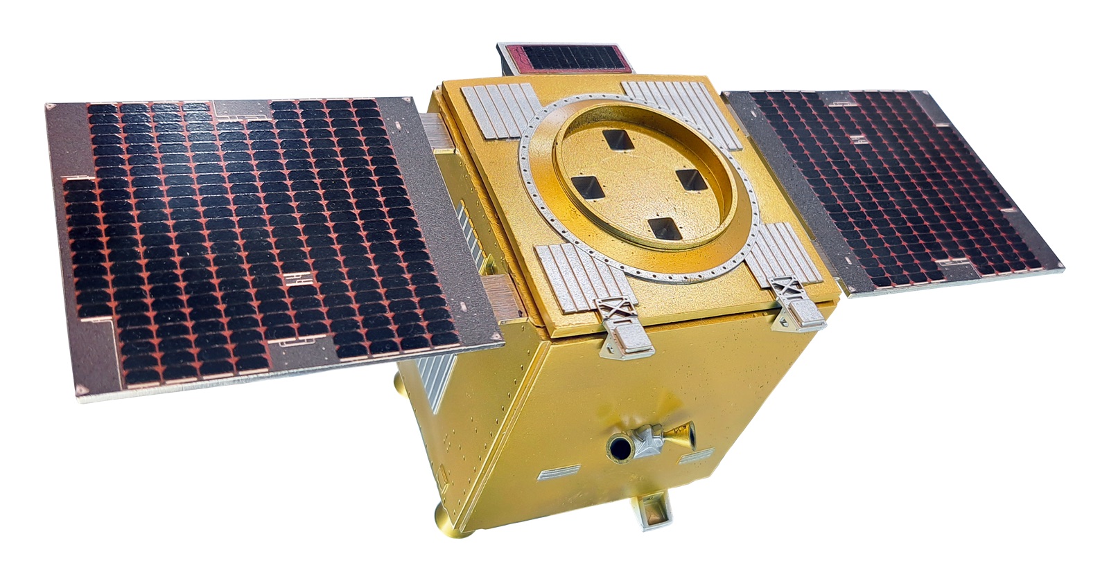
- FORMOSAT-8 Optical Remote Sensing Satellite Constellation Official Visual (hero) — © Taiwan Space Agency TASA official release, fair use editorial commentary.
- FORMOSAT-3/COSMIC Microsatellite Constellation Diagram (weather section) — © Taiwan Space Agency TASA official release, fair use editorial commentary.
- FORMOSAT-5 Launching Aboard Falcon 9 from Vandenberg (2017-08-24) — Photo: Senior Airman Kyla Gifford/U.S. Air Force (VIRIN 170824-F-DD985-026), 2017-08-24, public domain (U.S. Air Force official work). Original image 6698×4784, resized to 1600×1142.
- National Space Center Restructuring as Administrative Corporation Sign Unveiling (2023-01-01) — © Taiwan Space Agency TASA official event image, fair use editorial commentary.
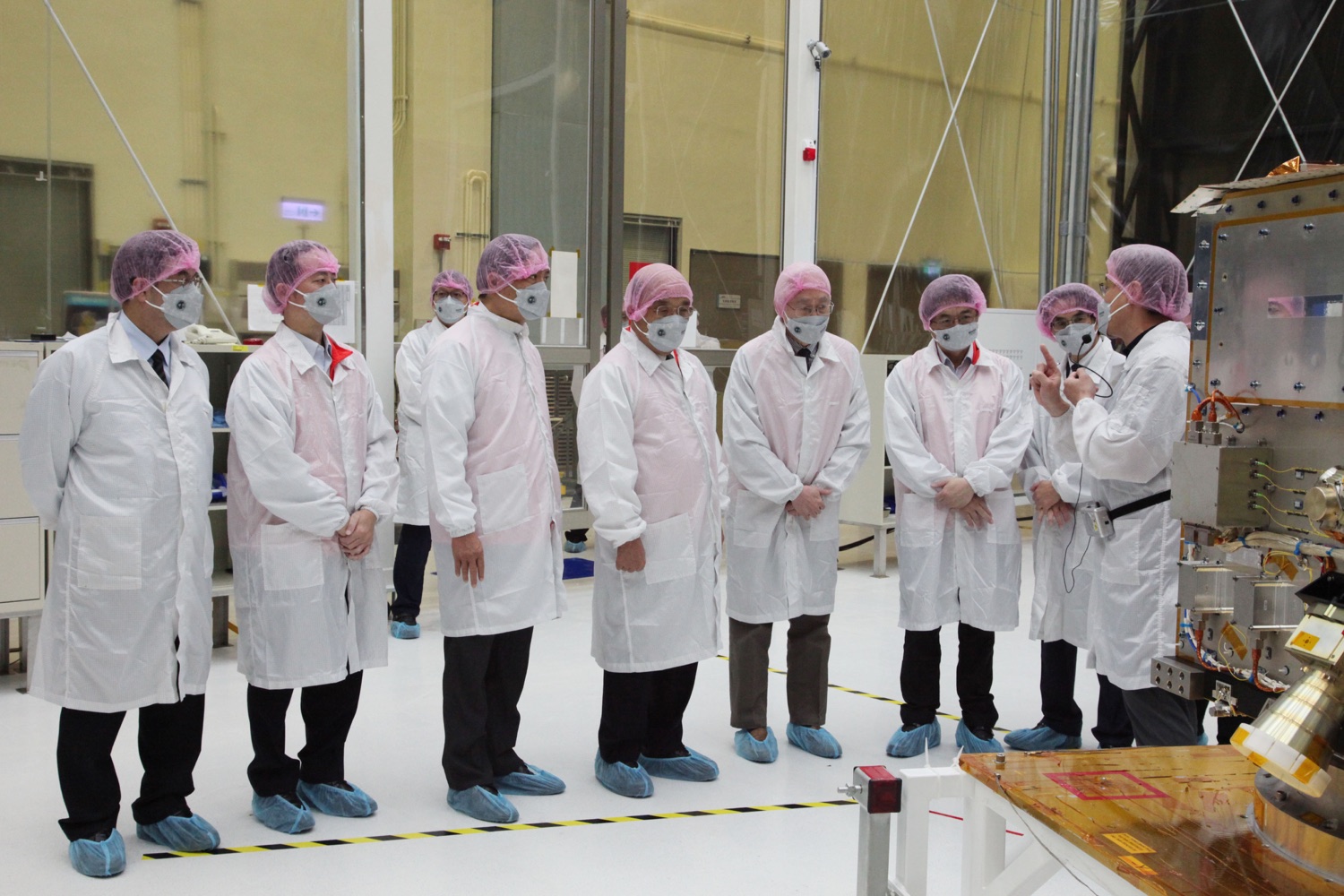
- Triton Satellite Clean Room Integration and Testing — © Taiwan Space Agency TASA official release, fair use editorial commentary.
- FORMOSAT-8 Spacecraft Physical Model (2025) (national security section) — © Taiwan Space Agency TASA official release, fair use editorial commentary.
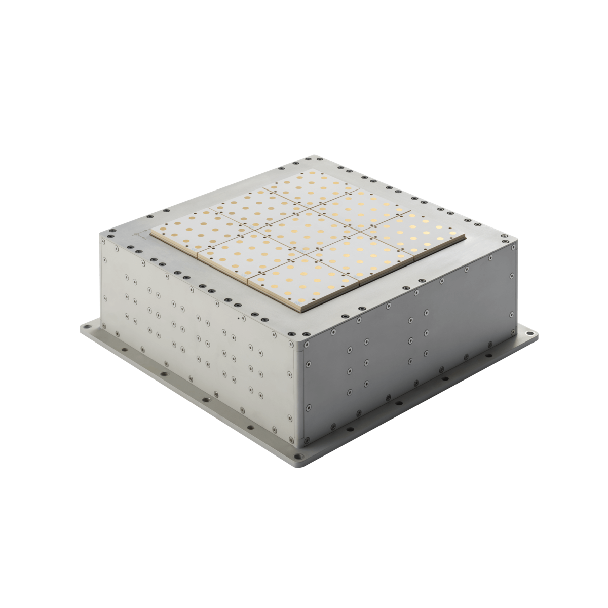
- FORMOSAT-9 Synthetic Aperture Radar (SAR) Payload — © Taiwan Space Agency TASA official release, fair use editorial commentary.
References
- Grass Jelly Studio / Making of Mayday’s “Tough” Music Video — Director Muh Chen’s 2016 music video for “Tough” was modeled on Jong-Shinn Wu, “Rocket Uncle,” and his rocket-building story. It became the institution’s best-known face in popular culture.↩
- Taipei Times: Taiwan space agency renamed — On 2023/1/1, the institution was restructured as an administrative corporation and changed its English name from NSPO to TASA (Taiwan Space Agency), deliberately putting Taiwan into the name to enhance international recognition.↩
- TASA Missions and Imagery Service Page — Operational satellites in orbit include FORMOSAT-5, FORMOSAT-7/COSMIC-2 (six satellites), Triton, and FORMOSAT-8A. The control center is on Zhanye 1st Road in Hsinchu Science Park, paired with a ground station on Taiwan proper. TASA provides an imagery service platform for government agencies (fsimage.tasa.org.tw), and historical FORMOSAT-2/FORMOSAT-5 imagery has been placed on the government open data platform.↩
- Agency of Rural Development and Soil and Water Conservation: Announcement of Interpretation Results for Newly Formed Landslides after the 0403 Hualien Earthquake — After the 2024/4/3 Hualien earthquake (M7.4), TASA remotely reset FORMOSAT-5 mission parameters six minutes after the quake and captured imagery three hours later, with a single-pass width of about 24 kilometers. Using multi-satellite imagery including FORMOSAT-5, the agency identified 1,391 newly formed landslides totaling 943.76 hectares, including 444 within debris-flow potential zones and 62 threatening railways or roads. National Central University estimated about 20.6 square kilometers of landslides in Xiulin. TASA activated Sentinel Asia to receive imagery from Japan’s JAXA, Thailand’s GISTDA, and India’s ISRO. Note: the interpretation area figures were published by the agency; TASA was responsible for the satellite imaging portion.↩
- Central News Agency: Taiwan Launches Lunar Exploration, Two Major Mission Payload Instruments Could Launch as Soon as 2028 — In 2025, TASA launched Taiwan’s first lunar exploration mission, with launch as soon as 2028. It issued a NT$335 million tender for integrated delivery of a lunar lander carrying two domestically made payloads: a lunar vector magnetometer and the Formosa Lunar Ultraviolet Telescope. The 2034 orbital rocket target is from [^35]. Wu’s statement to the NASA administrator that “Taiwan wants to be a part of the lunar adventure” (NASA has not formally confirmed Taiwan’s participation in Artemis), and his vision of “young people’s coming-of-age ceremony visiting a rocket launch and national space museum,” are from public interview remarks (Science and Technology Viewpoint / PanSci); the spaceport and space museum have not yet been approved.↩
- The Reporter: FORMOSAT-8 National Security Mission Feature — The Reporter interviewed the space center and noted that FORMOSAT-8’s intelligence analysis capability “could long be done but not spoken of.” Together with the president’s public linkage of space to national security, this is the basis for identifying the first public framing of the institution’s national security mission.↩
- TASA “About TASA” / History — On 1991/10/3, the Executive Yuan approved the first phase of the long-term space technology development program and established the “Preparatory Office of the National Space Program,” the starting point of the institution and first-hand basis for the temporary nature of the “Preparatory Office.”↩
- Taiwan Space Agency (English Wikipedia) — On 2003/6/1, the institution was transferred to NARLabs and renamed the National Space Program Office; on 2005/4/1, it was renamed the National Space Organization. The abbreviation NSPO stayed the same while the two full names differed, making this the verification source for “same abbreviation, two full names.”↩
- TechNews: Review of FORMOSAT-1 through the FORMOSAT series — FORMOSAT-1 launched from Cape Canaveral on 1999/1/27. Its body was manufactured by the U.S. company TRW, and Taiwan sent engineers to the United States for on-site learning. This is the basis for “the first satellite was bought and learned from.”↩
- PanSci: The FORMOSAT Series and Taiwan Space — FORMOSAT-2 launched in 2004 as Taiwan’s first remote sensing satellite. Its body was manufactured by France’s EADS Astrium; it provided daily revisit imaging and supported hundreds of domestic and international disaster relief operations before retirement in 2016.↩
- TechNews: FORMOSAT-3 COSMIC Weather Constellation — FORMOSAT-3 launched on 2006/4/15 as a six-microsatellite U.S.-Taiwan COSMIC program, using GPS radio occultation to measure the atmosphere. It was called “the most accurate thermometer in space” and improved global weather forecasting accuracy.↩
- Taiwan Space Agency (English Wikipedia) FORMOSAT series entry — FORMOSAT-4 was halted because of a procurement scandal and replaced by FORMOSAT-5; FORMOSAT-6 was originally planned in 2009 for self-launch before cancellation. This is the basis for the FORMOSAT family missing numbers 4 and 6.↩
- The News Lens: FORMOSAT-5 Indigenous Development — FORMOSAT-5 launched aboard a SpaceX Falcon 9 on 2017/8/25, cost NT$5.659 billion, took six years to develop, and for the first time had Taiwan produce five major key components including payload computer, power control, and flight software.↩
- Taiwan Panorama: The Young Uncle’s Space Dream — Jong-Shinn Wu said: “Once people have seen a rocket made by Taiwan launch, national confidence will rise. You will immediately become 100 percent Taiwanese.”↩
- Citizen Orange: Taiwan’s First Fully Self-Made Satellite FORMOSAT-5 — Because high-grade CCD image sensors were subject to export controls and could not be obtained, FORMOSAT-5 used CMOS sensors and developed them independently into space-grade remote sensing components, becoming the world’s first high-resolution remote sensing satellite using CMOS image sensors, completed over five years by more than fifty industry-academia-research teams.↩
- Radio Taiwan International: FORMOSAT-5 Photos Defocused, NARLabs Proposes Three Solutions — After FORMOSAT-5 launched, its returned images were blurry and showed halos around buildings. There was concern that the NT$5.6 billion-plus satellite would become space junk. NARLabs proposed three solutions: changing temperature, changing orbit, and software back-projection correction.↩
- Central News Agency: Hsiao-ching Liu Learns from FORMOSAT-5 Failure to Lead FORMOSAT-8 Team — FORMOSAT-5 imaging team leader Hsiao-ching Liu recalled that the collimator had not been properly calibrated and that “a one-millimeter deviation can cause very serious defocus.” The team used software back-projection correction to restore the imagery to commercial quality. She later led the FORMOSAT-8 project and resolved to redeem the failure.↩
- Liberty Times: Control Yuan Spends One Year and Four Months Finding Cause of FORMOSAT-5 Image Defocus — The Control Yuan spent one year and four months investigating and concluded the problem lay with a collimator purchased from the United States in 2011 for more than NT$8 million; NARLabs lacked experience in procurement and calibration management for the first domestically made imaging instrument.↩
- NYCU Department of Mechanical Engineering: Jong-Shinn Wu Faculty Page — Wu was born in 1964 in a poor rural family in Tainan, attended Tainan First Senior High School and National Taiwan University’s Department of Mechanical Engineering, earned an aerospace PhD from Michigan, joined the space center in 1995, and later became a professor at Chiao Tung University. This is a first-hand source for his biographical timeline.↩
- Business Next: Jong-Shinn Wu and ARRC Crowdfunding — In 2012 Wu founded ARRC and crowdfunded rocket development. In 2015 he delivered a TEDxTaipei talk entirely in Tâi-gí, closing with: “We absolutely will not give up. We just have to leave Earth!”↩
- Wikipedia: TiSPACE — On 2016/5/16, NASA-returned scientist Yen-Sen Chen and seconded Chiao Tung University professor Jong-Shinn Wu, among others, co-founded the private company TiSPACE. Wu left in 2018 over differences in philosophy and stated that ARRC had no connection with TiSPACE. Hapith I ignited at 6:56 a.m. on 2020/2/13 in Nantian Village, Daren Township, Taitung, but did not lift off.↩
- Liberty Times: Former TiSPACE Chair Lee Jin-yi Sentenced to 50 Days Detention — TiSPACE’s launch site was applied for as a “shrimp farm” but was in fact on Indigenous reserved land, violating the Regional Planning Act. Taitung County imposed three fines totaling NT$860,000, and former chair Lee Jin-yi was sentenced to 50 days of detention, convertible to a fine.↩
- Central News Agency: Rocket Uncle Jong-Shinn Wu Takes Over Space Center — On 2021/8/1, Jong-Shinn Wu became director general of the National Space Organization, moving from academia and private rockets into a national institution.↩
- TechOrange: From Barking at a Train to Driving the Train Himself — Wu described his criticism as a scholar as being like “a dog barking at a train,” and after becoming director as driving the train himself. The original article returns 403 and could not be checked word for word, so this is presented as paraphrase and not placed in quotation marks in the body.↩
- Ministry of Science and Technology: Space Development Act Passed on Third Reading — The Legislative Yuan passed the Space Development Act on 2021/5/31, Taiwan’s first dedicated space law, with six chapters and twenty-two articles.↩
- Full Text of the Space Development Act (Laws & Regulations Database) — Article 11, Paragraph 1 states that launch vehicles launched within Taiwan “shall conduct launch operations at a national launch site,” the legal basis for Taiwan needing its own launch site.↩
- Act for the Establishment of the National Space Center (NSTC Legal System) — The Act passed its third reading in the Legislative Yuan on 2022/4/19 and took effect on 2023/1/1, with five chapters and thirty-three articles.↩
- Full Text of the Act for the Establishment of the National Space Center (Laws & Regulations Database) — Article 2 states: “The Center shall be an administrative corporation; its supervisory authority shall be the National Science and Technology Council,” the verbatim provision establishing the institution’s administrative corporation status and legal personhood.↩
- TechNews: Substantive Changes from TASA Restructuring — After becoming an administrative corporation, the institution can sign contracts and procure independently, and its salary system is separated from the civil service. Wu said recruitment became nearly ten times faster.↩
- NIAR Restructuring Announcement — The official explanation stated that the English name was changed to TASA to “add Taiwan into the name and enhance international recognition.”↩
- Executive Yuan: Draft Act for the Establishment of the National Space Center Announcement — In the announcement related to the draft act, Premier Su Tseng-chang said the aim was to “send Taiwan’s national strength into space.”↩
- ECMWF / NOAA: COSMIC-2 Radio Occultation Data International Adoption — FORMOSAT-7/COSMIC-2 provides about 4,000–5,000 radio occultation data points per day. ECMWF’s 2020 evaluation found “improvements of about 5% at 100 hPa in the tropics” and incorporated the data in 2020/3. NOAA incorporated the data into GFS in 2020/5 and called the program “the largest technology collaboration between the United States and the Taiwan authorities.” Note: the widely circulated “10–11% improvement” lacks an original source; this article uses the ECMWF wording.↩
- TASA FORMOSAT-8 Mission Page / Constellation Deployment Schedule — FS-8A launched on 2025/11/29, captured imagery in early 2026, and is expected to enter formal operations in 2026/7. First images included Hsinchu Science Park, Anping in Tainan, Hsingda Harbor in Kaohsiung, the National Stadium in Tokyo, and Barcelona Airport. The full eight-satellite FORMOSAT-8 constellation is planned for completion in 2031, with three daily revisits. It carried sixteen domestically made key components that completed in-orbit verification.↩
- TASA FORMOSAT-9 Mission Page / Deployment Schedule — The two FORMOSAT-9 SAR satellites are planned for launch in 2028 and 2030, and are currently in the component procurement stage. Together with FORMOSAT-8 optical remote sensing, they form a complementary Earth observation system.↩
- Central News Agency: Space Center’s South-Rockets, North-Satellites Layout / Tainan Shalun Base — TASA adopts a “rockets in the south, satellites in the north” layout. The Tainan Shalun rocket integration and testing base has a budget of NT$3.388 billion for 2026–2029 and is planned to open in 2030; Pingtung Jiupeng is the national launch site.↩
- National Science and Technology Council: Jong-Shinn Wu’s Three Major Satellite Constellation Directions — Wu described TASA’s three major directions verbatim as “deploy communication, optical remote sensing, and synthetic aperture radar satellite constellations to build Taiwan’s autonomous three-dimensional communication and Earth observation network,” plus launch vehicles and the space industry.↩
- The Reporter: Self-Made Satellites and Scheduling Priority — The Reporter noted that imagery of national security targets is “usually the first priority for domestically made satellites in each country. Even buyers willing to pay a great deal may not be able to get into the schedule.” This is the basis for Taiwan’s insistence on self-made satellites to control scheduling priority.↩
- The Reporter: Matai’an River Barrier Lake Overflow and Collapse: Monitoring, Disaster Prevention, and Evacuation — In September 2025, for the Hualien Matai’an River barrier lake, multiple satellites including FORMOSAT-5 confirmed about 500 hectares of landslides and the lake’s water extent. TASA’s Chang Li-hsueh said the maximum area a satellite can capture in one pass is about 24 kilometers, requiring multi-satellite, multi-pass image stacking and analysis to support local water gauge installation and evacuation assessment.↩
- Global Taiwan Institute / Central News Agency: Matsu Cable Cuts and Communication Resilience — In 2023/2, Matsu’s two undersea cables were severed within six days by a Chinese fishing vessel and cargo ship (Taimatsu No. 2 and Taimatsu No. 3). Some 13,000 people lost internet access for fifty days and relied on microwave backup; sending one Line message took 15–20 minutes. Ninety-nine percent of Taiwan’s external traffic runs through fourteen undersea cables. The Taiwan-Matsu cables break an average of 5.1 times per year, 25–50 times the global rate. Undersea cable capacity is about 100,000 times that of a single communication satellite, so satellite backup does not replace cables.↩
- TechNews: ONGLAISAT CubeSat Completes Mission Three Months after Launch — ONGLAISAT is a Taiwan-Japan collaboration with the University of Tokyo ISSL. It was ejected into orbit from the International Space Station on 2024/12/9; it verified in space for the first time a Taiwan Semiconductor Research Institute self-made CMOS TDI sensor; it uses Korsch off-axis optics and JPEG2000 in-orbit compression. It succeeded in 100 percent of fifty imaging attempts, with 2.5- to 3-meter resolution, ranking among the world’s top CubeSats.↩
- TechNews: Taiwan’s First Scientific Research Rocket HTTP-3A Successfully Launches from Xuhai — National Yang Ming Chiao Tung University’s Advanced Rocket Research Center (ARRC) HTTP-3A was the world’s first hybrid rocket with flight guidance and control technology, or thrust vector control. On 2022/7/10 it conducted a test flight at Xuhai, reaching about 3 kilometers, below the expected 10 kilometers because atmospheric drag was higher than estimated. Wei Shih-hsin said guidance and control operated according to plan for the first 30 seconds after launch, “equivalent to 99 percent success.” The project was completed with crowdfunding from about 7,000 people and NT$25 million, and served as the model for Mayday’s “Tough” music video.↩
- The Reporter: FORMOSAT-8’s Space Component Orphans: Autonomous Propellant and Green Chemistry — FORMOSAT-8 replaces highly toxic hydrazine for the first time with a Taiwan-developed high-concentration hydrogen peroxide (85% H₂O₂) green propellant. National Cheng Kung University’s Chao Yi-chin was the technology’s initiator and said verbatim: “The thrust generated by hydrogen peroxide is only 10 percent lower than hydrazine.” It uses special nozzles and aluminum alloy fuel tanks, producing high-temperature water vapor and oxygen above 700°C after decomposition.↩
- TASA Triton Mission Page: GNSS-R Bistatic Radar Principle — Triton uses GNSS-R (Global Navigation Satellite System reflected signal) technology to measure wind: existing GPS/GNSS satellite signals serve as the “illumination source,” while Triton acts only as the receiver in a bistatic radar design. It infers ocean surface wind speed from the disorder in reflected signals from the sea surface, without actively transmitting signals or touching the ocean.↩
- TASA Triton Mission Page — Triton launched on 2023/10/9 aboard Europe’s Vega from Kourou. Originally the thirteenth FORMOSAT-7 satellite, it later became independent; domestic content reached 82 to 83 percent, AIDC handled integration, and data were downloaded through NOAA’s Alaska ground station.↩
- Domino Theory: Taiwan's Space Industry — Because Taiwan is not a UN member, it cannot directly apply to the ITU for frequency coordination and orbital slots. Launches and orbital resources must therefore be handled through other countries.↩
- National Science and Technology Council: Space Center Hiring and North-South Layout — A new office in Hsinchu Science Park was completed in 2024; the institution plans to hire 300 people over three years and adopt a “rockets in the south, satellites in the north” layout, with Tainan Shalun for rockets and Hsinchu for satellites.↩
- TASA/NSTC: Pingtung Manzhou Jiupeng National Launch Site — On 2025/3/26, the National Science and Technology Council selected Jiupeng Village in Manzhou Township, Pingtung, as the permanent national launch site, with environmental assessment underway.↩
- United Daily News: Third Phase Expanded to NT$71 Billion and Extended to 2031 — On 2025/10/20, the Executive Yuan approved expanding the third phase of the long-term space technology development program to NT$71 billion and extending it to 2031, from the originally approved NT$25.1 billion for 2019–2028.↩
- Wikipedia: Taiwan Launch Site Distinctions — Jiupeng (NCSIST military facility, since 1975), Xuhai (NSTC scientific sounding rocket site, opened 2022), Jiupeng Village (2025 national launch site), and Nantian (TiSPACE Hapith I, Daren Township, Taitung) are four different locations under different authorities and for different purposes.↩
- TASA Orbital Launch Vehicle Mission Page — The orbital rocket uses a two-stage liquid configuration and aims to send a 200-kilogram payload into low Earth orbit. Intermediate suborbital test vehicles (STV) will verify the technology in stages. Because target years differ among sources, this article conservatively describes the goal as a “2030s” project.↩
- Economic Daily News: Low Earth Orbit Satellite Explainer — The Taiwan-version low Earth orbit communication constellation uses a 2+4 model: the government builds the first two satellites to set specifications, then helps the private sector build the remaining four. The idea was inspired by Starlink’s uninterrupted communication performance in Ukraine.↩
- Digitimes: B5G Communication Payload Delay — The Taiwan-version Starlink 1A satellite was delayed from its originally planned 2025 launch to 2027 because development of the communication payload failed to meet targets.↩
- Global Taiwan Institute: A Plan B for PRC Cable-Cutting — GTI notes that a constellation sufficient to support Taiwan’s communication resilience would require at least 120 satellites, vastly different from Taiwan’s planned six satellites before 2029.↩
- TASA FORMOSAT-8 Mission Page — FS-8A, the “Chi Po-lin Satellite,” launched on 2025/11/29 from Vandenberg aboard Falcon 9 Transporter-15, with an orbital altitude of 561 kilometers, six 1-meter-resolution satellites and two sub-meter super-resolution satellites.↩
- Business Today: Chi Po-lin Satellite Launch and Chi Ting-huan on His Father Guarding Taiwan from a Higher Perspective — Chi Po-lin directed Beyond Beauty: Taiwan from Above (2013) and died in a helicopter crash while filming its sequel in Hualien on 2017/6/10. At the FORMOSAT-8 launch, his son Chi Ting-huan said the satellite would “stand in for my father and guard Taiwan from a higher perspective.”↩
- Presidential Office: Successful Launch of FORMOSAT-8 Chi Po-lin Satellite — At FORMOSAT-8’s successful launch on 2025/11/29, Lai Ching-te said verbatim: “Therefore, it was named ‘Chi Po-lin,’ in the hope that Director Chi Po-lin’s spirit can extend into space, continue watching over Taiwan and observing the world,” and expressed hope for building a new “sacred mountain protecting Taiwan.”↩
- TASA FORMOSAT-8 Mission Page: Domestic Content — FORMOSAT-8’s domestic content reaches 84 percent, a further improvement from FORMOSAT-5, with more than twenty Taiwanese firms participating.↩
- United Daily News: Taiwan’s Self-Made “Strongest Eagle Eye” FORMOSAT-8 Can Clearly Identify Vehicles from Space — FORMOSAT-8 program lead Hsiao-ching Liu said FORMOSAT-5 could roughly see cars moving on highways from space but had difficulty seeing detail, while FORMOSAT-8 can distinguish vehicle types such as trucks and passenger cars because of greatly improved resolution.↩
- The Reporter: FORMOSAT-8 Revisit Frequency and Infrared Sensing — FORMOSAT-8 increases revisit frequency from FORMOSAT-5’s once every two days to three times daily, and carries a short-wave infrared (SWIR) sensor that can penetrate clouds to detect high-temperature heat sources on the ground.↩
- Central News Agency: Hsiao-ching Liu Learns from FORMOSAT-5 Failure and Leads FORMOSAT-8 Team in Rush Work — FORMOSAT-8 is led by Hsiao-ching Liu, who led the team that rescued FORMOSAT-5’s imagery during the defocus crisis. She resolved to redeem the failure with FORMOSAT-8 and led her team through weekend work without complaint.↩
- TASA FORMOSAT-9 Mission Page — FORMOSAT-9 is Taiwan’s first microwave remote sensing synthetic aperture radar (SAR) satellite. It has a 514-kilometer orbit, total mass of about 700 kilograms, best resolution of ≤1 meter, and maximum swath above 50 kilometers. It is unaffected by day, night, or weather, and forms a complementary Earth observation system with FORMOSAT-8 optical remote sensing. The two satellites are planned for launch in 2028 and 2030.↩
- The Reporter: FORMOSAT-8 “Could Be Done but Not Spoken Of” — The Reporter wrote that these tasks “could long be done but not spoken of,” and that FORMOSAT-8 “through long-term accumulated imagery, can conduct more intelligence analysis, even interpreting various military movements of the People’s Liberation Army.”↩
- Presidential Office: Lai Ching-te Inspection of FORMOSAT-8 Transcript — Lai Ching-te said: “Space technology is a long challenge, and it is even more closely related to Taiwan’s industrial upgrading and national security.”↩
- ORF: China threat spurs Taiwan's space ambitions — ORF wrote that “national security is the primary consideration in Taiwan's pursuit of its ambitions in space,” marking the strategic turn from weather to security.↩
- USCC 2024 Annual Report to Congress — The USCC described Taiwan’s space program as intended to provide “24/7 intelligence on the cross-Strait battlefield.”↩