
30-Second Overview: Taoyuan ponds are a decentralized water storage system formed by early inhabitants digging pools and building embankments along the topography of the plateau to farm in an area lacking stable river sources. There were once as many as 8,846 such ponds; however, they have significantly decreased due to the Taoyuan Grand Canal, Shimen Reservoir, land readjustment, and urban development. Today, these ponds not only recall the agricultural era but are also seeking new life in water regulation, ecological education, disaster prevention, recreation, and local identity.1 2 3
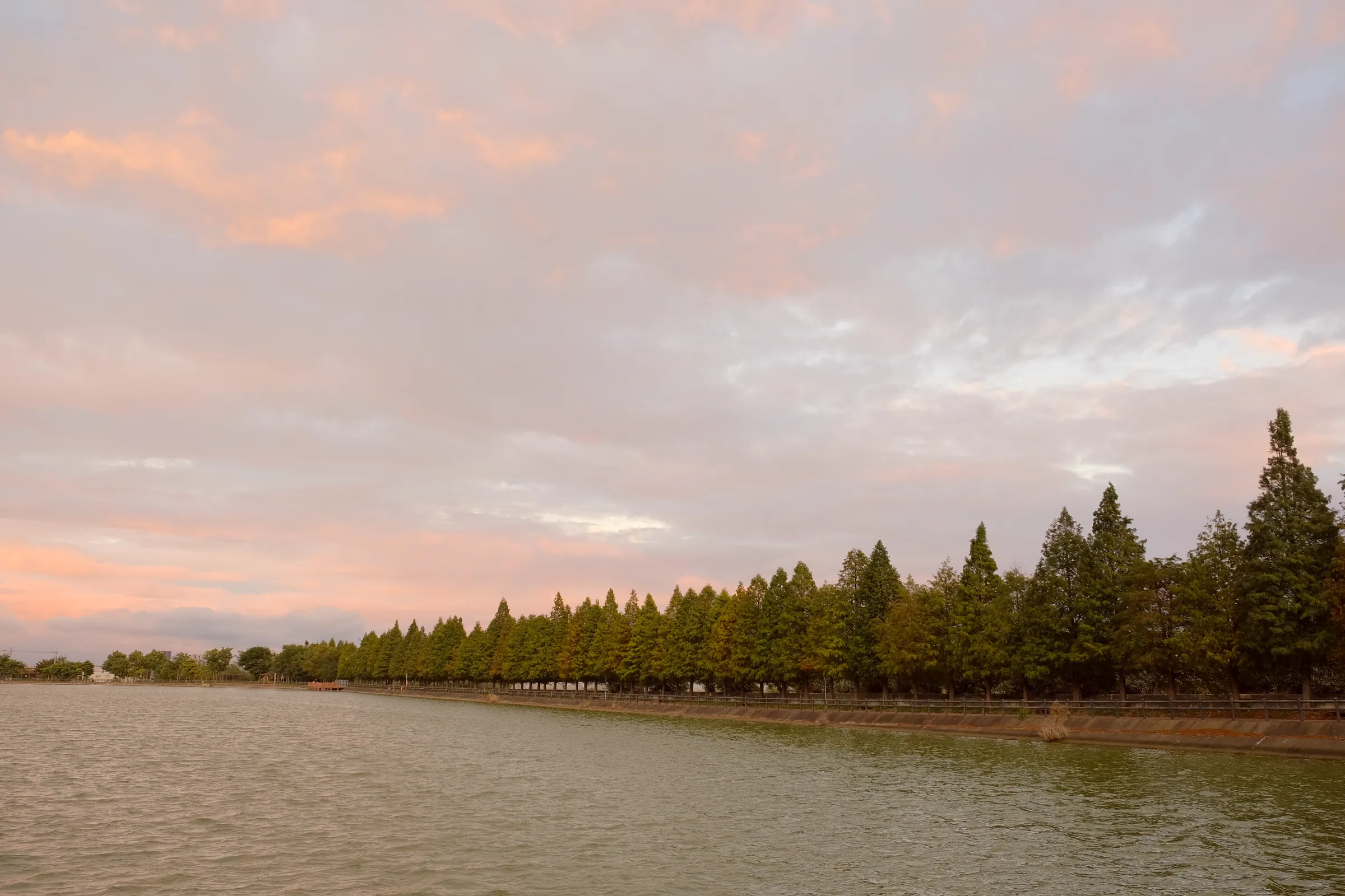
Figure: Xiaoli Pond. Photo: Taiwankengo / Wikimedia Commons, CC BY-SA 4.0.
More Than Ponds—A Decentralized Reservoir System
As one travels south or west from the urban area of Taoyuan City, ponds often appear as patches of tree shade, sections of embankments, or bodies of water enclosed by land. If they are only viewed as lakes in a park, their most important identity is missed: they were originally reservoirs for farmland, and not large reservoirs, but rather numerous small storage units linked in sequence.
The Taoyuan plateau is an ancient Shimen alluvial fan, with the ground sloping gently from southeast to northwest. This gradient allows water to flow from ponds at higher elevations downstream. The red soil and yellow soil have high stickiness, which helps retain water after digging pools and building embankments. On the other hand, streams on the plateau are short and steep; they often flood rapidly during rain but suffer from water scarcity when dry, making them unreliable as a year-round irrigation source.1
The Taoyuan Management Office calls the landscape resulting from the intersection of these geographical conditions and human engineering "the Land of a Thousand Ponds." The emphasis of this name is not just on quantity, but on how the water surface, earth embankments, fields, canals, and settlements collectively form a life-scale resource: water was not a distant public construction, but a nearby resource that farmers had to allocate, wait for, and maintain daily.2
| Condition | Impact on Pond Formation | Result in Daily Life |
|---|---|---|
| Gentle slope of the ancient Shimen alluvial fan | Created conditions for linked upstream/downstream water flow | Ponds can be connected by elevation |
| Sticky red and yellow soils | Reduced seepage, suitable for pond construction | Small-scale digging can store water |
| Short, steep streams and seasonal rainfall | Unstable river supply | Rainwater must be retained on the plateau |
| Rice cultivation needs | Required supplementary irrigation during dry periods | Ponds became the basis of agricultural production |
The Answer to Scarcity Left by Severed Rivers
The story of Taoyuan ponds cannot begin solely with "the diligence of early inhabitants." A deeper reason lies in the alteration of the water system. Due to upstream erosion in the freshwater river basin, some streams on the ancient Shimen alluvial fan lost their original continuous upstream supply, forming what is often called a "severed river" (or duantouhe) in hydraulic history. The streams still exist, but they can no longer reliably supply large areas of farmland.
Thus, settlers broke down unreliable rainfall into many controllable segments: pools were dug at higher points on the fields, and the excavated earth was piled into embankments. During rain, runoff was collected in the ponds; during drought, it was released onto the fields. This method required less technical skill than a large reservoir but demanded long-term cooperation, as the water level of one pond affected the harvest of another downstream pond.
The Taoyuan Management Office cited local historical materials stating that in 1741, the headman of Xiaoli Village (Xiao li She) and his mother, Liu Zhao (Zhi Mu), excavated the Xiaoli Grand Canal and four ponds to store water for irrigating the fields around Bade today. This record cannot be simplified into a single "origin year." It is more like a visible time point that allows us to see how hydraulic engineering, colonization, and local society formed together.2
From Small Ponds to the Taoyuan Grand Canal
Before the construction of the Taoyuan Grand Canal, there were many ponds, but water supply was not always reliable. Official historical records state that there were approximately 8,846 ponds in the Taoyuan plateau. Another survey from the early Japanese colonial period recorded a total of 6,685 public and external ponds in Taoyuan Prefecture. The statistical scope and time periods of these two sets of numbers differ, so they cannot be directly added or treated as a single census, but both indicate that early water facilities were highly decentralized.1 2
The severe drought of 1913 made the water shortage even more acute. The Japanese administration subsequently promoted the Taoyuan Grand Canal, which began construction in 1917, drawing water from the Dahan River (the upper reaches of the Dahan River today) via a diversion canal, main channel, branch lines, and distributaries to bring water into the Taoyuan plateau. The diversion and main channels were completed in 1924, the commissioning ceremony was held in 1925, and the entire system was completed in 1928.2 3
The Taoyuan Grand Canal did not replace all the ponds; rather, it reorganized them. Small ponds were integrated, merged, or abandoned, and canals delivered more stable external water to the ponds, which then distributed the water. The Taoyuan Management Office's timeline records that 2,326 small ponds were consolidated into 231 larger ponds. This indicates that "modernization" here was not a linear progress of concrete replacing earth, but a reorganization of the decentralized network.3

_Figure: Bade Pond Ecological Park, image provided remotely by Wikimedia Commons. See File Page for licensing and author information.*
The Canals Wove an Invisible Sentence Connecting Ponds
To understand the Taoyuan ponds today, one must not only count the water surfaces but also read the waterways. The Taoyuan Grand Canal system is primarily supplied by the Shimen Reservoir, with a diversion canal of about 18 kilometers, a main channel of about 25 kilometers, and a total of about 141 kilometers in branch lines and distributaries, serving 12 irrigation areas. These numbers show that the ponds are not isolated sites but nodes of regulation within a vast network.3
| Hydraulic Level | Main Function | Can Be Imagined As |
|---|---|---|
| Reservoir, River Intake | Providing stable source water | The upstream of the system |
| Diversion Canal and Main Channel | Long-distance transport | The main artery |
| Branch Lines, Distributaries | Delivering water to various areas | The branch vessels |
| Ponds | Temporary storage, regulation, redistribution | Decentralized reservoir |
| Field Waterways | Delivering water to crop roots | The last mile |
This system also explains why the "smallness" of the ponds does not mean insignificance. While a single pond's capacity may be limited, many connected ponds can store excess water from the rainy season, so that irrigation during the dry season is not entirely dependent on current rainfall. Management office data also mentions that connecting waterways between ponds serve as a buffer for regulation between the Shimen Reservoir and farmland, and even reuse return water from drainage.1
The Reversal Brought by the Shimen Reservoir
The severe drought of 1953 prompted the construction of the Shimen Reservoir. After the reservoir was completed in 1964, the Taoyuan Grand Canal gained a more stable water source, and the Shimen Grand Canal gradually took shape. Water conditions improved, which supported agricultural production. However, this same change reduced the original needs of many small ponds.1 3
This is the most significant historical reversal in Taoyuan ponds: the more modernized the water supply became, the more easily some old hydraulic facilities were seen as redundant. Land readjustment straightened out field plots, and urban planning—including construction for airports, industrial zones, and roads—changed land use; ponds that were originally used for storage and irrigation might have been filled in, reduced, or converted to other uses. The success of the water system, to some extent, made it less noticeable as a once indispensable intermediary node.1 2
Therefore, when discussing the disappearance of ponds, one cannot simply summarize it with "development destruction." It also encompasses irrigation technology upgrades, agricultural structural transformation, rising land prices, and public construction needs. The real difficulty is: when ponds no longer serve only rice fields, can we still explain their irreplaceable value to the city?
A Pond as a Memory Device for a Community
The embankments of the ponds were once paths for patrolling water, drawing water, releasing water, and travel. Fields, trees, temples, and homes surrounded the ponds, and changes in water levels inscribed the seasons into daily life. The Taoyuan Management Office specifically records Xinfu Canal No. 1 Pond and Piliun Earth God: a spiritual space next to hydraulic facilities, making engineering not just engineering, but a place where local residents narrated their hopes, risks, and mutual aid.2
In the Daxi irrigation area, ponds such as Baishi Pond, Qianci Lake, Houci Lake, and Niujao Nan Pond form another water landscape with the San-Ceng Canal and Xinfu Canal. The system documented by the Taoyuan Management Office shows that water flows sequentially from Baishi Pond through the San-Ceng Canal, Longguomai Pond, Ci Lake, and Niujao Nan Pond. Another branch reaches Xinfu Canal Pond via the Xinfu Canal Tunnel, Nanzai Stream, and canal path. These place names form a local map written by water flow.3
The Hakka Committee's survey of Taoyuan ponds places them in the context of history, culture, society, ecology, and technology, reminding us that preservation is not just about keeping a body of water. If only the appearance is preserved while losing the waterways, usage memory, and local narratives, what remains might be merely an uncontextualized landscape specimen.4
From Irrigation Facility to Ecological Park
The public nature of ponds can also be seen through their water levels. They are not always fixed mirrors but places where work is done according to irrigation seasons, rainfall, drainage, and maintenance adjustments. To tourists, changes in water level might just mean different scenery. To managers and nearby farmers, however, it relates to inflow, outflow, embankment safety, and whether downstream fields receive water at the correct time. This difference reminds us that the reuse of ponds cannot only look at riverside facilities; it must also preserve the rhythm of hydraulic operation.
From Irrigation Facility to Ecological Park (Repetition)
Ponds now often reappear in the form of recreational parks. The Bade Pond Natural Ecological Park, spanning about 5 hectares, serves functions for scenery, recreation, and ecological education. It allows residents to reconnect with the waterfront in the city and transforms the pond from an "internal agricultural facility" into part of the public environment.5
This transformation has its value, but it is also necessary to avoid turning all ponds into the same type of park. The water levels, embankments, inlets/outlets, and maintenance needs of irrigation ponds differ from those of scenic lakes. If safety is ignored for the sake of waterfront access, or if the shoreline is completely hardened for neatness, it may actually weaken its ecological function. Early maintenance records from the Water Resources Agency have pointed out that sedimentation, embankment erosion, animal burrowing, and sluice gate inspections are practical management issues.1
From an engineering perspective, there has been a conceptual shift in pond embankments. Early methods often used earth embankments and dry-stacked stones; later, concrete grids were gradually incorporated. Records from the early 2000s show experimental ecological techniques such as hollow bricks, vegetation bags, large rocks, and platforms. These practices are not choosing between "engineering" and "nature," but finding a maintainable compromise among safety, water storage, and habitat.1
Preservation is Not Freezing the Ponds
If a pond only retains its name, preservation becomes a flat display. Conversely, if the inlets/outlets, embankment roads, surrounding fields, temples, and residents' memories are brought together, the pond reclaims its original scale. This also requires conservation efforts to face some unromantic but critical issues, such as how to treat sludge, whether to repair embankments, who monitors water quality, whether ecological pond plants will spread into irrigation channels, and how public access and embankment safety can be maintained simultaneously.
Taoyuan City has used local ordinances to manage the preservation and promote new uses of ponds and canals. The policy aims to maintain unique cultural landscapes while serving functions such as irrigation, scenery, culture, recreation, ecological conservation, and disaster prevention. This multi-functional language is important because it acknowledges that ponds will not remain solely in the agricultural era, nor must they choose between "continued irrigation" and "complete tourism."6
However, regulatory names do not mean preservation is complete. CCTV's Our Island once reported on the choices facing Taoyuan ponds amid urban development: some ponds were considered to have potential as World Cultural Heritage but could not obtain full protection under cultural heritage laws because they were not designated as cultural landscapes. In the Zhonglu Urban Plan, some ponds also faced filling or reduction.7
Therefore, residents' participation is not merely decorative tours; it is a core process of determining "what is worth keeping." Research from institutions at National Cheng Kung University indicates that the improvement of the water system and changes in industrial structure led to the decrease, abandonment, and even landfilling of ponds, which necessitates understanding residents' perceptions and directions for reuse.8
What Truly Needs Preservation Today Is the Relationship
The most promising direction for Taoyuan ponds is not packaging every pond as a scenic spot, but placing them back into a system of relationships: which ones still function for irrigation, which are suitable for ecological restoration, which canal section can serve as an educational path, which embankment needs priority reinforcement, and whose story must be told by the residents.
In 2024, the Taoyuan Management Office published a monograph on the Taoyuan Grand Canal and Xinfu Canal, titled "A Century of Canals, Intergenerational Inheritance," preserving water conservancy memory through digital files, historical materials, and interviews with elders. The data also mentions future directions such as pond interconnection, IoT (Internet of Things), and AI models. This shows that hydraulic culture does not only need to be maintained by nostalgia; it can be continued using new management tools.3
The ecological aspect also needs to move from single points to networks. Recent work on Taoyuan ponds by the Forestry and Nature Conservation Agency includes species conservation bases, restoration of rare aquatic plants, cooperation between public and private sectors, and exhibition of park ecological ponds. These actions demonstrate that ponds can be green network nodes used jointly by aquatic plants and urban residents.9
| Preservation Layer | What is Not Just Preserved | Who Must Work Together |
|---|---|---|
| Water Body | Water surface and storage capacity | Water conservancy managers, engineering teams |
| Waterway | Inlets/outlets, canal paths, elevation | Water management units, local government |
| Ecology | Aquatic plants, bird and amphibian habitats | Conservation groups, researchers, schools |
| Memory | Place names, religion, industry, oral history | Residents, local cultural historians |
| Publicness | Recreation, education, disaster prevention, accessibility | Community, designers, users |
Let the Water Keep Flowing, Not Just Let the Story Stop in the Past
The most moving aspect of Taoyuan ponds is how they transformed "water scarcity" into a collective spatial wisdom. People did not wait for a perfect river to appear; instead, following the plateau's slope, soil, and monsoon, they stored rainwater diffusely, allowing it to flow to where it was needed through canals and social rules.
Today, the problem facing ponds has shifted from simply "having water" to "who decides the use of the water." Agriculture requires a stable supply; the city needs flood control and open space; ecology needs shorelines that are not overly manicured; and residents need a landscape they can still recognize. These needs do not harmonize automatically, but they can be placed on the same map through waterway surveys, public data, community participation, and long-term maintenance.
Therefore, preserving Taoyuan ponds is not putting the past under glass; it is allowing a once effective local hydraulic relationship to find new uses in facing urbanization and climate change. The next time we see the wind blowing over the water surface by a pond, what we should truly see is not just a landscape, but a living water system that many generations have collectively built and which still needs careful management.
Image Sources
The first image (Xiaoli Pond) has been cached in public/article-images/geography/ to avoid hotlinking to the source server: Xiaoli Pond 2021 — Photo: Taiwankengo / Wikimedia Commons, CC BY-SA 4.0. The second image (Bade Pond Ecological Park) is still embedded remotely from Wikimedia Commons' Special:FilePath, not downloaded or rehosted; see File Page for licensing and author information.
References
- History of Irrigation Ponds in Taoyuan Management Office — Water Resources Agency, August 31, 2021. Formation of Taoyuan ponds, historical quantity, current irrigation areas, engineering maintenance, and ecological techniques.↩2345678
- Pond Culture — Taoyuan Management Office, Water Resources Agency. Geography of the Taoyuan plateau, hydraulic history, Xiaoli Pond Canal, historical statistics, and cultural landscape.↩234567
- Publication of Taoyuan Main Canal and Xinfu Canal Monographs — Taoyuan Management Office, October 28, 2024. Scale of the Taoyuan Grand Canal, 12 branch lines, historical timeline, and digital preservation.↩234567
- Survey of Taoyuan Grand Canal and Guangfu Canal System Ponds — Hakka Committee, December 26, 2005. Survey on the preservation and interpretation of pond cultural landscapes.↩
- Bade Pond Natural Ecological Park — Ministry of Environment, Environmental Education. Scenery, recreation, and ecological education functions of Bade Pond Park.↩
- Taoyuan County Ordinance on Preservation and Promotion of New Uses for Ponds and Canals — Taoyuan City Government Legal Database. Policies regarding the preservation, multi-functional use, and cultural landscapes of ponds and canals.↩
- Multiple Choice After Ponds | Disappearance or Retention in the City — CCTV Our Island, August 23, 2021. Urban development, cultural landscape protection, and the case of Zhonglu ponds.↩
- Analysis of Residents' Perception of Ponds and Exploration of Reuse Directions — Institutional Archives of National Cheng Kung University. Resident perception, pond reduction, and reuse research.↩
- Local Guardianship: The Moving Natural Solution to Threatened Aquatic Plants in Taoyuan Ponds — Forestry and Nature Conservation Agency. Conservation and restoration of aquatic plants in Taoyuan ponds and public-private cooperation.↩