
30-Second Overview: Administratively a district of Taoyuan City, Zhongli is often treated in daily life as the core of a separate southern Taoyuan city. This seemingly contradictory statement stems from several layers of long-standing differences: Zhongli had already formed a relatively stable administrative scope in the 1920s, served as a county-administered city within Taoyuan County, and possessed its own station, commercial district, schools, and municipal memories. Located in the middle section of the Taoyuan Plateau, it connects Pingzhen, Longtan, Yangmei, Xinyu, and Guanyin, forming a north-south dual-core relationship with the Taoyuan District. Thus, saying "I am a Zhongli person" is often not a rejection of Taoyuan City as a special municipality, but an effort to avoid conflating Zhongli with the Taoyuan District.
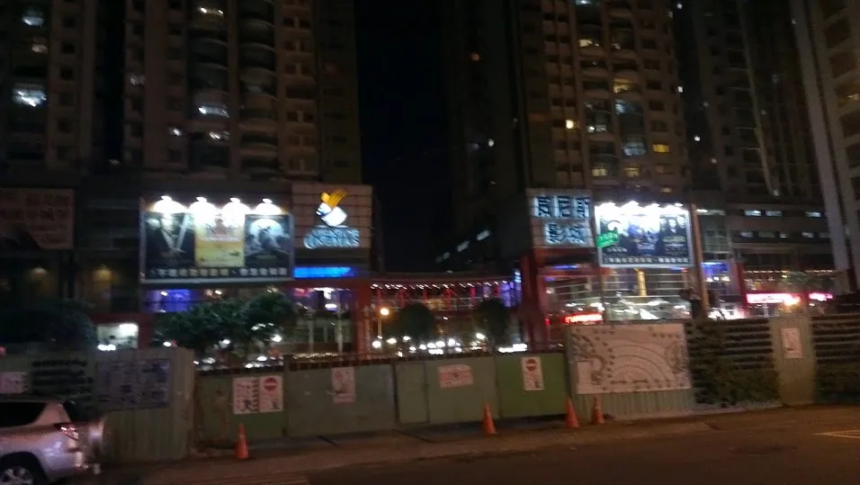
Image credit: Image taken from Wikimedia Commons "City of Zhongli, Taiwan", original image hotlink is https://upload.wikimedia.org/wikipedia/commons/4/40/City_of_Zhongli%2C_Taiwan.jpg, licensed under CC BY-SA 3.0.
Clarifying First: "Taoyuan" Has Two Meanings
In daily conversation, "Taoyuan" has two common meanings. The first is Taoyuan City, which was upgraded in 2014 and includes the Taoyuan District, Zhongli District, Pingzhen District, Bade District, Daxi District, Yangmei District, Luzhu District, Dayuan District, Guishan District, Longtan District, Xinyu District, Guanyin District, and Fuxin District. The second is the Taoyuan District within Taoyuan City, which is where the city government is located and what many refer to as "Taoyuan urban area."
Therefore, when a Zhongli resident says, "I am a Zhongli person, not a Taoyuan person," they may be responding to the second meaning, rather than denying that they live in Taoyuan City. To residents of other counties and cities, this statement sounds like an administrative contradiction; within Taoyuan, however, it is often a matter of geographic identification. The "I am a Zhongli person" and "Zhongli is not Taoyuan" recorded by local authors are examples of this lived context, but these are individual observations, not statistical conclusions for all residents. 1
To understand this difference, one cannot look only at today's administrative map. For a long time, Zhongli and the Taoyuan District were each places capable of supplying work, education, shopping, faith, and transportation. Although both belong to Taoyuan City, they do not need to share the same daily center.
Zhongli's Geographic Outline: A City Situated in the Middle of the Plateau
The Zhongli District covers an area of approximately 76.253 square kilometers, with an east-west distance of about 10.64 kilometers and a north-south distance of about 7.38 kilometers. The Zhongli District Office notes that Zhongli's administrative boundaries are winding, with a total length of approximately 56 kilometers, accounting for about 6.26 percent of Taoyuan City's total area. 2
Zhongli is located in the middle section of the Taoyuan Plateau, with the Laojie Creek and Xinjie Creek flowing through it. This position means it is neither a simple northern commuter residential area nor a plateau settlement relying solely on agriculture. To the north, it connects to the Taoyuan District and Dayuan; to the south, it links to Pingzhen, Yangmei, and the Hsinchu living circle; and to the west, it leads to Xinyu, Guanyin, and the coastal areas. Zhongli's tendency to form its own sense of cityhood is related to its orientation toward multiple directions simultaneously.
The Taoyuan City Government's English district introduction divides Zhongli into four geographic areas: Central District, Neili, Longgang, and Dalun. 3 These are not strict administrative division names but convenient ways to understand local life. The Central District centers on the station, Zhongping Road, Zhongzheng Road, Laojie Creek, and traditional commercial streets. Neili is close to the railway and industrial zones; Longgang connects diverse ethnic groups, military settlements, and campuses; and Dalun retains more agricultural landscapes and the character of western settlements.
Zhongli's geographic scale cannot be understood by area alone. The smallest Zhongli, Zhongjian, and Puyi neighborhoods are located in the old commercial area, each covering less than 0.05 square kilometers. In contrast, Shandong, Zhiba, and Yue Mei neighborhoods are all in the northwest rural area, each covering more than five square kilometers. The Zhongli District Office uses this disparity to illustrate that high-density old cities and large rural areas coexist within the same administrative district. 2
From Jianzaili to Zhongli District: Administrative Memories Behind the Name
Zhongli's early place name is related to Jianzaili. According to administrative history data from the Zhongli District Office, after Han Chinese immigrants arrived to develop the area in the Qing Dynasty, scattered villages and zhuang (townships) formed, later renamed Zhongli Street due to market development. During the Japanese colonial period, administrative systems changed; the Zhongli area first became Zhongli Village in Zhongli County, Hsinchu Prefecture, and was upgraded to Zhongli Street in 1931. 4
After 1945, the administrative name changed to Zhongli Township, Zhongli District, Hsinchu County. In 1950, following administrative reorganization, Hsinchu County was divided into Taoyuan, Zhu, and Miaoli counties, and Zhongli became the Zhongli Township directly administered by the Taoyuan County Government. In 1967, Zhongli was upgraded to a county-administered city due to its transportation position and industrial-commercial development. In 2014, when Taoyuan County was upgraded to a special municipality, Zhongli City became the Zhongli District of Taoyuan City. 4
Thus, Zhongli's "city center" and "Zhongli District" are not the same thing. The former is the core of the old city where the station, commercial streets, and historical buildings cluster. The latter also includes Neili, Longgang, Dalun, Qingpu, and the rural areas to the northwest. A complete introduction to Zhongli must place these places, which are not far apart but have different rhythms of life, on the same city map.
This history explains why the name "Zhongli" carries such a strong sense of place. Zhongli was once a township, then a county-administered city, with its own district office, urban construction, and its own city calling card. It was not the outer periphery of the Taoyuan District, but another city center officially recognized within Taoyuan County. After being restructured into Zhongli District, the administrative level changed, but the city memory did not disappear.
Taoyuan and Zhongli Have Always Been Two Cores
The Taoyuan City Government's regional introduction describes Zhongli as an important city within Taoyuan City, introducing it as the commercial center, educational center, and transportation node of Southern Taoyuan. 3 The Zhongli District Office also explicitly states that although Zhongli is not the seat of the Taoyuan City Government, due to its central location, industrial-commercial strength, and population size, it has long been on par with the Taoyuan District. 2
The "dual-core" here does not mean Taoyuan City has two city governments, but that residents' daily activities do not need to concentrate in the same direction. The Taoyuan District possesses the city government and the administrative and commercial resources of Northern Taoyuan. Zhongli, on the other hand, serves the living circle of Southern Taoyuan and the middle section of the Taoyuan Plateau, forming its own station commercial district, school network, medical services, traditional markets, and industrial employment zones.
The differences between the two are therefore not as clear-cut as county-city boundaries, but more like two overlapping magnetic fields. Some live in Pingzhen but work or study in Zhongli. Some live in Dayuan but commute to Qingpu due to the high-speed rail and airport. Some live in the Taoyuan District but frequently visit Zhongli for shopping, medical care, or family ties. The same administrative Taoyuan City has not eliminated the multi-center nature of living circles.
The Station, Qingpu, and Laojie Creek: Three Different Entrances to Zhongli
The first entrance to Zhongli is the Taiwan Railways Administration (TRA) Zhongli Station. The Zhongping Road, Zhongzheng Road, and traditional market around the station form the old city center; the density of shops, food choices, and foot traffic still maintain a street rhythm different from new redevelopment zones. The city here is not a straight avenue, but pieced together by arcades, alleys, temple squares, cram schools, bento shops, and small businesses.
The second entrance is Neili. Neili is connected to the railway, industrial zones, and residential living circles; residents' commuting directions may be Taoyuan, Taipei, Zhongli, or Hsinchu. This makes Zhongli not just a traditional city center, but a city developing alongside industrial employment, technical labor, and family housing. Bus Route 208 connects the High-Speed Rail (HSR), Neili Industrial Park, Neili Railway Station, and Yuan Ze University, making Neili an indispensable middle section in Zhongli's multi-core transportation network. 5
Huaxun is another type of residential living circle. It does not focus on HSR or station tourism, but is composed of markets, parks, schools, medical facilities, and community roads forming daily services. Including Huaxun in the introduction to Zhongli avoids representing the entire Zhongli only through the station, Qingpu, and universities. The integrity of a city often lies in living nodes that do not appear in tourism promotional headlines.
The third entrance is Qingpu. The Taoyuan HSR Station is located in the Qingpu area of Zhongli District; official introductions view it as an important transportation node connecting Taoyuan International Airport and other cities. 3 Qingpu's HSR, Airport MRT, malls, performances, and large-scale residential developments present the scale of a new urban area. The Zhongli Station, however, retains the pedestrian density of the old commercial street. Both belong to Zhongli, yet they are like city entrances from two different eras.
These nodes are not isolated. The Bus Route 208 in the Taoyuan City Government's traffic data connects the Taoyuan HSR Station, Da Jiang Shopping Center, Wan Neng University of Science and Technology, Neili Industrial Park, Neili Railway Station, Yuan Ze University, and Huaxun, linking to Bade. 5 The significance of this route lies not only in "convenient transfers," but in placing HSR travelers, industrial laborers, student commuters, and residential life within the same public transportation context. Zhongli's city scope is therefore not a square box on a map, but different areas stitched together by people moving daily.
Laojie Creek is the fourth entrance and the best place to illustrate how Zhongli handles urban issues. Named after flowing through Zhongli's old street, the main stream is approximately 36.7 kilometers long. In 1989, the urban section was covered and malls were built, but later demolished due to low utilization, flood discharge, and river defense issues. The uncovering project was completed in 2011, releasing waterfront space and barrier-free trails. 6
The Laojie Creek River Education Center, converted from two Hakka old houses, is certified by the Ministry of the Environment as the country's first environmental education center themed around rivers, and has established a cooperative network with the Water Environment Patrol Team. 7 Here, Zhongli's river governance, Hakka settlements, environmental education, and public leisure are brought together, reminding people that Zhongli is not just about blocks and transportation, but also water environments requiring long-term maintenance.

Image credit: Image taken from Wikimedia Commons "TRA EMU400 and EMU600 at Zhongli Station 20131109", hotlink is https://upload.wikimedia.org/wikipedia/commons/2/2e/TRA_EMU400_and_EMU600_at_Zhongli_Station_20131109.jpg, licensed under CC BY-SA 3.0.
Zhongli's Old City Is More Than Just a Station
The streets in front of Zhongli Station are not only modern commerce. Local investigations by Yuan Ze University record that the Zhongping Road Story House is a preserved Japanese-style semi-detached building, which served early as a government official's residence. The Yishi Hall in Zhongzheng Park was built in the Qing Dynasty, worshipping ancestors who died in Min-Yue conflicts. Yuanhua Institute is hidden in a street district with dense traffic; Renhai Palace was founded in the Qing Dynasty and is known locally as "Zhongli Ma" (Mother of Zhongli). The Shengji Pavilion next to Xinjie Elementary School preserves the physical object of the ancient belief in respecting paper with words. 8
The value of these locations lies not in each becoming a check-in spot, but in how they divide Zhongli's history into several different memories. Yishi Hall preserves memories of conflict and reconciliation; Renhai Palace represents cross-generational faith networks; the Zhongping Road Story House presents Japanese colonial urban architecture; and the Shengji Pavilion connects education, text, and faith. Walking through this small section of the old city, one finds that Zhongli's history is not a straight line from ancient to modern, but many eras stacked in the same block.
Xinjie Creek, Art Park, and Central Park
If Laojie Creek represents how Zhongli returns a hidden river to the city, Xinjie Creek presents another waterfront route. Data from Hakka Village Small Travel indicates that Xinjie Creek and Laojie Creek are listed as Zhongli's two major rivers; Xinjie Creek plans a three-kilometer water-friendly linear river green belt and installs a 1.5-kilometer river trail. The Zhongfu section along the line features the Zhongli Art Park and Cherry Blossom Trail; the Xizhou section connects Renhai Palace, the Shengji Pavilion, and the river walking route. 9
Central Park is located near Zhongli Station, forming part of the old city's daily life alongside cram schools, clothing streets, and restaurants. The Taoyuan City Government Press Office records that after renovation, Central Park is divided into a Central Stage Area, a Moonlight Ring Corridor, and an Installation Art Area; the renovation also addressed leakage in the underground parking lot caused by park water accumulation. 10 It is not a park like Qingpu, which focuses on large-scale open spaces and new buildings, but one that reopens corners that were originally closed in the old city.
Viewing the Zhongli Art Park together with Central Park reveals two directions in Zhongli's public space. One follows the river, connecting walking, exercise, and ecology into a green belt. The other is embedded in the old city, using stages, corridors, and installation art to allow places that were merely pass-throughs to become places to stay. Zhongli's urban renewal is not just about large-scale construction, but also about how to let residents stay ten minutes longer in familiar neighborhoods.
Why Does Zhongli's Campus Density Change the City's Temperament?
The Taoyuan City Government's English introduction lists several higher education institutions within Zhongli, including National Central University, Chung Yuan Christian University, Yuan Ze University, Wan Neng University of Science and Technology, and Chien Hsin University of Science and Technology. 3 The names of schools and statistical times may vary slightly across different official pages; therefore, this article only uses them as evidence that educational resources are concentrated in Zhongli, not treating the list as a fixed, latest statistic.
The impact of campus density is not just an increase in students. Higher education institutions attract teachers, researchers, service industries, rental populations, and out-of-town families. Zhongli thus has stronger demand for cram schools, dining, rentals, printing, performances, and nighttime consumption than general traditional market towns. The Qingpu and Shuanglianpo areas around Central University and the Zhongyuan Commercial Circle around Chung Yuan Christian University each form different campus living nodes.

Image credit: Image taken from Wikimedia Commons "Pacific Sogo Zhongli Store 20121103", hotlink is https://upload.wikimedia.org/wikipedia/commons/3/38/Pacific_Sogo_Zhongli_Store_20121103.jpg, licensed under CC BY-SA 3.0. The image presents a 2012 commercial street scene and does not represent the current store condition.
Educational resources also change residents' imagination of the city. School choices are often influenced by travel time and living circles. A paper on the north-south regionalization of Taoyuan from National Taiwan Normal University uses the student sources of Taoyuan High School and Central University Affiliated High School as examples, pointing out that the geographical location and traffic network of the two schools make students tend to choose schools according to north-south living circles. 11
This is also one reason why Zhongli is viewed by some as different from the Taoyuan District. When students, parents, and teachers have an educational network centered on Zhongli, the city they encounter daily does not need to pass through the Taoyuan District. Local identity is often not a declaration, but a route repeated daily.
Hakka, Minnan, and More Moving Zhongli
Zhongli cannot be simplified as a "Hakka city," but Hakka history is indeed an important clue to understanding Southern Taoyuan. Both the Zhongli District Office and Taoyuan City Government data mention that Hakka immigrants from Guangdong developed the Zhongli area in the Qing Dynasty. 3 The surrounding area's Bobo (God of the Earth) faith, settlements, cuisine, and language memories remain part of local culture today.
On the other hand, Zhongli is also a city with a highly concentrated mobile population. The station, industrial zones, higher education institutions, military settlements, and new housing make Minnan, Hakka, Mainlander, Indigenous peoples, new residents, and foreign laborers meet in the same urban area. The Dian-Burma cuisine and immigrant memories in the Longgang area are often seen as representatives of Zhongli's diverse culture, but they should not be packaged as a single tourism label. These communities are first and foremost residents, not just features for tourists to photograph.
North-South Taoyuan research indicates that the distribution of immigrants since the Qing Dynasty, Min-Hakka relations, religious titles, and settlement history jointly formed the regional phenomenon of "North Minnan, South Hakka." The research also reminds us that this is a structural analysis of population and local history, not equivalent to every individual's ethnic identity today. 11
Therefore, saying Zhongli is "more Hakka" can be a generalization of historical structure, but cannot be used to label all residents. Zhongli's true appearance is closer to a city with deep Hakka history that simultaneously absorbs incoming populations continuously.
What Does Zhongli Eat: Not a List of Famous Products, But the Intersection of Living Circles
Zhongli's culinary memories usually start from the station, Central West Road, Zhongping Road, Zhongxiao Road, Longgang, and night markets. Beef noodle soup, rice noodles, rice threads, Hakka snacks, braised dishes, bentos, breakfast shops, and Southeast Asian cuisine appear side by side, reflecting population and transportation nodes, not just local famous product competitions.
Zhongli beef noodle soup is often mentioned due to the station commercial circle, Mainlander dietary memories, immigration, and urban consumption. Longgang rice noodles and rice threads connect the Dian-Burma immigrant community and their descendants' dietary inheritance. The two cannot be mixed into the same "Zhongli taste," nor can it be assumed that all shops follow the same set of ancestral stories. A more reliable introduction method is to place shops, communities, and blocks back into their respective historical contexts.
The Taoyuan Tourism Guide introduces the Laojie Creek River Education Center, also including the Fruit Street, Zhongli Market, beef noodle soup, and Zhongli's oldest elementary school in the display content of local stories. 12 This arrangement is interesting because it does not separate the river and food. Markets, food, schools, and waterfronts jointly constitute the method by which residents recognize Zhongli.
To fully introduce Zhongli, one cannot just list three famous shops. It is more important to see how people eat breakfast near the station, look for rice noodles in Longgang, dine around campuses, buy bentos after shifts in industrial zones, and return home along the Laojie Creek trail. Food is the schedule of local life.
The First Reason for "Zhongli Is Not Taoyuan": Administrative Name vs. Daily Place Name
The most direct reason for this saying is that "Taoyuan City" and "Taoyuan District" are often shortened to the same word in colloquial speech. The Zhongli District Office is a subordinate agency of the Taoyuan City Government; administratively, Zhongli is undoubtedly part of Taoyuan City. 4
But when Taoyuan people say "go to Taoyuan," they sometimes refer to the station, department stores, government agencies, or urban area of the Taoyuan District. When Zhongli people say "I am a Zhongli person," they are often providing a more precise location to avoid being mistaken for a Taoyuan District resident. This difference is similar to someone in Taipei saying they live in Daan or Beitou; it does not mean they deny being Taipei people, but that the scale of place is different.
The Second Reason: Zhongli Was Once a County-Administered City With Its Own City Identity
Before 2014, Taoyuan County and Zhongli City were local administrative units at different levels. Zhongli was upgraded to a county-administered city in 1967 and did not change to a district under a special municipality like other county-administered cities until 2014. 4
For those who grew up before the restructuring, "Zhongli City" was not just an address, but a set of municipal memories. Schools, roads, stations, commercial circles, local elections, and the district office all operated under the name Zhongli. The post-restructuring "Zhongli District" still inherited these memories, so when residents say Zhongli, they are often referring to a city once officially recognized by the administrative system, not just a simple neighborhood or suburb.
The Third Reason: The Two Areas Each Possess Complete Living Circles
Neither the Taoyuan District nor the Zhongli District are satellite areas that can only rely on each other. Zhongli has its own TRA station, traditional commercial center, schools, medical facilities, industry, and large-scale development zones. The Taoyuan District is the seat of the city government, possessing the administrative and political-economic functions of Northern Taoyuan. There is competition between the two cores, as well as commuting, schooling, medical care, and consumption exchanges.
Local articles written from personal observation note that the Taoyuan District and Zhongli District can both provide complete functions in commerce, schools, hospitals, libraries, department stores, and commercial circles; residents do not need to move across districts for every leisure activity. 1 This phenomenon of "living independently" explains better than any slogan why the two areas have formed different local identities.
The Fourth Reason: The North-South Regionalization of Taoyuan Is Not Just a Joke
Research from National Taiwan Normal University views Zhongli as the core of Southern Taoyuan and the Taoyuan District as the core of Northern Taoyuan, analyzing how ethnicity, religion, politics, education, and transportation jointly form north-south regionalization. 11
The research points out that the distribution of immigrants and settlements in the Qing Dynasty caused different ethnic structures in Northern and Southern Taoyuan. Administrative divisions during the Japanese colonial period also divided Taoyuan, Zhongli, and Daxi into different counties. Post-war political traditions, the distribution of Land God and Bobo temples, and the sources of high school students extended these regional differences into the modern era.
This does not mean Taoyuan people are forever divided into two camps, nor that there are insurmountable boundaries between Northern and Southern Taoyuan. A more accurate understanding is that administrative regions, transportation directions, and cultural networks once concentrated on different cores for a long time, and residents gradually learned to position themselves using north and south.
The Fifth Reason: Zhongli's "Difference" Also Includes Competition and Jokes
"Zhongli is not Taoyuan" is sometimes serious local identification, sometimes a distinction from the Taoyuan District, and sometimes just a joke between the two city cores. Local authors divide this context into several situations, including the need to subdivide locations within the Taoyuan District, explaining to people from other counties and cities where they are from, and regional jokes played among friends. 1
Therefore, one should not treat a slogan as proof of Zhongli residents collectively opposing Taoyuan. Nor should one reverse and say local identity is just a joke, because the joke only works precisely because it is built on the real differences in history, transportation, and urban competition/cooperation.
Is Zhongli Actually Different From Taoyuan?
The answer depends on which "difference" you are asking about. If asking about administration, Zhongli is the Zhongli District of Taoyuan City, without question. If asking about daily place names, Zhongli and the Taoyuan District are often used separately by residents. If asking about history, Zhongli was once a county-administered city developing independently within Taoyuan County. If asking about living circles, Zhongli has Southern Taoyuan as its hinterland, possessing its own transportation, education, commerce, and cultural nodes. If asking about identity, the answer varies by generation, length of residence, family background, and usage context.
| Question | More Accurate Answer |
|---|---|
| Is Zhongli part of Taoyuan City? | Yes. Since 2014, it has been the Zhongli District of Taoyuan City. 4 |
| Is Zhongli the Taoyuan District? | No. The Zhongli District and Taoyuan District are two different administrative districts of Taoyuan City. |
| Do Zhongli and Taoyuan each have their own city centers? | Yes. Official and local data view the two as the important dual cores of Taoyuan City. 2 3 |
| Is Zhongli a Hakka city? | It has deep Hakka history, but today's population and culture are diverse; all residents cannot be classified into the same identity. 3 11 |
| Is "Zhongli is not Taoyuan" a fact? | If referring to administration, the statement is incomplete. If referring to daily place names and local living circles, it reflects a common regional identification. 1 |
A River, A Station, and A City Still in Flux
The most noteworthy thing about Zhongli is not whether it can be summarized by the phrase "Southern Taoyuan," but that it is always changing. The area around the station retains the density of a traditional city; Neili connects industry and housing; Longgang preserves diverse immigrant and military dependent life; Central University and Chung Yuan Christian University expand the education and population network; Dalun retains rural landscapes; and Qingpu brings HSR, performances, and new housing into the city.
The story of Laojie Creek especially illustrates this change. In 1989, Zhongli once hid the river with malls and cover plates. After 2011, the local community used uncovering, waterfront trails, sewage treatment, the River Education Center, and patrol teams to make the river a public space again. 6 The River Education Center, converted from Hakka old houses, places engineering history and local life in the same field. 7 This is not restoring Zhongli to some imagined ancient appearance, but acknowledging that the city must constantly correct itself.
Zhongli is therefore not a miniature version of Taoyuan City, nor a southern copy of the Taoyuan District. It is a city district within Taoyuan City with its own historical layers, administratively forming a special municipality together with Taoyuan, and in daily life maintaining its identity through its own neighborhoods, transportation, schools, cuisine, ethnic groups, and waterfronts.
When someone says "I am a Zhongli person, not a Taoyuan person," the best response is not to immediately correct them with "Zhongli is obviously Taoyuan," nor to treat this sentence as a political manifesto. First, ask clearly which scale of Taoyuan they are referring to, and you will find that both statements can coexist: Zhongli is part of Taoyuan City, and Zhongli is indeed a place recognized by many through their own life experiences.
Further Reading
Zhongli District Office, Taoyuan City: This District's Scope | Zhongli District Office, Taoyuan City: Administrative Regions | Taoyuan City Government English District Introduction: Zhongli District
Image Sources
The three images in this article are all adapted from external hotlinks. The first image is Wikimedia Commons "City of Zhongli, Taiwan," file page is https://commons.wikimedia.org/wiki/File:City_of_Zhongli,_Taiwan.jpg, original image URL is https://upload.wikimedia.org/wikipedia/commons/4/40/City_of_Zhongli%2C_Taiwan.jpg, licensed under CC BY-SA 3.0. The station image is Wikimedia Commons "TRA EMU400 and EMU600 at Zhongli Station 20131109," file page is https://commons.wikimedia.org/wiki/File:TRA_EMU400_and_EMU600_at_Zhongli_Station_20131109.jpg, original image URL is https://upload.wikimedia.org/wikipedia/commons/2/2e/TRA_EMU400_and_EMU600_at_Zhongli_Station_20131109.jpg, licensed under CC BY-SA 3.0. The commercial street scene image is Wikimedia Commons "Pacific Sogo Zhongli Store 20121103," file page is https://commons.wikimedia.org/wiki/File:Pacific_Sogo_Zhongli_Store_20121103.jpg, original image URL is https://upload.wikimedia.org/wikipedia/commons/3/38/Pacific_Sogo_Zhongli_Store_20121103.jpg, licensed under CC BY-SA 3.0.
References
Image License and Production Notes: This article currently embeds three Wikimedia Commons images, all using
upload.wikimedia.orgoriginal file hotlinks. The original two local/article-images/illustrative images have been removed to avoid invalidation during website deployment due to asynchronous public directories. The file pages and CC BY-SA 3.0 licenses for the three images are listed in 13, 14, and 15 respectively. Image hotlinks and file pages are marked in the main text and the "Image Sources" section; no Shutterstock, Alamy, or images with unclear licenses are used.
- Don't Divide So Finely: The Rivalry Between Taoyuan and Zhongli — A local author's personal observation on "I am a Zhongli person" and the differences in living circles between Taoyuan and Zhongli. This article only uses it as an example of local discourse, not as a statistic for all residents.↩234
- Zhongli District Office, Taoyuan City: This District's Scope — Provides Zhongli's area, east-west-north-south distances, the time when the population broke 400,000, and the official local overview of Zhongli being on par with the Taoyuan District.↩234
- Taoyuan City Government: Zhongli District — Taoyuan City Government's English district introduction, explaining Zhongli's area and population data, Laojie Creek and Xinjie Creek, Southern Taoyuan city functions, four geographic areas, higher education institutions, station commercial circles, and Qingpu HSR station.↩234567
- Zhongli District Office, Taoyuan City: Administrative Regions — Zhongli's history page from zhuang, street, township, city to the administrative district under a special municipality, supporting this article's narrative of administrative changes in 1920, 1931, 1950, 1967, and 2014.↩2345
- Taoyuan City Government Traffic Safety Promotion Group: Convenient Transfer New Service, Urban Bus Route 208 — Official traffic article explaining how Route 208 connects Taoyuan HSR Station, Neili Industrial Park, Neili Railway Station, Yuan Ze University, Huaxun, and Bade, supporting this article's description of Zhongli's multi-node transportation living circle.↩2
- Ministry of the Environment Water Quality Protection Network: Laojie Creek — Provides Laojie Creek watershed, cover and uncover engineering, 3.6-kilometer barrier-free trails, River Education Center, gravel bed treatment, and water environment governance data.↩2
- National Environmental Education Certification System: Laojie Creek River Education Center — Explains the center's conversion from Hakka old houses, river education functions, and the guardianship network cooperating with the Water Environment Patrol Team.↩2
- Yuan Ze University Department of Geography: Local Multicultural Course Group: An Exploration Journey of Zhongli's Monuments — Yuan Ze University local investigation article recording the historical context of Zhongping Road Story House, Yishi Hall, Yuanhua Institute, Renhai Palace, and the Shengji Pavilion next to Xinjie Elementary School.↩
- Hakka Village Small Travel: Zhongli Laojie Creek Trail, Xinjie Creek Trail — Hakka tourism article explaining Xinjie Creek's water-friendly linear green belt, river trail, Zhongli Art Park, Renhai Palace, and the walking relationship of the Shengji Pavilion.↩
- Taoyuan City Government Press Office: Zhongli Central Park Renovation Completed and Opened, Becoming a Charming Landmark and New Check-in Highlight — Taoyuan City Government article explaining Central Park's renovation budget, stage area, Moonlight Ring Corridor, Installation Art Area, and the relationship between the park and Zhongli Station commercial street.↩
- Wang Yi-ting: The Local Significance of Taoyuan's "North-South War": An Exploration of Regionalization — Abstract of a Master's thesis from National Taiwan Normal University, analyzing Taoyuan's north-south regionalization and the relationships between ethnicity, religion, politics, education, and transportation from the perspective of new regional geography.↩234
- Taoyuan Tourism Guide: Laojie Creek River Education Center — Introduces Zhongli Laojie Creek Story House, River Ecology Education Hall, Hakka old houses, restoration and activation displays, and the display context of Zhongli Market, beef noodle soup, and local life.↩
- Wikimedia Commons: City of Zhongli, Taiwan — Zhongli cityscape file page, marked CC BY-SA 3.0, article uses its original image hotlink.↩
- Wikimedia Commons: TRA EMU400 and EMU600 at Zhongli Station 20131109 — Zhongli Station platform train photo file page, marked CC BY-SA 3.0, article uses its original image hotlink.↩
- Wikimedia Commons: Pacific Sogo Zhongli Store 20121103 — Zhongli Zhongzheng Road commercial street scene photo file page, marked CC BY-SA 3.0, article uses its original image hotlink.↩


