

Conjunto de dados cartográficos de código aberto
O formato de Taiwan
SVG, GeoJSON, TopoJSON — dados cartográficos completos e de código aberto para desenvolvedores, designers e pesquisadores.
Por que o formato de Taiwan é importante
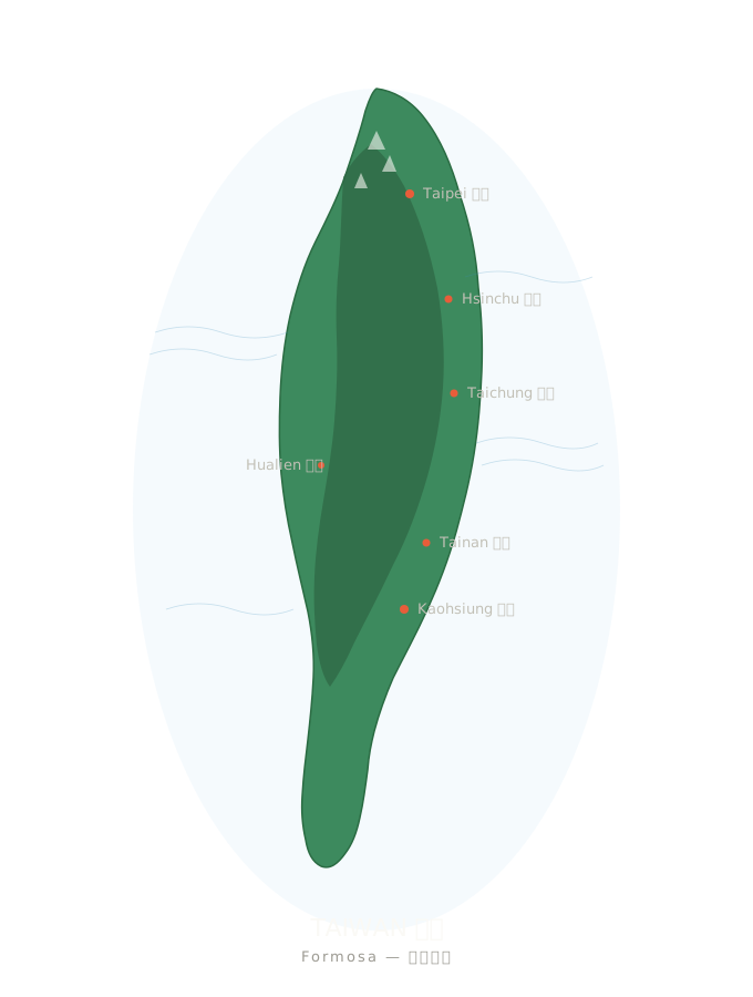
Peça a qualquer ferramenta de geração de imagens por IA para desenhar Taiwan e o resultado quase sempre será algo redondo e rechonchudo, entre uma azeitona e uma batata. Taiwan não é uma azeitona. É uma batata-doce de 394 quilômetros de comprimento, com uma cordilheira central que atravessa a ilha de norte a sul e mais de cem ilhas periféricas.
Representar o formato corretamente não é apenas um detalhe de design, mas uma questão de identidade. Esta página reúne todos os recursos cartográficos de código aberto que usamos no taiwan.md, para que qualquer pessoa possa representar Taiwan com precisão em seu próprio projeto.
vs. 🇹🇼 — A IA erra toda vez, de verdade
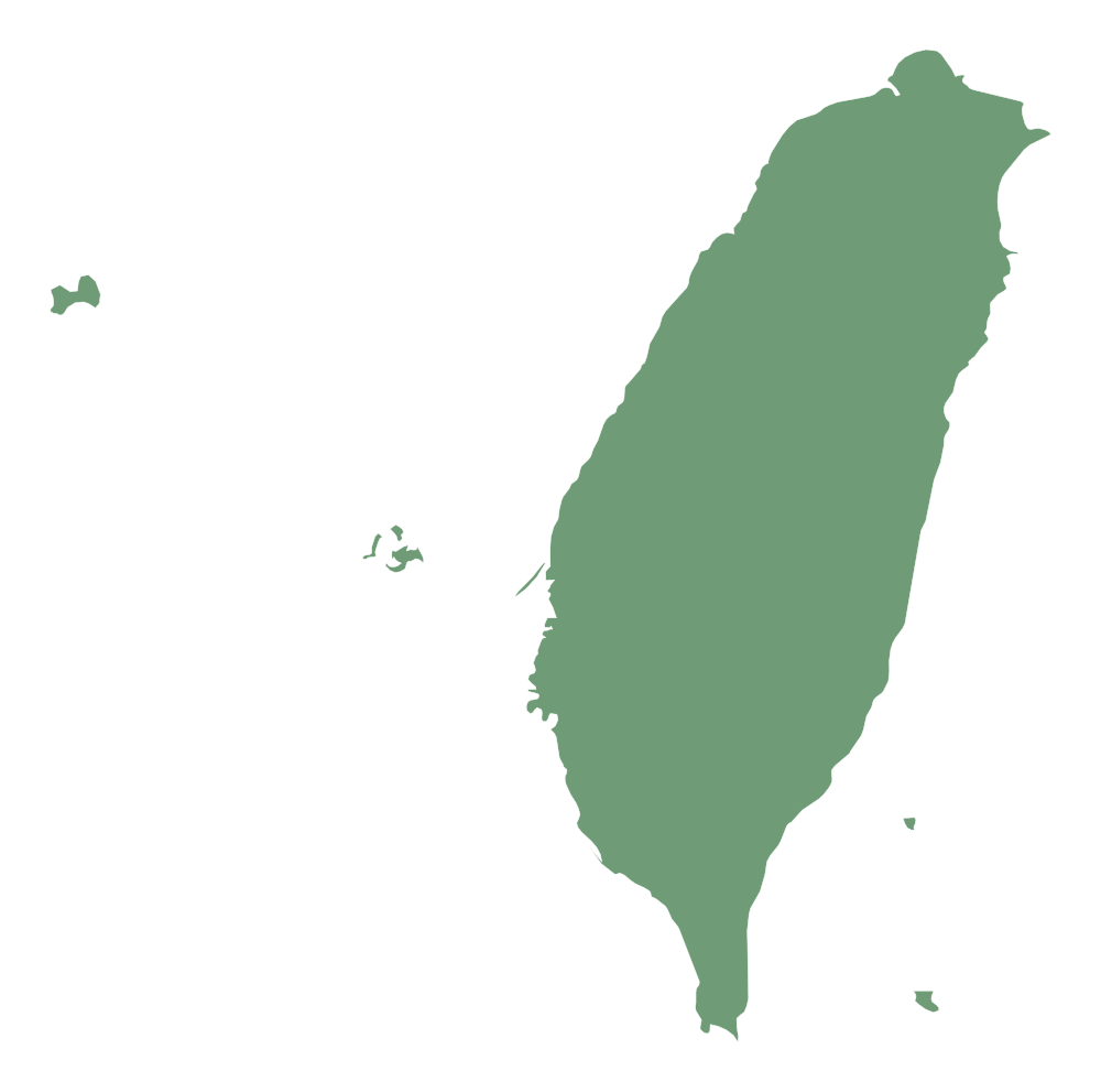
Contornos SVG — incorporação direta
Quatro conjuntos selecionados de arquivos SVG, todos sob licenças CC ou em domínio público. Podem ser inseridos diretamente em qualquer página web, App ou projeto de design.
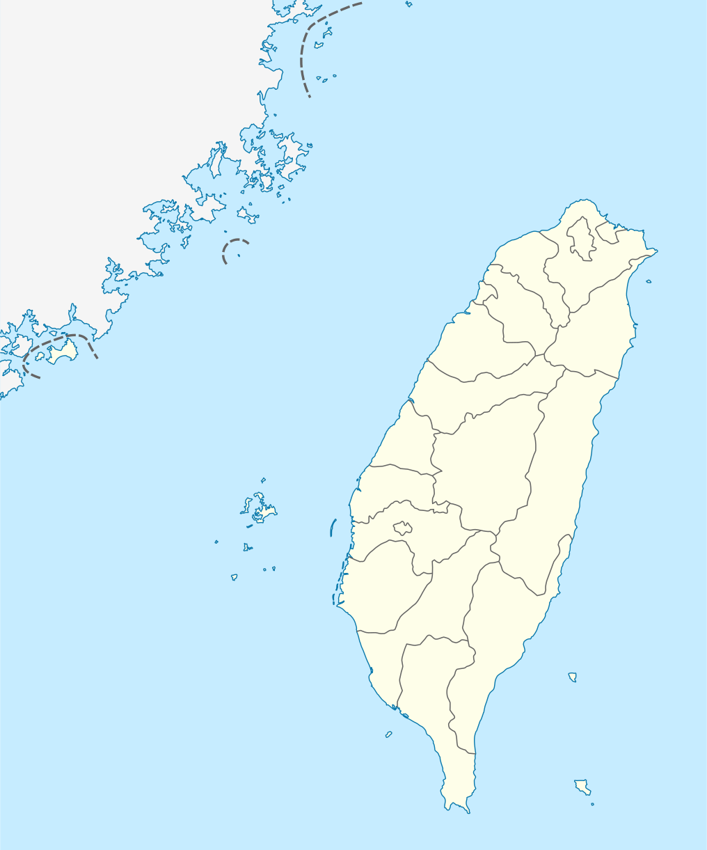
taiwan-location-map.svg
Mapa de localização com grelha de lat/lon e marcadores de cidades.
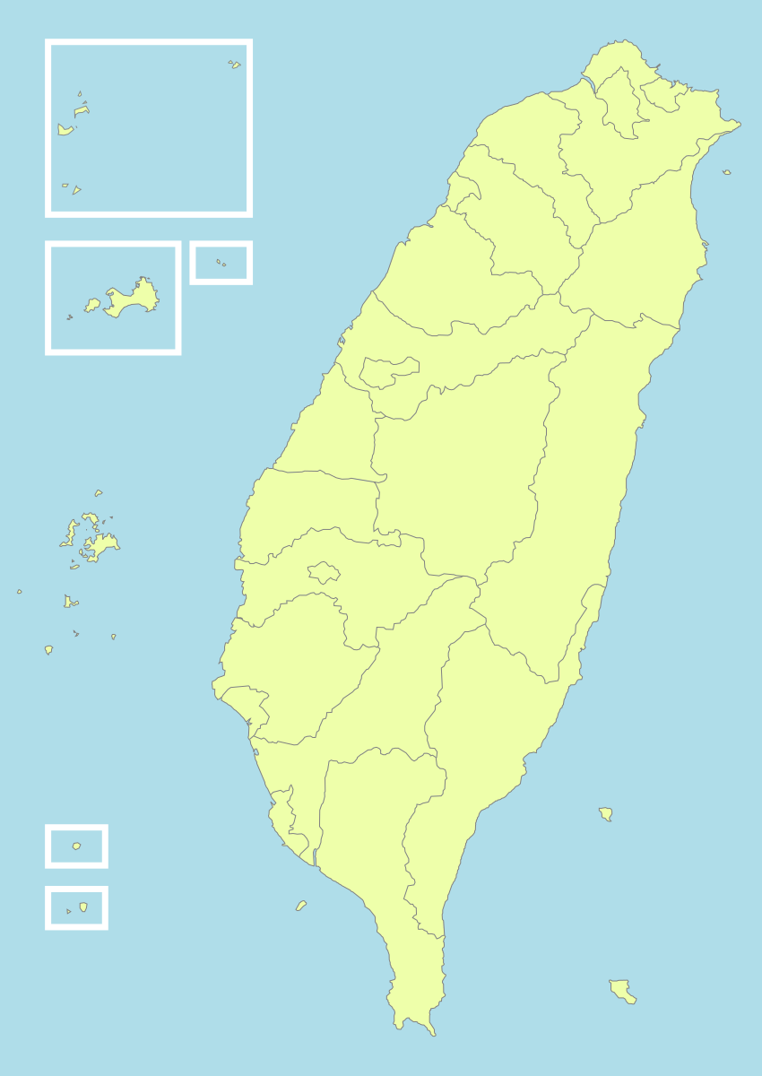
Como usar
<!-- HTML -->
<img src="https://taiwan.md/assets/svg/taiwan-icon-wiki.svg" alt="Taiwan" width="200">
/* CSS */
background-image: url('https://taiwan.md/assets/svg/taiwan-icon-wiki.svg');
<!-- Markdown -->
Todos os SVG estão sob licenças Creative Commons ou em domínio público. A atribuição da fonte é recomendada, mas não obrigatória.
TopoJSON — mapa interativo por condado e cidade
Se você deseja criar um mapa interativo — com zoom, efeitos ao passar o mouse e cores baseadas em valores de dados — não precisa de caminhos SVG, mas de dados com coordenadas geográficas reais. Empacotamos os arquivos TopoJSON extraídos do taiwan-vue-components de Waiting (licença MIT, 2018).
TopoJSON é uma versão compactada do GeoJSON: as fronteiras compartilhadas entre condados e cidades vizinhos são armazenadas apenas uma vez, reduzindo o arquivo em 80%. Com topojson-client, é possível convertê-lo novamente em GeoJSON em tempo real.
TopoJSON vs GeoJSON — qual escolher
TopoJSON
TopoJSON: arquivos menores, fronteiras compartilhadas entre regiões vizinhas, ideal para mapas interativos na web.
GeoJSON
GeoJSON: formato simples, diretamente compatível com Python geopandas, QGIS e a maioria das ferramentas GIS.
Contorno nacional (22 condados e cidades)
Arquivo TopoJSON de aproximadamente 21 KB, contendo 22 condados, cidades e municípios especiais, cada um como uma feature independente. Um ponto de partida para criar mapas choropleth.
taiwan-country.topo.jsonDados municipais dos 22 condados e cidades
Empacotamos os arquivos TopoJSON em nível municipal de todos os 22 condados e cidades, extraídos do mesmo repo de origem.
taiwan-towns-63000.topo.json taiwan-towns-64000.topo.json taiwan-towns-65000.topo.json taiwan-towns-66000.topo.json taiwan-towns-67000.topo.json taiwan-towns-68000.topo.json taiwan-towns-10002.topo.json taiwan-towns-10004.topo.json taiwan-towns-10005.topo.json taiwan-towns-10007.topo.json taiwan-towns-10008.topo.json taiwan-towns-10009.topo.json taiwan-towns-10010.topo.json taiwan-towns-10013.topo.json taiwan-towns-10014.topo.json taiwan-towns-10015.topo.json taiwan-towns-10016.topo.json taiwan-towns-10017.topo.json taiwan-towns-10018.topo.json taiwan-towns-10020.topo.json taiwan-towns-09007.topo.json taiwan-towns-09020.topo.json Todos os 22 condados e cidades estão incluídos acima. Dados de limites de distritos extraídos de github.com/waiting7777/taiwan-vue-components,MIT License © 2018 Waiting。
Tabela de códigos das divisões administrativas
As divisões administrativas de Taiwan são codificadas com códigos numéricos. Veja abaixo a tabela das 22 divisões administrativas em nível de condado e cidade (padrão dos nomes de arquivo: `towns-{code}.json`).
| Código | Divisão administrativa | Tipo |
|---|---|---|
63000 | 臺北市 Taipei | municipality |
64000 | 高雄市 Kaohsiung | municipality |
65000 | 新北市 New Taipei | municipality |
66000 | 臺中市 Taichung | municipality |
67000 | 臺南市 Tainan | municipality |
68000 | 桃園市 Taoyuan | municipality |
10002 | 宜蘭縣 Yilan | county |
10004 | 新竹縣 Hsinchu | county |
10005 | 苗栗縣 Miaoli | county |
10007 | 彰化縣 Changhua | county |
10008 | 南投縣 Nantou | county |
10009 | 雲林縣 Yunlin | county |
10010 | 嘉義縣 Chiayi | county |
10013 | 屏東縣 Pingtung | county |
10014 | 臺東縣 Taitung | county |
10015 | 花蓮縣 Hualien | county |
10016 | 澎湖縣 Penghu | county |
10017 | 基隆市 Keelung | city |
10018 | 新竹市 Hsinchu City | city |
10020 | 嘉義市 Chiayi City | city |
09007 | 連江縣 Lienchiang (Matsu) | offshore |
09020 | 金門縣 Kinmen | offshore |
Exemplos de uso
D3.js — choropleth interativo
// D3.js v7 + topojson-client
import * as d3 from 'd3';
import * as topojson from 'topojson-client';

const topo = await d3.json('https://taiwan.md/assets/geo/taiwan-country.topo.json');
const counties = topojson.feature(topo, topo.objects.map);

const projection = d3.geoMercator()
  .center([121, 24])
  .scale(8000)
  .translate([400, 300]);

const path = d3.geoPath().projection(projection);

d3.select('svg')
  .selectAll('path')
  .data(counties.features)
  .join('path')
    .attr('d', path)
    .attr('fill', d => colorScale(d.properties.value))
    .attr('stroke', '#333');
Python — geopandas
# Python — convert TopoJSON to GeoDataFrame
import json, geopandas as gpd
from topojson import Topology

with open('taiwan-country.topo.json') as f:
    topo = json.load(f)

# Convert to GeoJSON
topology = Topology(topo)
gdf = gpd.GeoDataFrame.from_features(
    topology.to_geojson()['features']
)
gdf.plot(column='name', legend=True)
Leaflet — sobreposição em mapa de mosaicos
// Leaflet + topojson
import L from 'leaflet';
import * as topojson from 'topojson-client';

const map = L.map('map').setView([24, 121], 7);
L.tileLayer('https://{s}.tile.openstreetmap.org/{z}/{x}/{y}.png').addTo(map);

fetch('https://taiwan.md/assets/geo/taiwan-country.topo.json')
  .then(r => r.json())
  .then(topo => {
    const geojson = topojson.feature(topo, topo.objects.map);
    L.geoJSON(geojson, {
      style: { color: '#4a90e2', weight: 1, fillOpacity: 0.3 }
    }).addTo(map);
  });
Vue — taiwan-vue-components
// Vue 2 — taiwan-vue-components (original source)
npm install taiwan-vue-components

// In your Vue component
import { Country, Taipei, Kaohsiung } from 'taiwan-vue-components';

<template>
  <div>
    <Country :width="400" :height="600" fill="#f0f0f0" stroke="#333" />
    <Taipei :width="300" :height="300" />
  </div>
</template>
Outras fontes de dados abertos
Se você precisa de mais do que está incluído aqui — maior resolução, projeções diferentes ou limites administrativos históricos — estas são as fontes que recomendamos:
- 政府資料開放平臺 (data.gov.tw) — Plataforma oficial de dados abertos do governo, incluindo shapefiles de limites administrativos publicados pelo Ministério do Interior.
- Natural Earth — Dados globais de mapas em domínio público, nas escalas 1:10m / 1:50m / 1:110m. Ideal para mapas-múndi que incluem Taiwan.
- OpenStreetMap (Taiwan relation) — Mapa de Taiwan editado pela comunidade do OSM, disponível para download em OSM XML ou PBF via Overpass API e Geofabrik.
- GADM — Taiwan — Banco de dados global de áreas administrativas, com limites administrativos de Taiwan nos níveis 0-3, disponível nos formatos Shapefile / GeoPackage / KMZ / R.
- g0v.tw — Comunidade de tecnologia cívica de Taiwan. Muitos projetos g0v publicam dados de mapas tratados e visualizações em código aberto.
Licenças e fontes
Todos os arquivos desta página são de código aberto. Confira abaixo as informações completas sobre fontes e licenças:
- taiwan-icon-wiki.svg · taiwan-location-map.svg · taiwan-political-division.svg — Wikimedia Commons, licença Creative Commons.
- taiwan-simplemaps.svg — SimpleMaps, uso comercial gratuito com atribuição.
- taiwan-country.topo.json · taiwan-towns-*.topo.json — Extraído de waiting7777/taiwan-vue-components, MIT License © 2018 Waiting.