

ओपन-सोर्स मानचित्र डेटासेट
ताइवान का आकार
SVG, GeoJSON, TopoJSON — डेवलपरों, डिज़ाइनरों और शोधकर्ताओं के लिए संपूर्ण ओपन-सोर्स मानचित्र डेटा।
ताइवान का आकार क्यों महत्वपूर्ण है
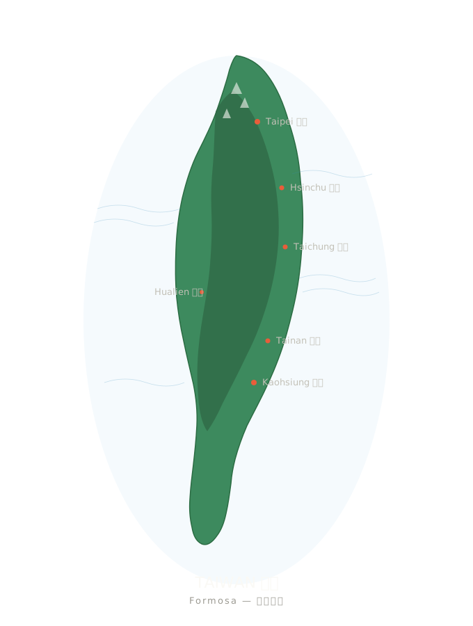
किसी भी AI चित्रण टूल से ताइवान बनवाएँ, तो लगभग हर बार एक गोल-मटोल चीज़ निकलती है, जो जैतून और आलू के बीच की लगती है।ताइवान जैतून नहीं है।यह 394 किलोमीटर लंबा शकरकंद जैसा द्वीप है, जिसके बीच उत्तर से दक्षिण तक केंद्रीय पर्वतमाला और सौ से अधिक अपतटीय द्वीप हैं।
आकार को सही बनाना केवल डिज़ाइन का विवरण नहीं, पहचान का प्रश्न है।इस पृष्ठ पर taiwan.md में उपयोग की गई सभी ओपन-सोर्स मानचित्र सामग्रियाँ संकलित हैं, ताकि कोई भी अपने प्रोजेक्ट में ताइवान को सटीक रूप से प्रस्तुत कर सके।
vs. 🇹🇼 — AI हर बार ग़लत बनाता है, सचमुच
SVG रूपरेखा — सीधे एम्बेड करें
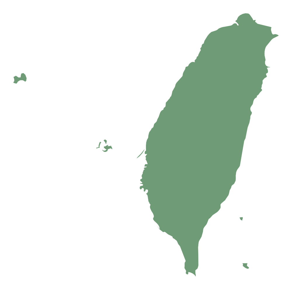
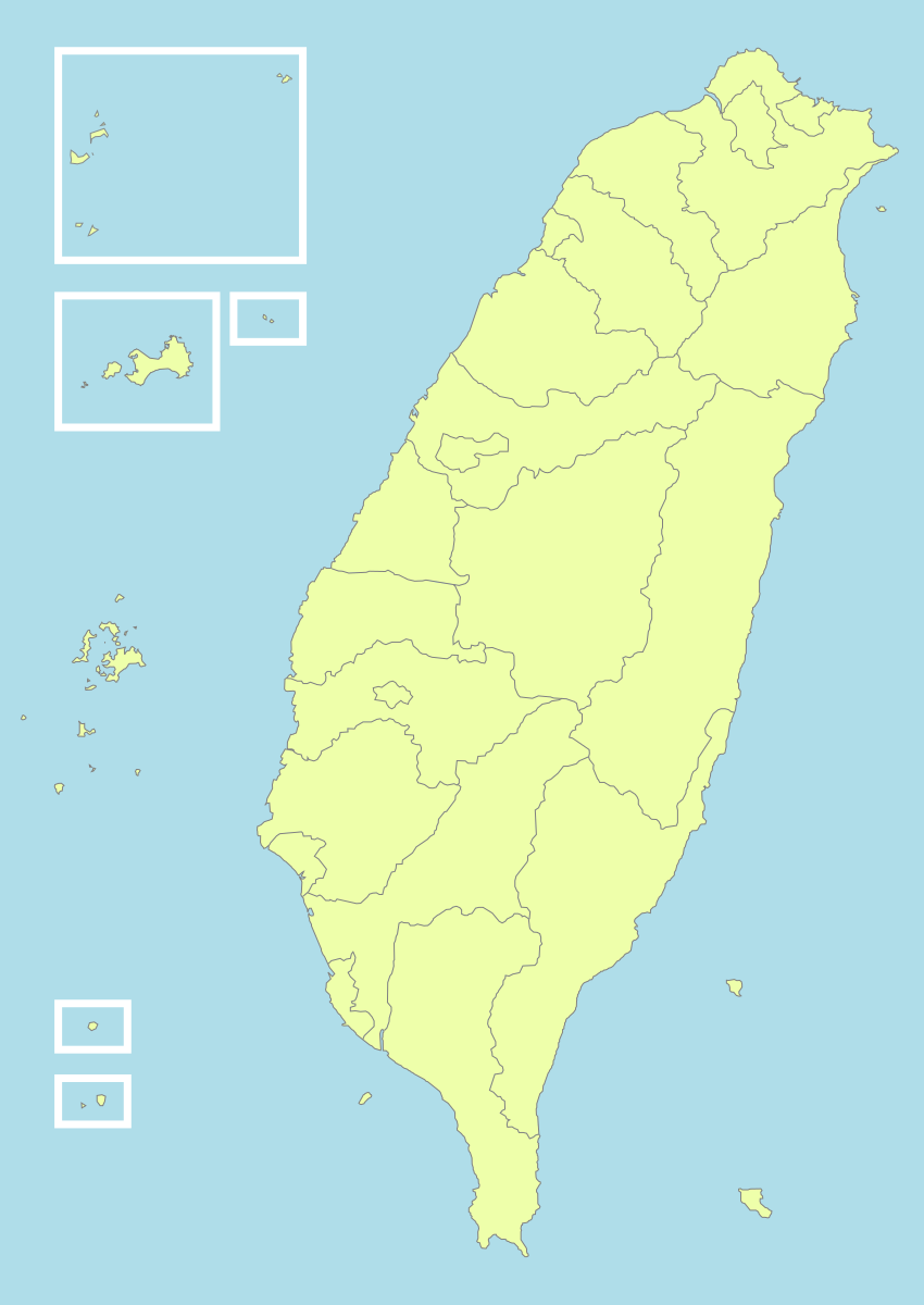
चार चुनिंदा SVG फ़ाइल समूह, सभी CC लाइसेंस या सार्वजनिक डोमेन के अंतर्गत।इन्हें सीधे किसी भी वेबपेज, App या डिज़ाइन ड्राफ़्ट में डाला जा सकता है।
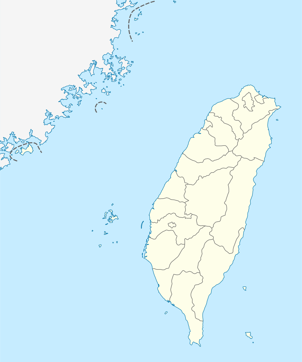
taiwan-location-map.svg
स्थान मानचित्र — अक्षांश/देशांतर ग्रिड और शहर चिह्नों सहित।
उपयोग का तरीका
<!-- HTML -->
<img src="https://taiwan.md/assets/svg/taiwan-icon-wiki.svg" alt="Taiwan" width="200">
/* CSS */
background-image: url('https://taiwan.md/assets/svg/taiwan-icon-wiki.svg');
<!-- Markdown -->
सभी SVG Creative Commons लाइसेंस या सार्वजनिक डोमेन के अंतर्गत हैं।स्रोत का उल्लेख करना बेहतर है, लेकिन आवश्यक नहीं।
TopoJSON — काउंटी और शहर स्तर का इंटरैक्टिव मानचित्र
यदि आप इंटरैक्टिव मानचित्र बनाना चाहते हैं—ज़ूम, माउस होवर और डेटा मान के अनुसार रंग भरना—तो आपको SVG पाथ नहीं, बल्कि वास्तविक भौगोलिक निर्देशांक डेटा चाहिए।हमने Waiting के taiwan-vue-components (MIT लाइसेंस, 2018) से निकाली गई TopoJSON फ़ाइलें पैकेज की हैं।
TopoJSON, GeoJSON का संपीड़ित संस्करण है: पड़ोसी काउंटियों और शहरों की साझा सीमाएँ केवल एक बार संग्रहीत होती हैं, जिससे फ़ाइल 80% छोटी होती है।topojson-client से इसे तुरंत वापस GeoJSON में बदला जा सकता है।
TopoJSON vs GeoJSON — किसे चुनें
TopoJSON
TopoJSON: छोटी फ़ाइल, पड़ोसी क्षेत्रों की साझा सीमाएँ और वेब के इंटरैक्टिव मानचित्रों के लिए उपयुक्त।
GeoJSON
GeoJSON: सरल प्रारूप, Python geopandas, QGIS और अधिकांश GIS टूल के साथ सीधे संगत।
पूरे देश की रूपरेखा (22 काउंटी और शहर)
लगभग 21 KB की TopoJSON फ़ाइल, जिसमें 22 काउंटी, शहर और विशेष नगरपालिकाएँ शामिल हैं और प्रत्येक एक स्वतंत्र फ़ीचर है।कोरोप्लेथ मानचित्र बनाने का शुरुआती बिंदु।
taiwan-country.topo.jsonसभी 22 काउंटियों और शहरों का टाउनशिप स्तर का डेटा
हमने सभी 22 काउंटियों और शहरों की टाउनशिप स्तर की TopoJSON फ़ाइलें पैकेज की हैं, जो एक ही स्रोत repo से निकाली गई हैं।
taiwan-towns-63000.topo.json taiwan-towns-64000.topo.json taiwan-towns-65000.topo.json taiwan-towns-66000.topo.json taiwan-towns-67000.topo.json taiwan-towns-68000.topo.json taiwan-towns-10002.topo.json taiwan-towns-10004.topo.json taiwan-towns-10005.topo.json taiwan-towns-10007.topo.json taiwan-towns-10008.topo.json taiwan-towns-10009.topo.json taiwan-towns-10010.topo.json taiwan-towns-10013.topo.json taiwan-towns-10014.topo.json taiwan-towns-10015.topo.json taiwan-towns-10016.topo.json taiwan-towns-10017.topo.json taiwan-towns-10018.topo.json taiwan-towns-10020.topo.json taiwan-towns-09007.topo.json taiwan-towns-09020.topo.json उपरोक्त में सभी 22 जिलों और शहरों को शामिल किया गया है। तहसील सीमा डेटा स्रोत github.com/waiting7777/taiwan-vue-components,MIT License © 2018 Waiting。
प्रशासनिक क्षेत्र कोड संदर्भ तालिका
ताइवान के प्रशासनिक क्षेत्रों को संख्यात्मक कोड दिए गए हैं।नीचे 22 काउंटी और शहर स्तर के प्रशासनिक क्षेत्रों की संदर्भ तालिका है (फ़ाइल नाम नियम: `towns-{code}.json`)।
| कोड | प्रशासनिक क्षेत्र | प्रकार |
|---|---|---|
63000 | 臺北市 Taipei | municipality |
64000 | 高雄市 Kaohsiung | municipality |
65000 | 新北市 New Taipei | municipality |
66000 | 臺中市 Taichung | municipality |
67000 | 臺南市 Tainan | municipality |
68000 | 桃園市 Taoyuan | municipality |
10002 | 宜蘭縣 Yilan | county |
10004 | 新竹縣 Hsinchu | county |
10005 | 苗栗縣 Miaoli | county |
10007 | 彰化縣 Changhua | county |
10008 | 南投縣 Nantou | county |
10009 | 雲林縣 Yunlin | county |
10010 | 嘉義縣 Chiayi | county |
10013 | 屏東縣 Pingtung | county |
10014 | 臺東縣 Taitung | county |
10015 | 花蓮縣 Hualien | county |
10016 | 澎湖縣 Penghu | county |
10017 | 基隆市 Keelung | city |
10018 | 新竹市 Hsinchu City | city |
10020 | 嘉義市 Chiayi City | city |
09007 | 連江縣 Lienchiang (Matsu) | offshore |
09020 | 金門縣 Kinmen | offshore |
उपयोग के उदाहरण
D3.js — इंटरैक्टिव कोरोप्लेथ
// D3.js v7 + topojson-client
import * as d3 from 'd3';
import * as topojson from 'topojson-client';

const topo = await d3.json('https://taiwan.md/assets/geo/taiwan-country.topo.json');
const counties = topojson.feature(topo, topo.objects.map);

const projection = d3.geoMercator()
  .center([121, 24])
  .scale(8000)
  .translate([400, 300]);

const path = d3.geoPath().projection(projection);

d3.select('svg')
  .selectAll('path')
  .data(counties.features)
  .join('path')
    .attr('d', path)
    .attr('fill', d => colorScale(d.properties.value))
    .attr('stroke', '#333');
Python — geopandas
# Python — convert TopoJSON to GeoDataFrame
import json, geopandas as gpd
from topojson import Topology

with open('taiwan-country.topo.json') as f:
    topo = json.load(f)

# Convert to GeoJSON
topology = Topology(topo)
gdf = gpd.GeoDataFrame.from_features(
    topology.to_geojson()['features']
)
gdf.plot(column='name', legend=True)
Leaflet — टाइल मानचित्र ओवरले
// Leaflet + topojson
import L from 'leaflet';
import * as topojson from 'topojson-client';

const map = L.map('map').setView([24, 121], 7);
L.tileLayer('https://{s}.tile.openstreetmap.org/{z}/{x}/{y}.png').addTo(map);

fetch('https://taiwan.md/assets/geo/taiwan-country.topo.json')
  .then(r => r.json())
  .then(topo => {
    const geojson = topojson.feature(topo, topo.objects.map);
    L.geoJSON(geojson, {
      style: { color: '#4a90e2', weight: 1, fillOpacity: 0.3 }
    }).addTo(map);
  });
Vue — taiwan-vue-components
// Vue 2 — taiwan-vue-components (original source)
npm install taiwan-vue-components

// In your Vue component
import { Country, Taipei, Kaohsiung } from 'taiwan-vue-components';

<template>
  <div>
    <Country :width="400" :height="600" fill="#f0f0f0" stroke="#333" />
    <Taipei :width="300" :height="300" />
  </div>
</template>
अन्य ओपन-सोर्स डेटा स्रोत
यदि आपको यहाँ पैकेज किए गए डेटा से अधिक चाहिए—उच्च रिज़ॉल्यूशन, अलग प्रोजेक्शन या ऐतिहासिक प्रशासनिक सीमाएँ—तो ये हमारे सुझाए स्रोत हैं:
- 政府資料開放平臺 (data.gov.tw) — तैवान सरकार का आधिकारिक ओपन डेटा, जिसमें गृह मंत्रालय द्वारा जारी प्रशासनिक सीमा shapefiles शामिल हैं।
- Natural Earth — पब्लिक डोमेन वैश्विक मानचित्र डेटा, 1:10m / 1:50m / 1:110m — तीन स्केल उपलब्ध। ताइवान सहित विश्व मानचित्र बनाने के लिए उपयुक्त।
- OpenStreetMap (Taiwan relation) — OSM समुदाय द्वारा संपादित ताइवान का नक्शा, Overpass API और Geofabrik के ज़रिये OSM XML या PBF में डाउनलोड किया जा सकता है।
- GADM — Taiwan — वैश्विक प्रशासनिक क्षेत्र डेटाबेस, ताइवान की प्रशासनिक सीमाएँ 0-3 स्तर पर, Shapefile / GeoPackage / KMZ / R फ़ॉर्मेट में उपलब्ध।
- g0v.tw — ताइवान का सिविक टेक समुदाय। कई g0v परियोजनाएँ साफ़-सुथरे नक्शा डेटा और विज़ुअलाइज़ेशन को ओपन सोर्स के रूप में प्रकाशित करती हैं।
लाइसेंस और स्रोत
इस पृष्ठ की प्रत्येक फ़ाइल ओपन-सोर्स है।स्रोत और लाइसेंस की पूरी जानकारी नीचे दी गई है:
- taiwan-icon-wiki.svg · taiwan-location-map.svg · taiwan-political-division.svg — Wikimedia Commons, Creative Commons लाइसेंस।
- taiwan-simplemaps.svg — SimpleMaps, स्रोत का उल्लेख करने पर निःशुल्क व्यावसायिक उपयोग के लिए उपलब्ध।
- taiwan-country.topo.json · taiwan-towns-*.topo.json — स्रोत: waiting7777/taiwan-vue-components, MIT License © 2018 Waiting.