

Kumpulan Data Peta Sumber Terbuka
Bentuk Taiwan
SVG, GeoJSON, TopoJSON — data peta sumber terbuka yang lengkap untuk pengembang, desainer, dan peneliti.
Mengapa Bentuk Taiwan Penting
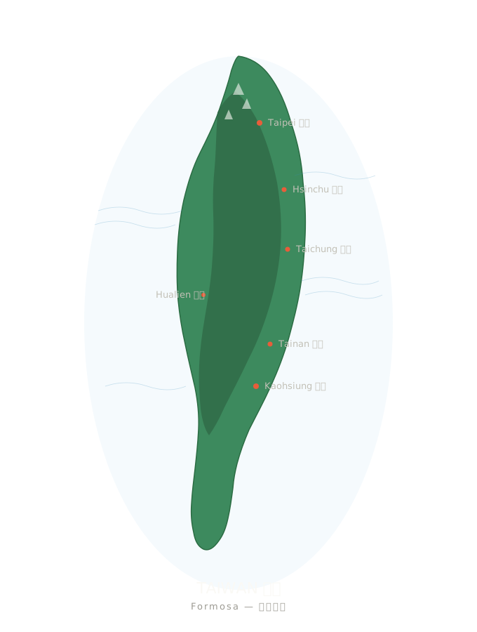
Mintalah alat pembuat gambar AI mana pun untuk menggambar Taiwan, hasilnya hampir selalu berupa benda bulat dan gemuk, antara buah zaitun dan kentang. Taiwan bukan buah zaitun. Bentuknya seperti ubi jalar sepanjang 394 kilometer, dengan Pegunungan Tengah yang membentang dari utara ke selatan serta lebih dari seratus pulau lepas pantai.
Menggambar bentuknya dengan benar bukan sekadar detail desain, melainkan persoalan identitas. Halaman ini mengumpulkan semua materi peta sumber terbuka yang kami gunakan di taiwan.md agar siapa pun dapat menampilkan Taiwan secara akurat dalam proyek mereka sendiri.
vs. 🇹🇼 — AI Selalu Salah Menggambarnya, Sungguh
Kontur SVG — Sematkan Langsung
Empat set berkas SVG pilihan, semuanya berlisensi CC atau berada dalam domain publik. Dapat langsung digunakan di halaman web, App, atau rancangan desain apa pun.
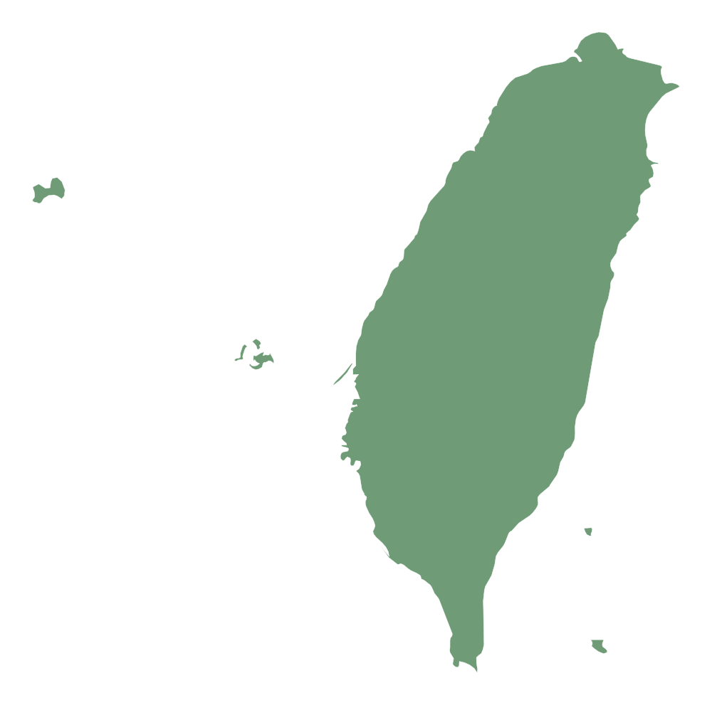
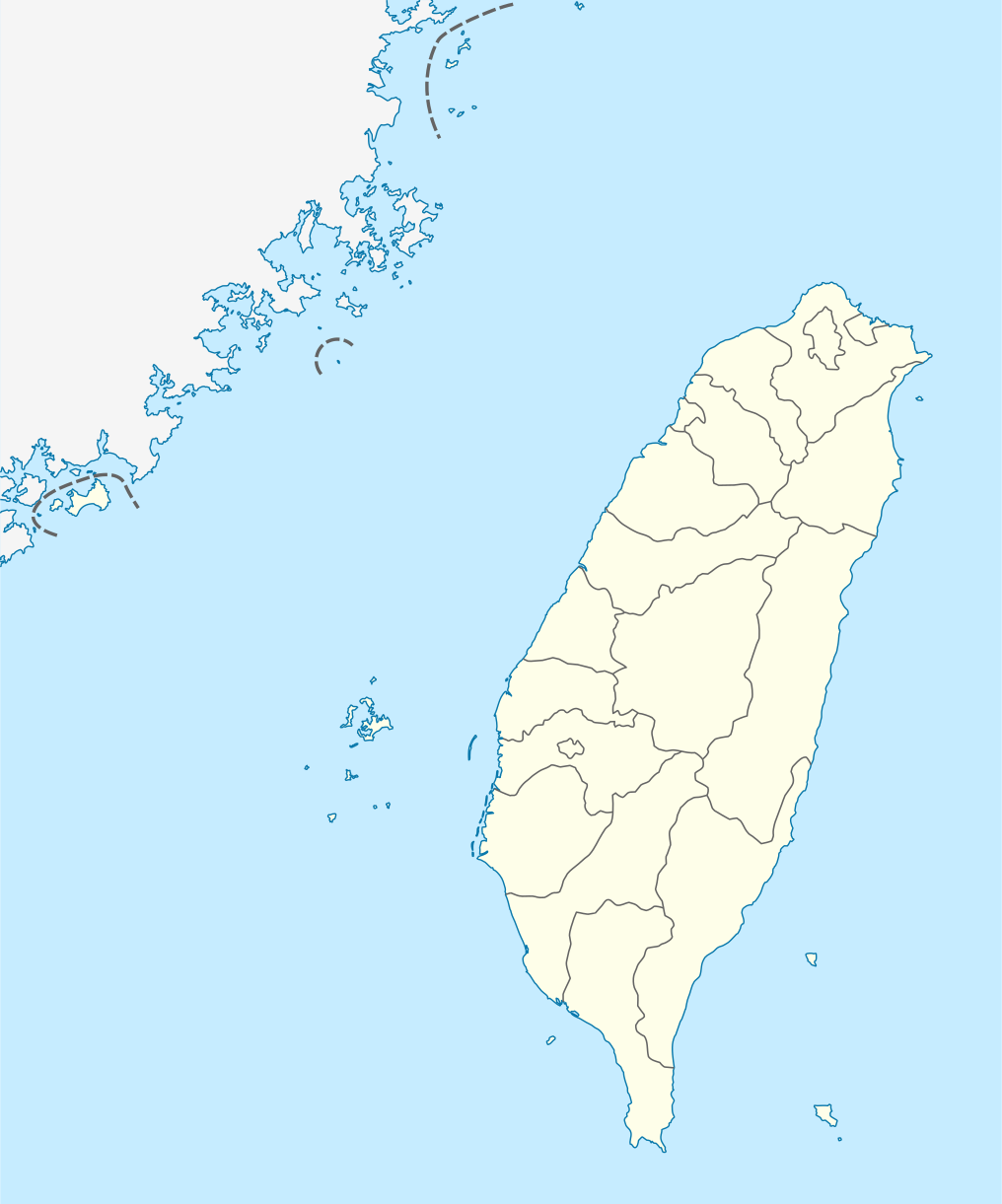
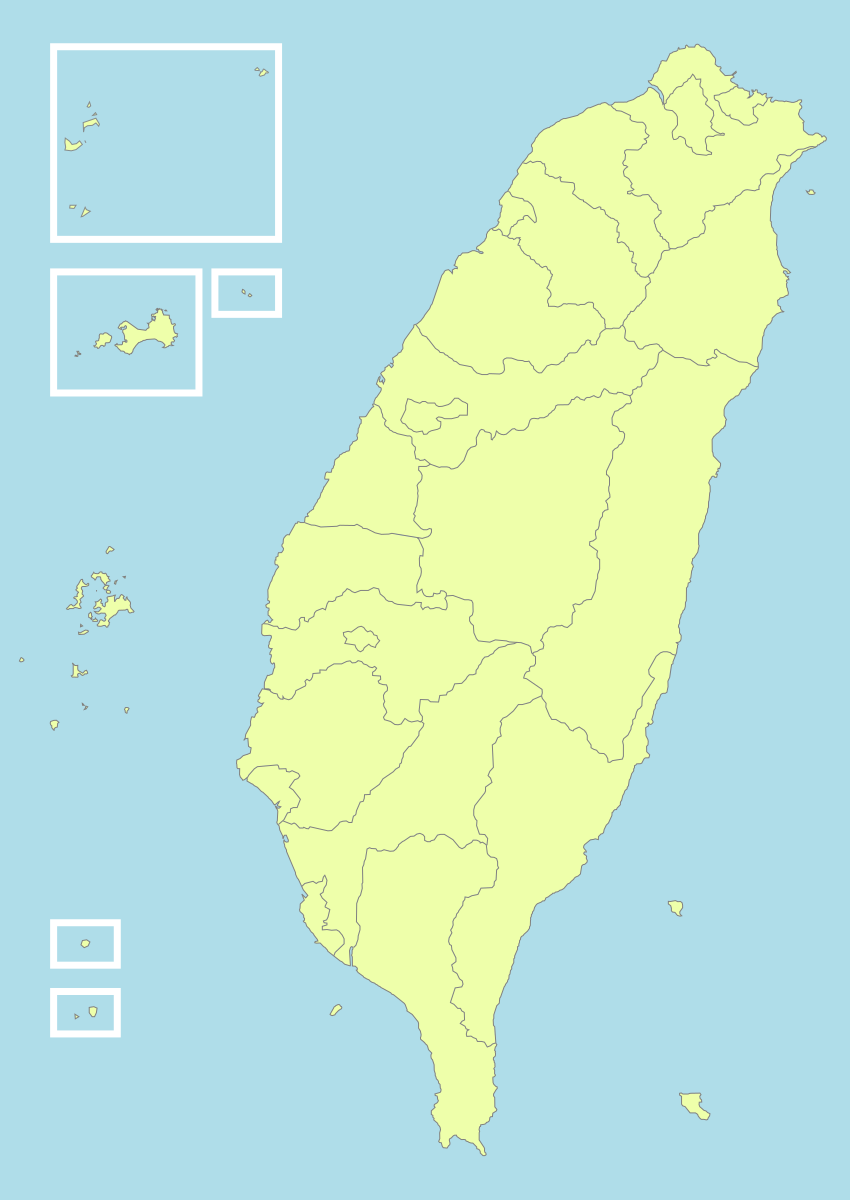
Cara Penggunaan
<!-- HTML -->
<img src="https://taiwan.md/assets/svg/taiwan-icon-wiki.svg" alt="Taiwan" width="200">
/* CSS */
background-image: url('https://taiwan.md/assets/svg/taiwan-icon-wiki.svg');
<!-- Markdown -->
Semua SVG berlisensi Creative Commons atau berada dalam domain publik. Sebaiknya cantumkan sumber, tetapi tidak wajib.
TopoJSON — Peta Interaktif Tingkat Kabupaten/Kota
Jika Anda ingin membuat peta interaktif—dengan fitur zoom, efek saat kursor diarahkan, dan pewarnaan berdasarkan nilai data—yang Anda butuhkan bukan jalur SVG, melainkan data koordinat geografis yang sesungguhnya. Kami telah mengemas berkas TopoJSON yang diekstrak dari taiwan-vue-components milik Waiting (lisensi MIT, 2018).
TopoJSON adalah versi GeoJSON yang dikompresi: batas yang digunakan bersama oleh kabupaten/kota bertetangga hanya disimpan satu kali sehingga ukuran berkas 80% lebih kecil. Gunakan topojson-client untuk mengonversinya kembali menjadi GeoJSON secara langsung.
TopoJSON vs GeoJSON — Mana yang Harus Dipilih
TopoJSON
TopoJSON: berkas lebih kecil, wilayah bertetangga berbagi batas, cocok untuk membuat peta web interaktif.
GeoJSON
GeoJSON: format sederhana, langsung kompatibel dengan Python geopandas, QGIS, dan sebagian besar alat GIS.
Kontur Seluruh Negara (22 Kabupaten/Kota)
Berkas TopoJSON berukuran sekitar 21 KB yang mencakup 22 kabupaten, kota, dan munisipalitas khusus, masing-masing sebagai feature tersendiri. Titik awal untuk membuat peta choropleth.
taiwan-country.topo.jsonData Tingkat Kecamatan untuk Seluruh 22 Kabupaten/Kota
Kami telah mengemas berkas TopoJSON tingkat kecamatan untuk seluruh 22 kabupaten/kota, semuanya diekstrak dari repo sumber yang sama.
taiwan-towns-63000.topo.json taiwan-towns-64000.topo.json taiwan-towns-65000.topo.json taiwan-towns-66000.topo.json taiwan-towns-67000.topo.json taiwan-towns-68000.topo.json taiwan-towns-10002.topo.json taiwan-towns-10004.topo.json taiwan-towns-10005.topo.json taiwan-towns-10007.topo.json taiwan-towns-10008.topo.json taiwan-towns-10009.topo.json taiwan-towns-10010.topo.json taiwan-towns-10013.topo.json taiwan-towns-10014.topo.json taiwan-towns-10015.topo.json taiwan-towns-10016.topo.json taiwan-towns-10017.topo.json taiwan-towns-10018.topo.json taiwan-towns-10020.topo.json taiwan-towns-09007.topo.json taiwan-towns-09020.topo.json Seluruh 22 kabupaten dan kota tercantum di atas. Data batas kecamatan diambil dari github.com/waiting7777/taiwan-vue-components,MIT License © 2018 Waiting。
Tabel Referensi Kode Wilayah Administratif
Wilayah administratif Taiwan dikodekan menggunakan angka. Berikut adalah tabel referensi untuk 22 wilayah administratif tingkat kabupaten/kota (aturan penamaan berkas: `towns-{code}.json`).
| Kode | Wilayah Administratif | Jenis |
|---|---|---|
63000 | 臺北市 Taipei | municipality |
64000 | 高雄市 Kaohsiung | municipality |
65000 | 新北市 New Taipei | municipality |
66000 | 臺中市 Taichung | municipality |
67000 | 臺南市 Tainan | municipality |
68000 | 桃園市 Taoyuan | municipality |
10002 | 宜蘭縣 Yilan | county |
10004 | 新竹縣 Hsinchu | county |
10005 | 苗栗縣 Miaoli | county |
10007 | 彰化縣 Changhua | county |
10008 | 南投縣 Nantou | county |
10009 | 雲林縣 Yunlin | county |
10010 | 嘉義縣 Chiayi | county |
10013 | 屏東縣 Pingtung | county |
10014 | 臺東縣 Taitung | county |
10015 | 花蓮縣 Hualien | county |
10016 | 澎湖縣 Penghu | county |
10017 | 基隆市 Keelung | city |
10018 | 新竹市 Hsinchu City | city |
10020 | 嘉義市 Chiayi City | city |
09007 | 連江縣 Lienchiang (Matsu) | offshore |
09020 | 金門縣 Kinmen | offshore |
Contoh Penggunaan
D3.js — Choropleth Interaktif
// D3.js v7 + topojson-client
import * as d3 from 'd3';
import * as topojson from 'topojson-client';

const topo = await d3.json('https://taiwan.md/assets/geo/taiwan-country.topo.json');
const counties = topojson.feature(topo, topo.objects.map);

const projection = d3.geoMercator()
  .center([121, 24])
  .scale(8000)
  .translate([400, 300]);

const path = d3.geoPath().projection(projection);

d3.select('svg')
  .selectAll('path')
  .data(counties.features)
  .join('path')
    .attr('d', path)
    .attr('fill', d => colorScale(d.properties.value))
    .attr('stroke', '#333');
Python — geopandas
# Python — convert TopoJSON to GeoDataFrame
import json, geopandas as gpd
from topojson import Topology

with open('taiwan-country.topo.json') as f:
    topo = json.load(f)

# Convert to GeoJSON
topology = Topology(topo)
gdf = gpd.GeoDataFrame.from_features(
    topology.to_geojson()['features']
)
gdf.plot(column='name', legend=True)
Leaflet — Hamparan Peta Ubin
// Leaflet + topojson
import L from 'leaflet';
import * as topojson from 'topojson-client';

const map = L.map('map').setView([24, 121], 7);
L.tileLayer('https://{s}.tile.openstreetmap.org/{z}/{x}/{y}.png').addTo(map);

fetch('https://taiwan.md/assets/geo/taiwan-country.topo.json')
  .then(r => r.json())
  .then(topo => {
    const geojson = topojson.feature(topo, topo.objects.map);
    L.geoJSON(geojson, {
      style: { color: '#4a90e2', weight: 1, fillOpacity: 0.3 }
    }).addTo(map);
  });
Vue — taiwan-vue-components
// Vue 2 — taiwan-vue-components (original source)
npm install taiwan-vue-components

// In your Vue component
import { Country, Taipei, Kaohsiung } from 'taiwan-vue-components';

<template>
  <div>
    <Country :width="400" :height="600" fill="#f0f0f0" stroke="#333" />
    <Taipei :width="300" :height="300" />
  </div>
</template>
Sumber Data Terbuka Lainnya
Jika Anda membutuhkan lebih banyak daripada yang kami kemas di sini—resolusi lebih tinggi, proyeksi berbeda, atau batas wilayah administratif historis—berikut adalah sumber yang kami rekomendasikan:
- 政府資料開放平臺 (data.gov.tw) — Platform data terbuka resmi pemerintah, mencakup Shapefile batas wilayah administratif yang diterbitkan oleh Kementerian Dalam Negeri.
- Natural Earth — Data peta global berstatus domain publik dalam tiga skala: 1:10m / 1:50m / 1:110m. Cocok untuk membuat peta dunia yang mencakup Taiwan.
- OpenStreetMap (Taiwan relation) — Peta Taiwan hasil suntingan komunitas OSM, dapat diunduh sebagai OSM XML atau PBF melalui Overpass API dan Geofabrik.
- GADM — Taiwan — Basis data wilayah administratif global, batas wilayah administratif Taiwan tingkat 0-3, tersedia dalam format Shapefile / GeoPackage / KMZ / R.
- g0v.tw — Komunitas teknologi warga Taiwan. Banyak proyek g0v memublikasikan data peta yang sudah dirapikan dan visualisasinya sebagai sumber terbuka.
Lisensi dan Sumber
Setiap berkas di halaman ini bersifat sumber terbuka. Berikut adalah informasi lengkap mengenai sumber dan lisensinya:
- taiwan-icon-wiki.svg · taiwan-location-map.svg · taiwan-political-division.svg — Wikimedia Commons, berlisensi Creative Commons.
- taiwan-simplemaps.svg — SimpleMaps, gratis untuk penggunaan komersial dengan mencantumkan sumber.
- taiwan-country.topo.json · taiwan-towns-*.topo.json — Diambil dari waiting7777/taiwan-vue-components, MIT License © 2018 Waiting.